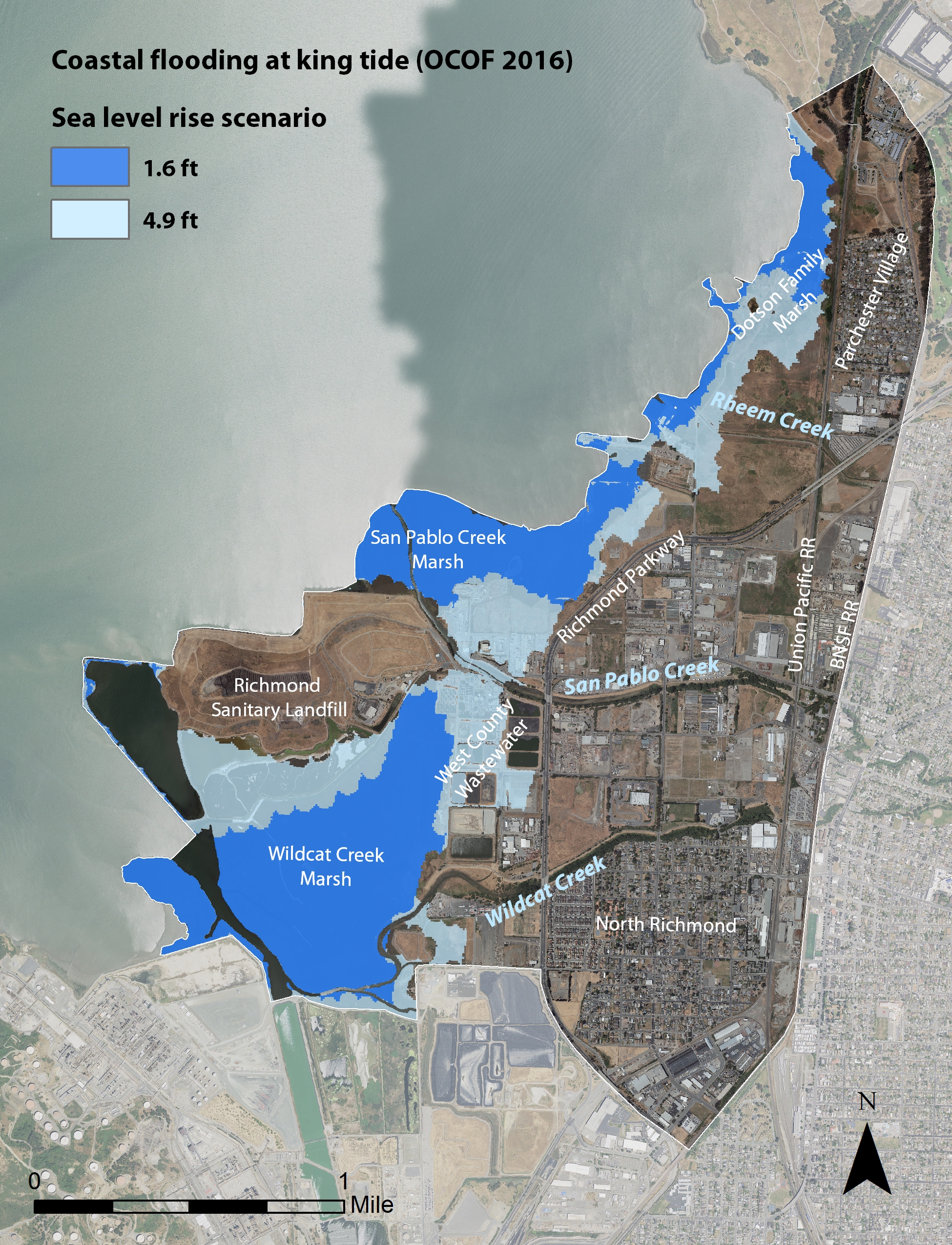
Today’s North Richmond shoreline looks much different from its historic blend of baylands, mudflats, and wet meadows. A lot of the land has been filled, or else fragmented by transit and industry. The region’s three creeks — the Rheem, the San Pablo, and the Wildcat are mostly behind levees for flood control (the San Pablo and Wildcat Creek levees were raised in late 2017).
The shoreline, and the 500 meters inland where the optimal marsh-upland transition zone could exist is bounded on one end by Chevron’s Richmond Refinery and by an Amazon distribution center and other new, massive warehouses at the other end. The middle of this zone is cut, not by long tidal plains or gentle sloping uplands, but by a high speed four-lane parkway that shortcuts between the 80 and the 580. Where the parkway jogs inland, the landward edge of the shoreline is defined by the rail line carrying regularly scheduled Amtrak trains along the Capitol Corridor route and freight trains loaded with imported cars from further down the line at the Port of Richmond.
Existing inside these narrow confines are a landfill, a wastewater treatment plant, Point Pinole Regional Shoreline, a shooting range, a flea market, and storage yards. There are also neighborhoods, such as North Richmond, and Shields-Reid, and Parchester Village.
But this story is not so much about place names and landmarks or what, exactly, the hard to define transition zone is. This story is about the people of North Richmond. It’s about what a community ringed by the consequences of industry wants its nearby shoreline to look like in the future.
Over the past year, a project led by the San Francisco Estuary Partnership collaborated with the San Francisco Estuary Institute and Richmond-based organization The Watershed Project to get community input into a North Richmond Shoreline Vision. The idea was to incorporate and organize ideas from residents and community-based organizations, community social equity leaders, the scientific and conservation communities, as well as from property owners and land managers (such as the landfill and wastewater treatment plant).
“We have seen a lot of shoreline projects proceed without thinking about the people who live there, so we were trying to not do that in this process,” says Heidi Nutters, an environmental planner with the Partnership and one of the leads on the vision project along with Joshua Bradt.
In North Richmond there are few ball fields and no large grocery stores, but there are brownfields and junkyards. The 2010 Census data shows that the shoreline study area is made up mostly of people identifying as African-American, Latino, or Pacific Islander. According to statewide data, the North Richmond area has a higher than average poverty rate, and is exposed to a disproportionate amount of chemical toxins and emissions.
So, put simply, the worrying about forage and cover for the salt marsh harvest mouse or thinking about flooding that may happen a couple of decades from now ranks lower than more immediate needs. And that’s exactly the challenge that the North Richmond Shoreline Vision wanted to start to address. “How can we draw attention to the importance of transition zones while addressing critical equity concerns in communities,” asks Nutters. “How can we marry resource protection with environmental justice?”
Making this leap is important to the Estuary Partnership and other entities like flood control districts and science and engineering organizations who sometimes get lost in the technical details of preparing for rising sea levels. The Partnership’s work studying the North Richmond shoreline may be useful to local governments and planners but not necessairly something a family living near the edge of the Bay in Richmond would find enlightening. But SFEP and others are awakening to the fact that sustainable and resilient design of landscapes and natural systems needs to be inclusive of people, and in particular to voices that are traditionally left out of the process.
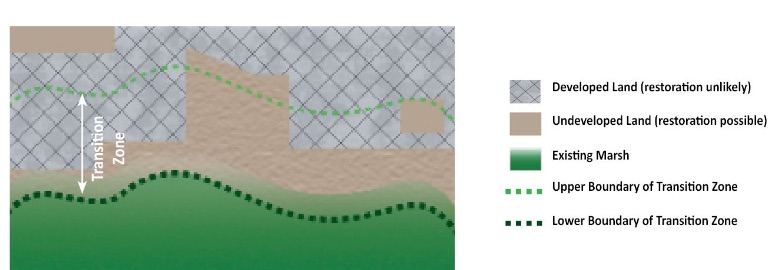
The transition zone, just inland from the farthest reaches of the tides, is fast becoming invaluable real estate for those charged with protecting shoreline habitats, communities and wildlife from rising sea levels. The San Francisco Estuary Institute and Estuary Partnership recently launched a new mapping tool for defining this amorphous zone.The tool resolves interface issues between two existing mapping methodologies: one designed to map the bay margins, and one designed to map upland transition zones, ecosystem services and boundaries. Now online, it offers guidance to scientists and managers trying to identify remaining open landscapes near shorelines where habitats and wildlife might find refuge and retreat in the future. See link below.
As Jeremy Lowe, a geomorphologist with the Estuary Institute who was involved in studying the North Richmond Shoreline’s transition zones puts it, “Often in the Bay, we spend a lot of time thinking about what we can do bayward of our levees,” he says. “As soon as you start looking on the landward side of the levee, which we’ve built up, you have to start talking to people. And it’s time that we should start thinking about those areas more and more.”
But gaining meaningful insights about what people actually want, and then figuring out how compatible those ideas are with what scientists, engineers, planners, and policy makers say should happen, is not an easy task. What’s needed are organizers and advocates that are able to navigate neighborhood politics. “We’ve been involved in the North Richmond watersheds for 15 years, and community based restoration projects for 20, so that’s why they called us to participate,” says Juliana Gonzalez, the executive director of the Watershed Project.
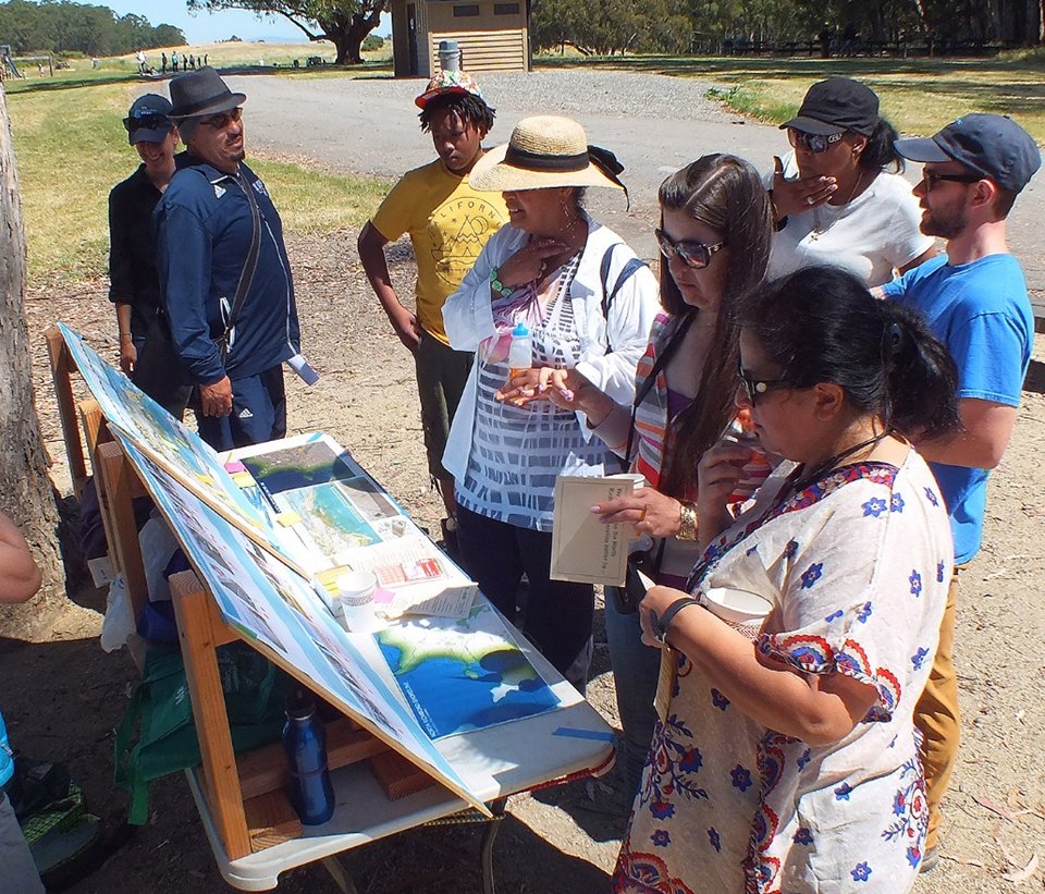
Gonzalez outlines the Watershed Project’s two-step approach. First they talked to all of the known stakeholders to capture their ideas about the shoreline (stakeholders like the East Bay Regional Park Service or Contra Costa County already have long-term plans). To get the information so far left out of these plans, Watershed Project staff developed what Gonzalez calls a “recreational survey,” meaning it wasn’t designed to explain the various issues facing the shoreline’s transition zones, or threat of sea level rise. Instead the survey was intended to figure out what residents wanted. “We went to where people were gathering, like PTA meetings, or neighborhood councils, or church groups,” Gonzalez says. “We reached 300 residents and asked them for their opinion.”
Courtesy of Heidi Nutters.
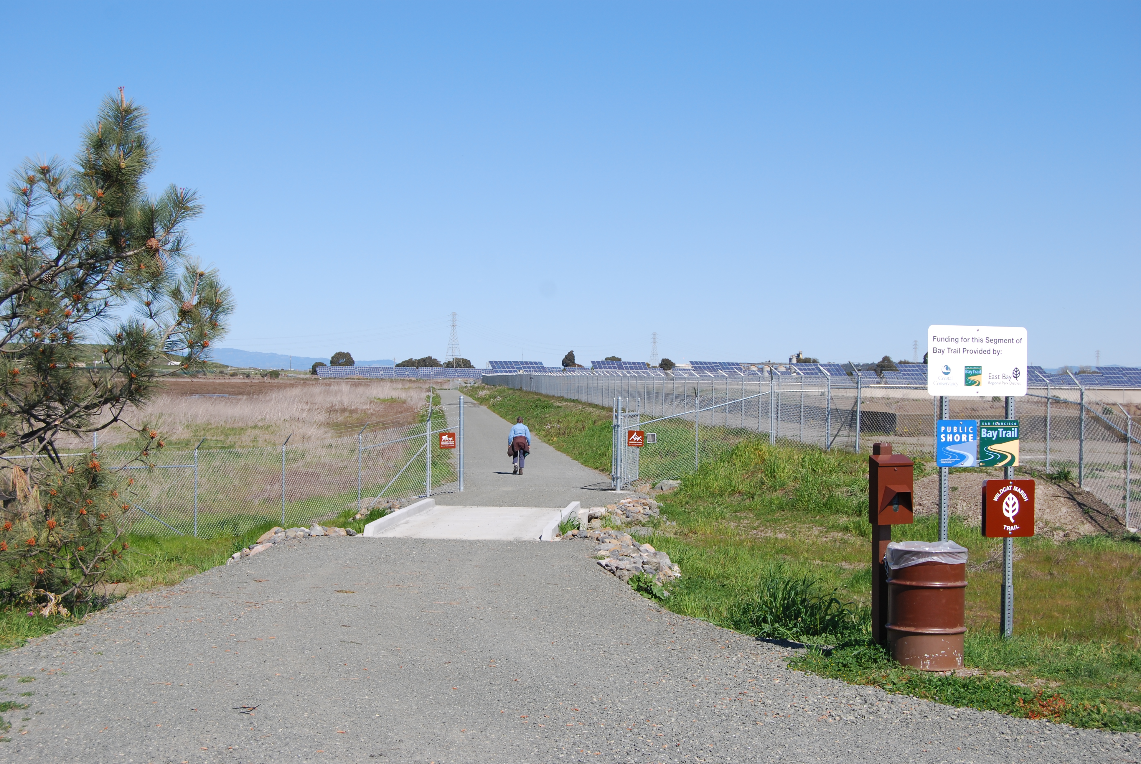
What the survey revealed is that the residents of the North Richmond’s neighborhoods feel removed from the shoreline. Despite their proximity, access by way of good pedestrian or bike trails is lacking. Crossing rail tracks, or the parkway (which includes an underpass that gets filled with mud or stagnant water) is enough of a barrier to prevent frequent visits. Residents also want to have more reason to visit the shoreline, like to check out an environmental education or natural history interpretation center.
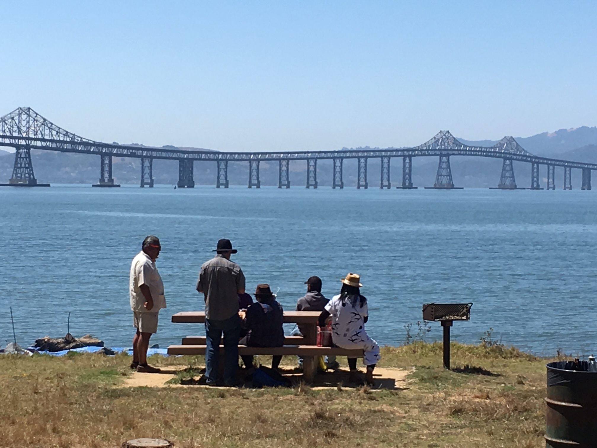
In some instances, these kinds of opportunities and projects align nicely with stakeholder visions of the shoreline. East Bay Parks, for instance, just opened the restored Dotson Family Marsh, with another 1.5 miles of bike trail and future Bay Trail. The new trail effectively connects Parchester Village with the 2,500 acre Point Pinole Regional Shoreline. Other projects, still in the planning phase, also overlap with what the community wants. Gonzalez points to the West County Wastewater Treatment Plant’s proposal for a horizontal levee as an example. Horizontal, versus conventional vertical rip-rapped levees, have broader shoulders and can provide space for native plants, habitats and other amenties. Communities around the Bay are beginning to embrace this gently sloping levee concept as more adaptable to rising seas. “It’s not so much that people want a horizontal levee,” she says, “as much as it is the recreational opportunities and access that it will bring.”
West Contra Costa Sanitary District lands near the proposed horizontal levee. Photo: Bay Trail
One of the outcomes of the North Richmond Shoreline Vision project is that several areas of prime upland transition zone were identified for further study. These areas present opportunities for restoration work in the future. But what, exactly, future projects along the North Richmond Shoreline will look like is still unclear.
While increased access and recreational opportunities are things that all parties seem to agree on, other priorities don’t always align neatly with how conservationists and environmental planners traditionally understand restoration work. Besides access and recreation, residents of North Richmond are also concerned about jobs, development, gentrification, and the ongoing battle against air and water pollution.
“When people have very immediate concerns about food and housing, it’s hard to think about long-term impacts like sea level rise,” says Nathan Bickart, who works on the Basins of Relations program, an education project that is part of the Richmond-based Urban Tilth. “So when you give people an open-ended question like: ‘what do you want to see on the shoreline,’ it creates an interesting dynamic.The people living there are saying we need affordable housing, and the science is saying that we need transition zones. So what happens when the community need doesn’t map one-to-one to what a scientist would devise in the absence of those needs?”
All involved with the North Richmond Shoreline Vision agree that it is just the beginning of what needs to be an ongoing conversation. “We have to learn to talk to each other,” says Jeremy Lowe. “Scientists are not the best people to do that, we all have to learn some common vocabulary and understand other perspectives. In an urbanized estuary, we may not be able to have a perfect marsh. What we need is a 21st-century marsh that can exist alongside people. We need to figure out what that looks like.”
Daniel McGlynn worked as an itinerant naturalist, trip leader, and wilderness guide before serving as an environmental educator with the Peace Corps in rural Nicaragua. Realizing that storytelling is a great educational tool, and productive way to inspire understanding and change, he then turned his attention to science and environmental writing. He is an alum of UC Berkeley’s Graduate School of Journalism and his work has appeared in a handful of national publications. He frequently writes about infrastructure projects and restoration work for Estuary News. Connect with him at danielmcglynn.com.
Our magazine’s media motto for many years has been “Where there’s an estuary, there’s a crowd.” The San Francisco Estuary is a place where people, wildlife, and commerce congregate, and where watersheds, rivers and the ocean meet and mix, creating a place of unusual diversity. In choosing to tell the...
Ever since the state and federal water projects were built in the 1930s and 1940s, California has captured snowmelt in foothill reservoirs, and moved the fresh water from dam releases and river outflows to parched parts of the state via aqueducts hundreds of miles long. A convoluted system of ancient...
Though the Clean Water Act did an amazing job of reducing wastewater and stormwater pollution of the San Francisco Estuary, some contaminants remain thorny problems. Legacy pollutants like mercury washed into the watershed from upstream gold mining, PCBs from old industrial sites, and selenium from agricultural drainage in the San...
Hothouse Earth
By Ariel Rubissow Okamoto
Photo by Megan Nguyen
Nothing could be stranger than sitting in the dark with thousands of suits and heels, watching a parade of promises to decarbonize from companies and countries large and small, reeling from the beauties of big screen rainforests and indigenous necklaces, and getting all choked up.
It was day two of the September 2018 Global Climate Action Summit in San Francisco when I felt it.
At first I wondered if I was simply starstruck. Most of us labor away trying to fix one small corner of the planet or another without seeing the likes of Harrison Ford, Al Gore, Michael Bloomberg, Van Jones, Jerry Brown – or the ministers or mayors of dozens of cities and countries – in person, on stage and at times angry enough to spit. And between these luminaries a steady stream of CEOs, corporate sustainability officers, and pension fund managers promising percentages of renewables and profits in their portfolios dedicated to the climate cause by 2020-2050.
I tried to give every speaker my full attention: the young man of Vuntut Gwichin heritage from the edge of the Yukon’s Arctic National Wildlife Refuge who pleaded with us not to enter his sacred lands with our drills and dependencies; all the women – swathed in bright patterns and head-scarfs – who kept punching their hearts. “My uncle in Uganda would take 129 years to emit the same amount of carbon as an American would in one year,” said Oxfam’s Winnie Byanyima.
“Our janitors are shutting off the lights you leave on,” said Aida Cardenas, speaking about the frontline workers she trains, mostly immigrants, who are excited to be part of climate change solutions in their new country.
The men on the stage, strutting about in feathers and pinstripes, spoke of hopes and dreams, money and power. “The notion that you can either do good or do well is a myth we have to collectively bust,” said New Jersey Governor Phil Murphy whose state is investing heavily in offshore wind farms.
“Climate change isn’t just about risks, it’s about opportunities,” said Blackrock sustainable investment manager Brian Deese.
But it wasn’t all these fine speeches that started the butterflies. Halfway through the second day of testimonials, it was a slight white-haired woman wrapped in an azure pashmina that pricked my tears. One minute she was on the silver screen with Alec Baldwin and the next she taking a seat on stage. She talked about trees. How trees can solve 30% of our carbon reduction problem. How we have to stop whacking them back in the Amazon and start planting them everywhere else. I couldn’t help thinking of Dr. Seuss and his truffala trees. Jane Goodall, over 80, is as fierce as my Lorax. Or my daughter’s Avatar.
Analyzing my take home feeling from the event I realized it wasn’t the usual fear – killer storms, tidal waves, no food for my kids to eat on a half-baked planet – nor a newfound sense of hope – I’ve always thought nature will get along just fine without us. What I felt was relief. People were actually doing something. Doing a lot. And there was so much more we could do.
As we all pumped fists in the dark, as the presentations went on and on and on because so many people and businesses and countries wanted to STEP UP, I realized how swayed I had let myself be by the doomsday news mill.
“We must be like the river, “ said a boy from Bangladesh named Risalat Khan, who had noticed our Sierra watersheds from the plane. “We must cut through the mountain of obstacles. Let’s be the river!”
Or as Harrison Ford less poetically put it: “Let’s turn off our phones and roll up our sleeves and kick this monster’s ass.”
4th California Climate Change Assessment Blues
by Isaac Pearlman
Since California’s last state-led climate change assessment in 2012, the Golden State has experienced a litany of natural disasters. This includes four years of severe drought from 2012 to 2016, an almost non-existent Sierra Nevada snowpack in 2014-2015 costing $2.1 billion in economic losses, widespread Bay Area flooding from winter 2017 storms, and extremely large and damaging wildfires culminating with this year’s Mendocino Complex fire achieving the dubious distinction of the largest in state history. California’s most recent climate assessment, released August 27th, predicts that for the state and the Bay Area, we can expect even more in the future.
The California state government first began assessing climate impacts formally in 2006, due to an executive order by Governor Schwarzenegger. California’s latest iteration and its fourth overall, includes a dizzying array of 44 technical reports; three topical studies on climate justice, tribal and indigenous communities, and the coast and ocean; as well as nine region-specific analyses.
The results are alarming for our state’s future: an estimated four to five feet of sea level rise and loss of one to two-thirds of Southern California beaches by 2100, a 50 percent increase in wildfires over 25,000 acres, stronger and longer heat waves, and infrastructure like airports, wastewater treatment plants, rail and roadways increasingly likely to suffer flooding.
For the first time, California’s latest assessment dives into climate consequences on a regional level. Academics representing nine California regions spearheaded research and summarized the best available science on the variable heat, rain, flooding and extreme event consequences for their areas. For example, the highest local rate of sea level rise in the state is at the rapidly subsiding Humboldt Bay. In San Diego county, the most biodiverse in all of California, preserving its many fragile and endangered species is an urgent priority. Francesca Hopkins from UC Riverside found that the highest rate of childhood asthma in the state isn’t an urban smog-filled city but in the Imperial Valley, where toxic dust from Salton Sea disaster chokes communities – and will only become worse as higher temperatures and less water due to climate change dry and brittle the area.
According to the Bay Area Regional Report, since 1950 the Bay Area has already increased in temperature by 1.7 degrees Fahrenheit and local sea level is eight inches higher than it was one hundred years ago. Future climate will render the Bay Area less suitable for our evergreen redwood and fir forests, and more favorable for tolerant chaparral shrub land. The region’s seven million people and $750 billion economy (almost one-third of California’s total) is predicted to be increasingly beset by more “boom and bust” irregular wet and very dry years, punctuated by increasingly intense and damaging storms.
Unsurprisingly, according to the report the Bay Area’s intensifying housing and equity problems have a multiplier affect with climate change. As Bay Area housing spreads further north, south, and inland the result is higher transportation and energy needs for those with the fewest resources available to afford them; and acute disparity in climate vulnerability across Bay Area communities and populations.
“All Californians will likely endure more illness and be at greater risk of early death because of climate change,” bluntly states the statewide summary brochure for California’s climate assessment. “[However] vulnerable populations that already experience the greatest adverse health impacts will be disproportionately affected.”
“We’re much better at being reactive to a disaster than planning ahead,” said UC Berkeley professor and contributing author David Ackerly at a California Adaptation Forum panel in Sacramento on August 27th. “And it is vulnerable communities that suffer from those disasters. How much human suffering has to happen before it triggers the next round of activity?”
The assessment’s data is publicly available online at “Cal-adapt,” where Californians can explore projected impacts for their neighborhoods, towns, and regions.


 The results are alarming for our state’s future: an estimated four to five feet of sea level rise and loss of one to two-thirds of Southern California beaches by 2100, a 50 percent increase in wildfires over 25,000 acres, stronger and longer heat waves, and infrastructure like airports, wastewater treatment plants, rail and roadways increasingly likely to suffer flooding.