San Mateo’s Coyote Point. Photo: Cariad Hayes Thronson
On an uncommonly sultry Thursday evening at the end of August several dozen people gathered in a grove at San Mateo’s Coyote Point, sipping beer and listening to a presentation on sea level rise by staff from San Mateo County’s Office of Sustainability. Then, accompanied by the sound of gunshots from a nearby firing range, everyone trooped down to the Bay’s edge, where temporary markers indicated how high the water would rise under three different scenarios. In the most dire projection, water would cover the heads of the people standing on the beach.
The event, “Shrinking Shores,” was presented by Sea Change San Mateo County, one of a handful of county-level projects around the Bay that aim to assess local vulnerability to sea level rise and develop long-term adaptation strategies. The goal of these kinds of projects, says the Bay Conservation and Development Commission’s Director of Planning, Lindy Lowe, is to enhance community resilience in the face of sea level rise, which she defines as “reducing the disruption to people, to businesses, and to our natural environment.”
To help municipalities, communities, and the region prepare for these changes, BCDC’s Adapting to Rising Tides (ART) project has developed detailed inundation maps of all nine Bay Area counties based on new FEMA data, and is currently embarking on a new Bay Area wide ART assessment with help from other regional partners and CalTrans. Most entities using the ART and FEMA maps are also using what the state considers the best available science – data projecting sea level rise published by the National Research Council in 2012 (NRC 2012). Each agency and municipality is packaging all this information together in their own way.
With both coastside and Bayside shorelines and an estimated $34 billion in assets threatened —including San Francisco Airport and a long stretch of Highway 101—San Mateo is considered the Bay Area county most at risk from rising sea levels. Sea Change SMC initiated a sea level rise vulnerability assessment in 2015 using maps developed by ART and modeling data from the USGS’s Our Coast, Our Future study and map toolkit, and paid for the work with funding from the Coastal Conservancy’s Climate Ready grant program. They released a draft report, covering the county’s entire Bay shore and coast north of Half Moon Bay, in April 2017. (Modeling data for the coast south of Half Moon Bay was not available at the time—an assessment of that area will be completed next year.)
Sea Change SMC evaluated three possible sea level rise scenarios (with the NRC 2012 data) for the bayshore—a baseline of current sea levels plus a 1% annual chance flood, a “reasonable” mid-level rise of 3.3 feet of sea level rise coupled with a 1% annual chance flood, and a worst case scenario of 6.6 feet of sea level rise coupled with a 1% annual chance flood. The same sea level rise scenarios were used for the coastside, but the coastside also included an erosion scenario.
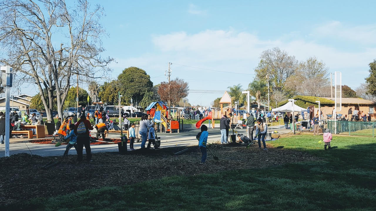
Park planting in East Palo Alto to build community resilience. Photo courtesy Canopy.
San Mateo’s assessment inventoried all assets that would get wet with each of the three scenarios described above, analyzed timing and location of flooding from 1-10 feet at 1-foot increments, and developed case studies for 30 representative assets—including a BART/CalTrain station, a school, a hospital and a wastewater treatment plant—and the community of East Palo Alto. The profiles analyze the extent to which each asset is vulnerable to sea level rise, the ability of the asset to cope with it, and possible adaptation strategies. According to the County’s Climate Resiliency Specialist, Jasneet Sharma, next steps include additional assessments of county facilities, updating the county’s climate action plan and general plan to reflect the findings and strategies, and developing guidance documents and toolkits. “We would also like to offer technical assistance and be a resource to our cities so they can start to embed adaptation within their plans and policies.” she says.
Marin County also received funding from the Coastal Conservancy’s Climate Ready Program for its bayshore sea level rise project BayWAVE, which looked at the entire Bay shoreline of Marin County, from south of Sausalito to the county line in North Novato. “We used the same models and a similar approach as San Mateo,” says BayWAVE’s Chris Choo, a Principal Planner with Marin County Public Works.
Like Sea Change, BayWAVE used three different sea level rise scenarios—10, 20 and 60 inches—which “fall within the range of near, mid and long-term projections from NRC,” says Choo—and layered in a 100-year flood event (also known as a 1% annual chance flood) for a total of six scenarios.
As with San Mateo, Marin’s vulnerability assessment found that sea level rise will seriously compromise transportation. “Our highways will all flood in portions, as well as major roadways,” says Choo, adding that many of these “shut down the entire county and beyond—the North Bay, access to City and the East Bay—when they are flooded.” Utilities and emergency services also emerged as significant concerns.
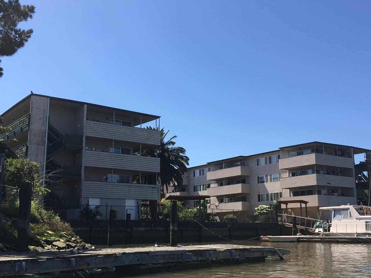
Vulnerable multi-family housing along the San Rafael Canal. Photo: Nate Seltenrich
BayWAVE completed its assessment earlier this year. Choo says next steps include looking at capital planning and land use planning, building adaptation projects to demonstrate green solutions, and working with cities and towns to provide them with guidance.
San Francisco has been developing an ambitious resilience plan for several years, issuing guidance for incorporating sea level rise (SLR) into capital planning in 2014. The S.F. Sea Level Rise Action Plan, launched in 2016, estimates that by the end of the century, six percent of the city—including Fisherman’s Wharf, the Marina and much of the Financial District—could be inundated, says city and county planner Maggie Wenger. In addition to flooding, SLR could also bring a higher water table that could exacerbate liquefaction in the event of an earthquake.
Like most of the other projects around the Bay, San Francisco’s project relies on SLR projections from the NRC 2012 report and incorporates ART modeling. The plan includes a vulnerability and risk assessment that is currently underway. “We are looking at all kinds of infrastructure and hoping to bring it all together in the spring of 2018,” says Wenger. “We are looking at where we need to act first, and what kinds of actions are appropriate.”
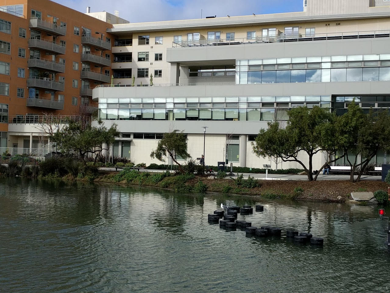
Burgeoning development in San Francisco’s Mission Bay neighborhood that may be at risk. Photo courtesy BCDC
Across the Bay, ART has conducted resilience projects with Alameda and Contra Costa counties, among other jurisdictions. At the beginning of each project, the ART team convened a working group of stakeholders to identify resilience goals, says BCDC’s Lowe. For example, in Alameda County, housing affordability is a significant problem for many people, “so having that as part of your resilience goals upfront is really important,” says Lowe. On the other hand, in Contra Costa, there was significant concern about industrial land uses, including refineries, and their role in the economy. On the flip side, another objective was to address concerns about the pollution associated with industry. “Some communities in the county are already exposed to more pollution than the rest of the region. If you lay on an additional stressor like SLR, or even a temporary flood from say a 50-year storm, that exposure could increase,” says Lowe. In addition, many Contra Costa neighborhoods have limited access to services such as hospitals and grocery stores, “making it harder for that community to be resilient in a hazard event,” she says. ART is currently working with the Boards of Supervisors and other agencies to “help them understand the findings of the studies and figure out how to advance the work that was done,” says Lowe.
With a number of large technology campuses—including Google and Facebook— located in areas potentially subject to inundation, Santa Clara County has taken sea level rise seriously for some time. With funding from the California Strategic Growth Council, the county’s Office of Sustainability launched Silicon Valley 2.0 in 2013, to identify the region’s climate vulnerabilities, conduct a gap analysis of climate change mitigation programs, and develop a decision-support tool that would map assets, measure their sensitivity to climate change impacts, and calculate the cost of failing to act.
The project released the Silicon Valley 2.0 Climate Adaptation Guidebook in 2015. The Guidebook was not intended as a plan so much as a set of strategies to be undertaken by individual agencies, groups of cities and/or regional partnerships. However, progress since then has been largely stalled, as the county’s Office of Sustainability has lacked ongoing leadership, according to interim director Kevin Armstrong. “We need someone permanent here to say ‘these are the strategies that we need to move forward on,’” he says, adding that he expects a permanent director will be on board by year-end. “Most of the maps for Santa Clara County were only wrapped up in the past year, so they weren’t available when SV 2.0 was done—resources have improved in the intervening time period, we would want to take a look at the strategies outlined here and see if they match what ART has produced since then,” he says.
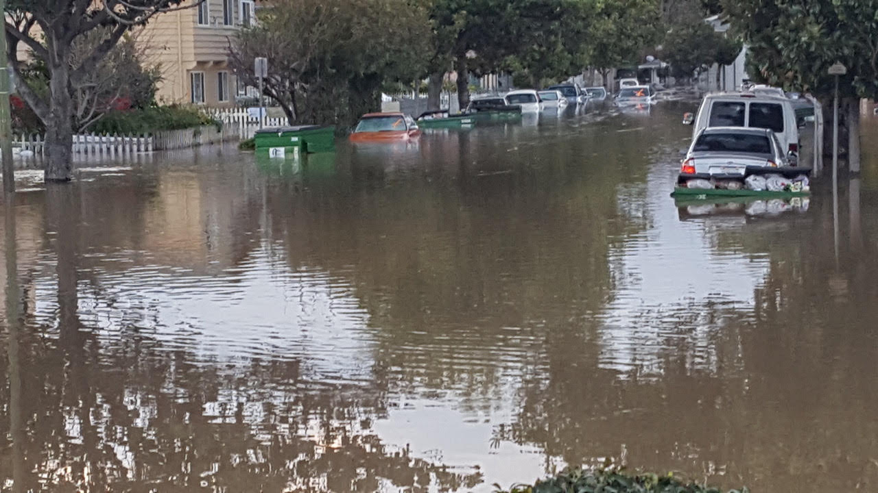
Extreme rainfall in the winter of 2017 flooded this Rock Spring neighborhood in San Jose. Sea level rise will only exacerbate such flooding. Photo courtesy Santa Clara Valley Water District.
Also in the South Bay, several initiatives were already underway long before ART developed its maps, including the South Bay Shoreline Project managed by the Army Corps of Engineers, the Santa Clara Valley Water District, the U.S. Fish and Wildlife Service and the Coastal Conservancy. Closely coordinated with the South Bay Salt Pond Restoration Project, which seeks to restore historic wetlands on 15,100 acres of former commercial salt ponds, the goal of the Shoreline Project is to protect the most vulnerable parts of the Santa Clara shoreline from flooding, including flooding from sea level rise.
The project plan, which was released in 2015, calls for a combination of levees and wetland restoration, and includes completion of the Bay Trail through the area. Congress authorized the project under the Water Resources Development Act of 2016, although no funding has yet been appropriated. David Kaulfers, the Corps’ manager on the project, says he is hopeful that funding will be approved this winter and that work can begin next summer on the first phase of a four-mile-long levee that will protect San Jose’s wastewater treatment plant and the community of Alviso. Two-thirds of the Bay side of the levee will be a so-called “horizontal levee, featuring a 30:1 slope, or ecotone, and restored tidal marsh. “Once we build the levee we can start breaching the berms around some of the salt ponds to restore tidal action to the ecosystem,” says Kaulfers.
Another planning effort long in the works addresses persistent flooding problems, which will only be exacerbated by rising sea levels, on the border between Santa Clara and San Mateo counties. Here construction is underway on the San Francisquito Creek Joint Powers Authority’s S.F. Bay to Highway 101 Project. The project is widening the creek channel, building sea wall and levees—including horizontal levees—and restoring marsh at the mouth of the creek, with the goal of protecting the adjacent communities from creek flooding and up to nine feet of sea level rise. The SFCJPA, which includes the cities of East Palo Alto, Palo Alto and Menlo Park, as well as the San Mateo County Flood Control District and the SCVWD, plans to tie the creek project to its SAFER Bay project, which will protect 11 miles of shoreline and create 22 new acres of marsh habitat. “One of the tenets of SAFER is that sustainability of the marshes and flood protection of property and people are codependent,” says SFCJPA Executive Director Len Materman. “You can’t do one with out the other.”
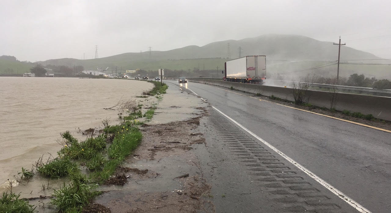
With the notable exception of Marin, sea level rise planning efforts in the North Bay are generally less mature than elsewhere in the region. However Sonoma County has just completed a vulnerability assessment of its coastal zone, including a community-specific adaptation plan for Bodega Bay, the at-risk area with the largest population. In part because the Bay side of the county is largely undeveloped, there are currently no SLR adaptation efforts underway there. The county is, however, working with Caltrans and other partners on a plan to protect Highway 37 from flooding (see ESTUARY News’ companion story in the September 2017 issue: High Road for the Wettest Highway?).
“We know there is be work that could be done on the Bay side,” says Sonoma County’s Sandi Potter. “There is infrastructure there, as well as implications for agriculture, such as changes in weather patterns and groundwater levels. We’ll be looking at these issues as we move forward with a general plan update next year.”
Flooding along Highway 37 between Marin and Vallejo in winter 2017 closed this major east-west artery for 28 days. Photo courtesy Caltrans and Solano County Transportation Authority.
In another Sonoma-based adaptation initiative, the county’s Agricultural Preservation and Open Space District received a $1 million grant from NASA to develop county-wide LiDAR, which it is using to identify lands to prioritize for conservation, says the District’s Karen Gaffney. “We want to know where areas that we have protected become inundated in the future, and where are areas that are important to protect so that we can have a planned retreat approach — where are there opportunities for marshes, for example, to move inland as sea level rises.”
Napa is “a little less vulnerable than the other counties,” says Rick Thomasser of the Napa Flood Control District, “We have a lot less infrastructure at risk.” Nevertheless, this summer the District embarked on a vulnerability assessment of a section of an area near the Napa River where 135 homes could get wet feet in the future. Thomasser says he hopes to have possible mitigation measures outlined by spring. “We need to make the community aware of the risk, and give them something to think about in terms of funding,” he says, adding that a big question is where that funding might come from. “Napa County’s issues may be small, but even they are too big for one community to handle alone.”
Of course, funding is the elephant in the room when it comes to sea level rise adaptation and resilience planning. Marin’s Choo observes that “We don’t have any idea what it would cost to protect the county in a meaningful way, and given the uncertainty, the range of options is so broad that it’s hard to even come up with a rough number. But the short answer is that it is a bunch of money that we don’t have.”
Apart from funding, the biggest challenge facing local climate change planners may be the interconnectedness of the nine Bay Area counties. What happens in one county has repercussions for others. UC Berkeley’s Mark Stacey, professor of civil and environmental engineering, received a National Science Foundation grant to study how sea level rise strategies in different parts of the Bay may affect each other, the RiSeR Bay Project.
“We want to make sure that we are thinking at the regional level,” says the Coastal Conservancy’s Kelly Malinowski, a project manager in the San Francisco Bay Program, adding that a number of agencies have tried to act as a regional coordinating body on climate change issues. Currently, she says, the role is being filled by the Bay Area Regional Collaborative’s members, or BARC, composed of BCDC, the Metropolitan Transportation Authority, the Association of Bay Area Governments, and the Air Quality Management District, with additional input from the Coastal Conservancy and the San Francisco Estuary Partnership. “It’s a hub of coordination that I have found useful,” she says.
BARC’s recently-posted draft report Raising the Bar on Regional Resilience notes that “local jurisdictions cannot be expected to…address regional-scale vulnerabilities on their own; nor …make strategic decisions about shoreline interventions without taking into account potential impacts to surrounding jurisdictions.” The report discusses and expands on six recommended steps to regional resilience contained in Plan Bay Area 2040. It also presents four case studies highlighting regional level vulnerabilities in specific places. While regional leaders decide how best to collaborate on resilience planning and support local municipalities in planning for multiple hazards – sea level rise, increased flooding, and earthquakes — BCDC is continuing to confront sea level rise head on. In September BCDC launched a regional sea level rise assessment called ART Bay Area.
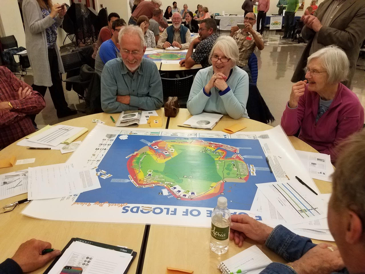
Marin County uses Game of Floods to orient residents to the challenges and choices ahead with rising sea levels. Photo courtesy Marin County.
The choices that will need to be made are so complex, and the cost of solutions so large, that an engaged public will be vital to successful SLR adaptation strategies. “The biggest challenge is getting people to understand that this will impact you no matter where you live,” says Sea Change SMC’s Sharma. “Even if you live up on a hill, if the water treatment plant gets inundated you may suddenly not be able to use your toilet. If Highway 101 is flooded you are not going to be able to get to work.” To get that message across, San Mateo and other counties are building robust public outreach campaigns into their SLR projects, including Marin’s award-winning Game of Floods, in which players are tasked with developing hypothetical adaptation plans for a future Marin County.
Successful sea level rise adaptation is going to require local jurisdictions and the region as a whole to answer a host of vital questions, including what level of SLR should we plan for? What are the most important things to protect, and what measures will the public accept to protect them? And of course, who will pay for it and how? As Marin’s Choo observes, “the vulnerability assessment was the easy part. Everything that follows is going to be the real challenge.”
Check out Canal Communities, Rich and Poor, Prep for Wetter Feet by Nate Seltenrich, the first feature published on a new storytelling hub for your tales of communities, people, shorelines, and wildlife preparing for sea level rise around San Francisco Bay. AcclimateWest.org, an independent project spun off from ESTUARY News, wants your ideas, photos, voices for its place-based stories.
Cariad Hayes Thronson covers legal and political issues for Estuary News. She has served on the staffs of several national publications, including The American Lawyer. She is a long-time contributor to Estuary News, and some years ago served as its assistant editor. She lives in San Mateo with her husband and two children.
Our magazine’s media motto for many years has been “Where there’s an estuary, there’s a crowd.” The San Francisco Estuary is a place where people, wildlife, and commerce congregate, and where watersheds, rivers and the ocean meet and mix, creating a place of unusual diversity. In choosing to tell the...
Ever since the state and federal water projects were built in the 1930s and 1940s, California has captured snowmelt in foothill reservoirs, and moved the fresh water from dam releases and river outflows to parched parts of the state via aqueducts hundreds of miles long. A convoluted system of ancient...
Though the Clean Water Act did an amazing job of reducing wastewater and stormwater pollution of the San Francisco Estuary, some contaminants remain thorny problems. Legacy pollutants like mercury washed into the watershed from upstream gold mining, PCBs from old industrial sites, and selenium from agricultural drainage in the San...
Hothouse Earth
By Ariel Rubissow Okamoto
Photo by Megan Nguyen
Nothing could be stranger than sitting in the dark with thousands of suits and heels, watching a parade of promises to decarbonize from companies and countries large and small, reeling from the beauties of big screen rainforests and indigenous necklaces, and getting all choked up.
It was day two of the September 2018 Global Climate Action Summit in San Francisco when I felt it.
At first I wondered if I was simply starstruck. Most of us labor away trying to fix one small corner of the planet or another without seeing the likes of Harrison Ford, Al Gore, Michael Bloomberg, Van Jones, Jerry Brown – or the ministers or mayors of dozens of cities and countries – in person, on stage and at times angry enough to spit. And between these luminaries a steady stream of CEOs, corporate sustainability officers, and pension fund managers promising percentages of renewables and profits in their portfolios dedicated to the climate cause by 2020-2050.
I tried to give every speaker my full attention: the young man of Vuntut Gwichin heritage from the edge of the Yukon’s Arctic National Wildlife Refuge who pleaded with us not to enter his sacred lands with our drills and dependencies; all the women – swathed in bright patterns and head-scarfs – who kept punching their hearts. “My uncle in Uganda would take 129 years to emit the same amount of carbon as an American would in one year,” said Oxfam’s Winnie Byanyima.
“Our janitors are shutting off the lights you leave on,” said Aida Cardenas, speaking about the frontline workers she trains, mostly immigrants, who are excited to be part of climate change solutions in their new country.
The men on the stage, strutting about in feathers and pinstripes, spoke of hopes and dreams, money and power. “The notion that you can either do good or do well is a myth we have to collectively bust,” said New Jersey Governor Phil Murphy whose state is investing heavily in offshore wind farms.
“Climate change isn’t just about risks, it’s about opportunities,” said Blackrock sustainable investment manager Brian Deese.
But it wasn’t all these fine speeches that started the butterflies. Halfway through the second day of testimonials, it was a slight white-haired woman wrapped in an azure pashmina that pricked my tears. One minute she was on the silver screen with Alec Baldwin and the next she taking a seat on stage. She talked about trees. How trees can solve 30% of our carbon reduction problem. How we have to stop whacking them back in the Amazon and start planting them everywhere else. I couldn’t help thinking of Dr. Seuss and his truffala trees. Jane Goodall, over 80, is as fierce as my Lorax. Or my daughter’s Avatar.
Analyzing my take home feeling from the event I realized it wasn’t the usual fear – killer storms, tidal waves, no food for my kids to eat on a half-baked planet – nor a newfound sense of hope – I’ve always thought nature will get along just fine without us. What I felt was relief. People were actually doing something. Doing a lot. And there was so much more we could do.
As we all pumped fists in the dark, as the presentations went on and on and on because so many people and businesses and countries wanted to STEP UP, I realized how swayed I had let myself be by the doomsday news mill.
“We must be like the river, “ said a boy from Bangladesh named Risalat Khan, who had noticed our Sierra watersheds from the plane. “We must cut through the mountain of obstacles. Let’s be the river!”
Or as Harrison Ford less poetically put it: “Let’s turn off our phones and roll up our sleeves and kick this monster’s ass.”
4th California Climate Change Assessment Blues
by Isaac Pearlman
Since California’s last state-led climate change assessment in 2012, the Golden State has experienced a litany of natural disasters. This includes four years of severe drought from 2012 to 2016, an almost non-existent Sierra Nevada snowpack in 2014-2015 costing $2.1 billion in economic losses, widespread Bay Area flooding from winter 2017 storms, and extremely large and damaging wildfires culminating with this year’s Mendocino Complex fire achieving the dubious distinction of the largest in state history. California’s most recent climate assessment, released August 27th, predicts that for the state and the Bay Area, we can expect even more in the future.
The California state government first began assessing climate impacts formally in 2006, due to an executive order by Governor Schwarzenegger. California’s latest iteration and its fourth overall, includes a dizzying array of 44 technical reports; three topical studies on climate justice, tribal and indigenous communities, and the coast and ocean; as well as nine region-specific analyses.
The results are alarming for our state’s future: an estimated four to five feet of sea level rise and loss of one to two-thirds of Southern California beaches by 2100, a 50 percent increase in wildfires over 25,000 acres, stronger and longer heat waves, and infrastructure like airports, wastewater treatment plants, rail and roadways increasingly likely to suffer flooding.
For the first time, California’s latest assessment dives into climate consequences on a regional level. Academics representing nine California regions spearheaded research and summarized the best available science on the variable heat, rain, flooding and extreme event consequences for their areas. For example, the highest local rate of sea level rise in the state is at the rapidly subsiding Humboldt Bay. In San Diego county, the most biodiverse in all of California, preserving its many fragile and endangered species is an urgent priority. Francesca Hopkins from UC Riverside found that the highest rate of childhood asthma in the state isn’t an urban smog-filled city but in the Imperial Valley, where toxic dust from Salton Sea disaster chokes communities – and will only become worse as higher temperatures and less water due to climate change dry and brittle the area.
According to the Bay Area Regional Report, since 1950 the Bay Area has already increased in temperature by 1.7 degrees Fahrenheit and local sea level is eight inches higher than it was one hundred years ago. Future climate will render the Bay Area less suitable for our evergreen redwood and fir forests, and more favorable for tolerant chaparral shrub land. The region’s seven million people and $750 billion economy (almost one-third of California’s total) is predicted to be increasingly beset by more “boom and bust” irregular wet and very dry years, punctuated by increasingly intense and damaging storms.
Unsurprisingly, according to the report the Bay Area’s intensifying housing and equity problems have a multiplier affect with climate change. As Bay Area housing spreads further north, south, and inland the result is higher transportation and energy needs for those with the fewest resources available to afford them; and acute disparity in climate vulnerability across Bay Area communities and populations.
“All Californians will likely endure more illness and be at greater risk of early death because of climate change,” bluntly states the statewide summary brochure for California’s climate assessment. “[However] vulnerable populations that already experience the greatest adverse health impacts will be disproportionately affected.”
“We’re much better at being reactive to a disaster than planning ahead,” said UC Berkeley professor and contributing author David Ackerly at a California Adaptation Forum panel in Sacramento on August 27th. “And it is vulnerable communities that suffer from those disasters. How much human suffering has to happen before it triggers the next round of activity?”
The assessment’s data is publicly available online at “Cal-adapt,” where Californians can explore projected impacts for their neighborhoods, towns, and regions.


 The results are alarming for our state’s future: an estimated four to five feet of sea level rise and loss of one to two-thirds of Southern California beaches by 2100, a 50 percent increase in wildfires over 25,000 acres, stronger and longer heat waves, and infrastructure like airports, wastewater treatment plants, rail and roadways increasingly likely to suffer flooding.