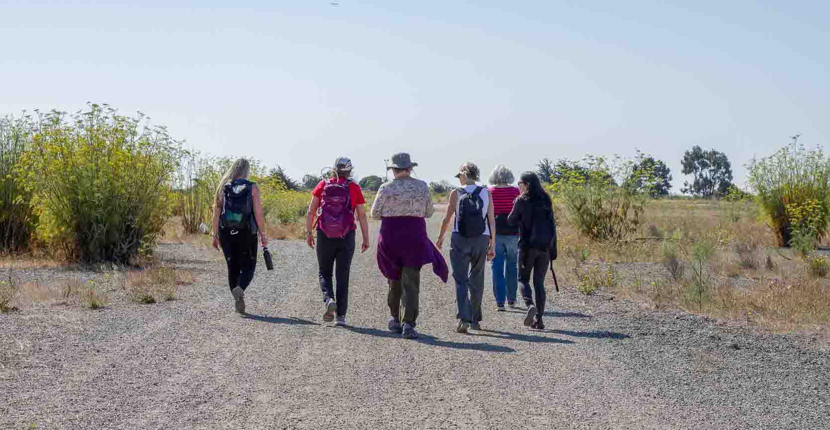
On
a clear San Francisco morning, I met Barb Christianson and Sally Jo Dinwoodie,
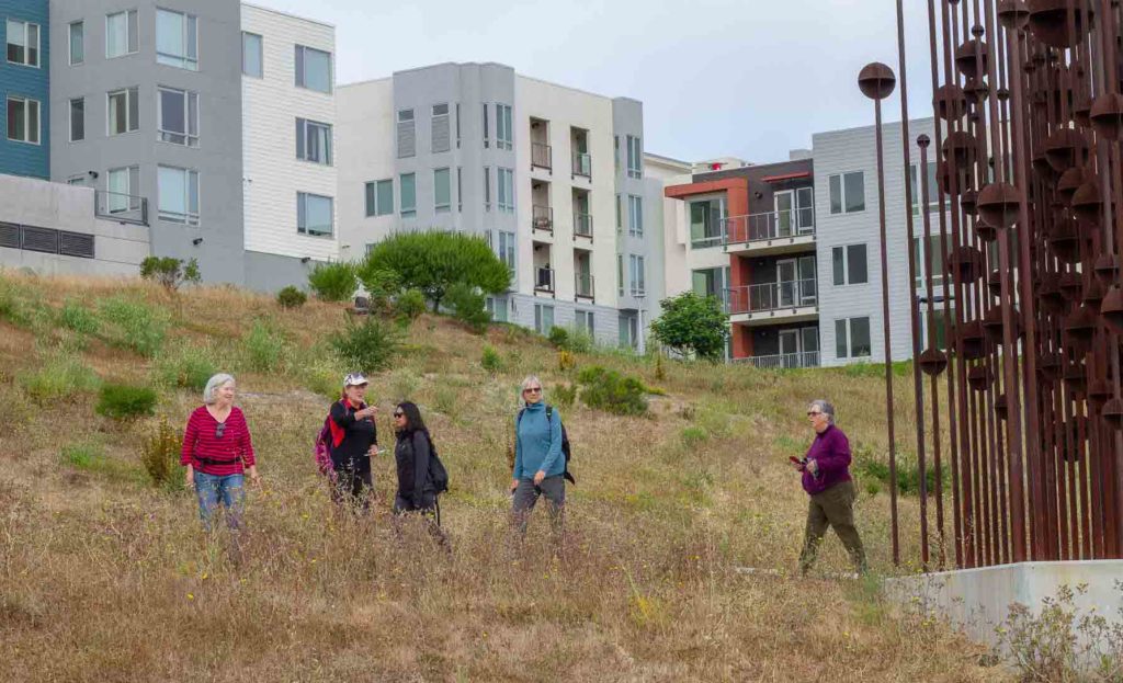
both 64, at a Hunter’s Point neighborhood with new, multi-storied townhouses
that can go for a million dollars. Seven of us headed down the hill towards the
Bay with the San Francisco skyline and Bay Bridge sparkling.
Christianson, Dinwoodie, and a small group of friends are walking the entire San Francisco Bay Trail by tackling one segment at a time, in order, once a month. After two years, they have covered more than half the trail, both the finished, and as best they can, the unfinished portions.
At the Hunter’s Point Shipyard, we walked past a guard who was fast asleep in the guardhouse. Our plan was to drop down to Crisp Street, the closest street to the water. As we discussed the route, a woman in a Jeep Cherokee drove up to the guard gate and honked her horn to wake up the guard. She yelled at him, and then yelled at us that the area was restricted.
After
some disappointed discussion and talk of dissent, we eventually chose to climb
back up to the transition area between Hunter’s Point and Bayview, where cultures
and economies are pushing against each other. The condos were tidy and neat, but
the neighborhood felt like a ghost town. The older neighborhoods had friendly
people and more activity but are in serious need of some love in the form of city
dollars.
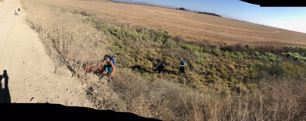
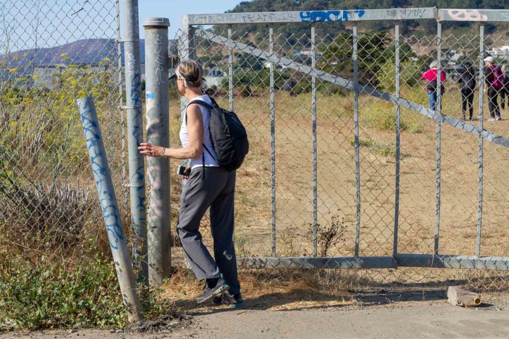
At
the bottom of Ingalls, we turned towards the water and were excited to find an
open gate to Yosemite Slough and a trail along the water. A field of pickleweed,
an egret, and a killdeer’s warning cry were familiar signs of a tidal marsh. Abruptly,
the trail ended in an area heaped with trash and clothes. “This is the Bay
Trail. One minute we’re on the trail and the next it dead ends into a homeless
camp,” someone said.
Photo: Katherine Briccetti
The San Francisco Bay Trail is a proposed 500-mile trail that when finished will ring the Bay. This year marks the 30th anniversary of the year the region launched the Bay Trail. To date, public and private landowners have completed 356 miles of trail. The finished miles appear as solid green lines on the navigation map and the 25 regional map cards, and the yet-to-be completed sections as dashed green lines.
Bay
Trail project manager Laura Thompson says that some of the dashed lines “represent
a vision of how people will experience the edge of the shoreline in the future.”
She stresses that the project discourages trespassing, and asks people not to
follow the dashed lines. On the ground, only some of the unfinished sections
are actually traversable. When they are, the Bay Trail map cards indicate a
safe way to navigate those legs.
Crosscountry connection. Photo: Barbara Christianson
From
the beginning, this group of Bay Trail walkers chose to walk the whole trail. “We stay as close as possible to the Bay.
We want to see it. We’re on the Bay Trail,” says Christianson. “We’ve only trespassed maybe five times.”
Dinwoodie says they draw a clear line. “We’ve gone through holes
in fences and walked through gates that were closed, but we have never climbed
a fence and we don’t go through residential private property.”
On their one-year
anniversary, the two women, along with Michelle Dhanak and Adena Kershner, approached
a closed gate with a “No Trespassing” sign in Vallejo. The factory inside the
fence was shuttered and there was a tempting hole in the fence.
They
weighed their options at the gate. The Mare Island Strait lay to their left,
and a steep cliff to the right. If they didn’t go forward, they would have to
backtrack for miles, and that was against one of their three rules: Stay as
close to the water as possible; don’t take shortcuts; and no back tracking.
Photo: Barbara Christianson
Their
trek had already proven challenging that morning. They had had to climb over
slippery rocks underneath the Carquinez Bridge because of a trail gap. There’s
a vision for the trail to cross Interstate 80 further north at Sonoma
Boulevard, but for now, it’s nothing more than a dashed line on the navigation
map.
After
a brief discussion, the walkers slid through the hole in the gate. What they
didn’t know was that they were stepping into a red-hot, land-use issue in
Vallejo. The shuttered factory was the old General Mills flour plant and the
site of a proposed cement plant opposed by many Vallejo citizens. (The Orcem
cement plant proposal was withdrawn on May 24, 2019.)
Within
minutes, a female caretaker sprang out of an abandoned building with two
leashed barking dogs. “You can’t go through here. You have to turn around,” she
snarled.
Without
missing a beat, Christianson approached the woman (and the barking dogs) with
phone in hand. She was polite, showed the caretaker where they were trying to
go, and asked if she had any ideas on how they could get through.
The
caretaker softened and escorted them to the gate at the other end of the 39-acre
property. “Barb won her over,” says Dinwoodie. “We always joke, if there’s a
problem we’ll send Barb.”
The
walkers celebrated their one-year anniversary that day with beers at the
Vallejo Ferry Terminal. Then they called Uber, and returned to their parked
cars.
Photo: Katherine Briccetti
Nitty Gritty
Christianson and Dinwoodie – both working women who are busy with friends and family – met as young moms 30 years ago. They walked the Bay Trail from Emeryville to Albany every Friday night with strollers. The moms kept walking until the Dinwoodie’s degenerative back pain kept her from the trail. Dinwoodie resisted surgery until her doctor told her she’d be in a wheelchair if she didn’t do something. She had the surgery.
Two
years later, when she was healing and Christianson had finished the “marathon
project” in which she ran a marathon in all 50 states in 10 years, they decided
it would be fun to walk the entire Bay Trail. “Just a little bit each month,” Christianson
told her friend. “You can do it.” They sent an email to their other female
friends. No regrets or RSVPs needed. Just show up if you want to go.
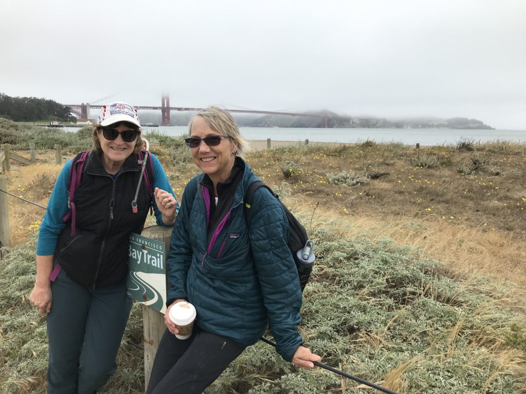
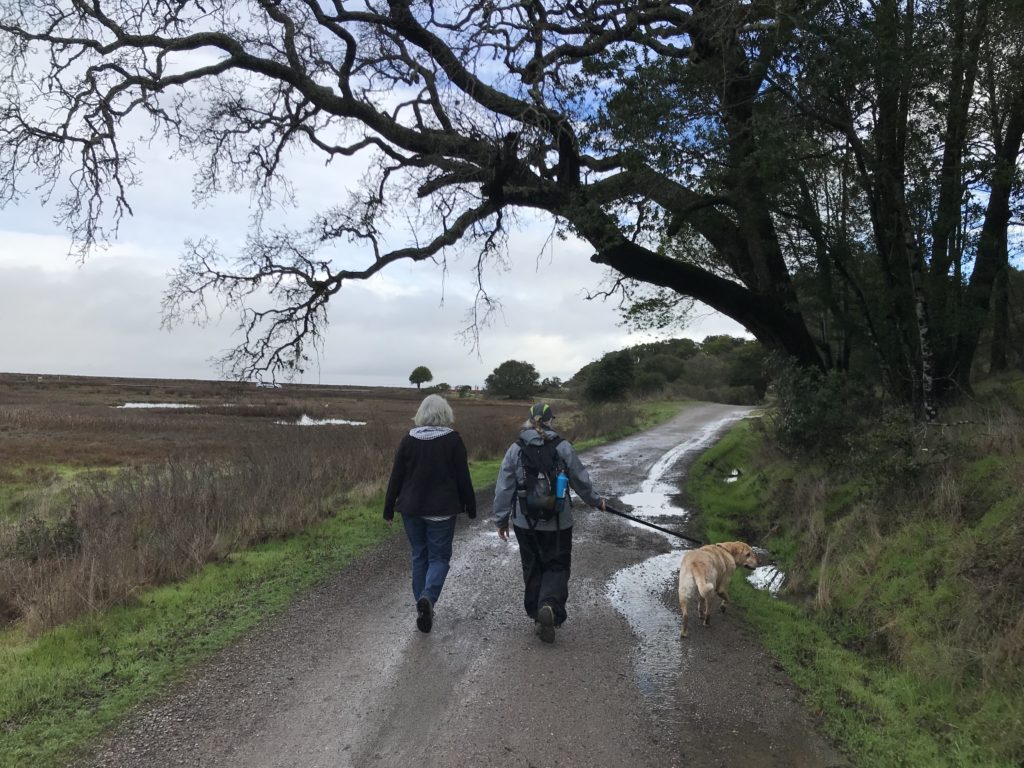
They started in Emeryville two years ago this June. One month after their two-year anniversary, I met the group on the north side of the Golden Gate Bridge (it was the first of two times I joined the group on the trail to research this story), when eight of us set out at 8 a.m. Christianson and Dinwoodie are the only two have walked a segment every month since the beginning. Michelle Dhanak, and Annette Williams have done most of them, and plan to schedule make-up walks. A core group of others come occasionally.
Christianson (left) and Dinwoodie (right). Photo: Aleta George
Eight
of us set out at 8 a.m. We crossed the fog-shrouded Golden Gate Bridge, and stopped
at the south overlook for a
snack, I asked the group if they knew of anybody else who had done the entire
trail. “By the time we finish, maybe there’ll be somebody,” said Dhanak, and
everyone laughed.
“We
don’t have a day deadline, or a number of miles that we have to go each day,”
says Dinwoodie. “We like to do ten miles, but it’s whatever works. We also
don’t have a deadline for when we finish. We figure it will take about two more
years.”
In
fact, several people have walked the finished sections of the trail, according
to Thompson. Corinne DeBra has walked around several times, and returned to her
car each time. Kurt Schwabe used public transit to walk all the solid lines in
30 days.
The
trail through San Francisco brought us to Crissy Field with a stop at the
Warming Hut; through a busy Farmer’s Market at Fort Mason; along the
scalloped-shaped Aquatic Cove with swimmers doing their laps; and into the
bustle of Fisherman’s Wharf and the Embarcadero. We took pictures, patted dogs,
and after nine miles of walking boarded a ferry bound for Sausalito and our
cars.
“Walking
once a month doesn’t get you more fit,” says Dhanak. “Psychologically you get
used to walking longer. Your feet hurt, your legs hurt, but you find out you
can do it anyway.”
Photo: Annette Williams.
To
hear more stories, I met Christianson and Dinwoodie at a café in Berkeley to
look at their pictures and the navigation map. As we did, I felt like I was going
through a family album with a married couple who had been together for years.
They corrected each other and helped one another remember details. And both of
them laughed a lot.
“Remember that
time in San Rafael when we had to get under the bridge, and that young man on
his bicycle helped us?” said Sally. The only route the walkers saw was on a
freeway ramp, but the kid led them down a ravine, through some branches, and onto
a trail they never would have seen without his help.
On
the same day, they had argued about whether or not to try and walk through San
Quentin State Prison grounds, or if they should follow the dashed line that
skirted it. According to the map, there was a road closer to the water
(remember that rule?) that went through prison grounds.
At the northern edge of San Quentin, the naysayers won the
debate and the group walked around the prison. But as they walked, they wondered,
“If we had called ahead would the prison have let us go through on the road?”
Curious, they stopped to ask the guard at the gate on the south end.
Apparently, his jaw
dropped. “Are you kidding me? It’s a prison!’” he said.
“He was so cute,” says Dinwoodie. “He thought we were so dorky.”
Photo: Annette Williams
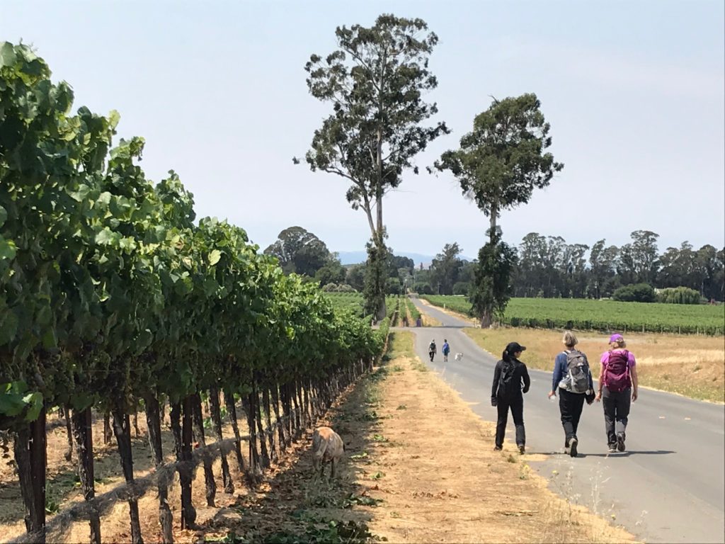
Napa
was difficult; it took them four months of Sundays to get through. A draw
bridge that never lowered stymied their progress, and they walked form miles on
railroad tracks in the hot sun. One day they had no choice but to walk on the
highway because they couldn’t get through an airport, a sanitation plant, and a
state wildlife refuge that is open to permitted hunting and fishing, but not
through-walkers.
They
also had fun in Napa. They walked alongside vineyards in the morning sun, went
wine tasting, and had a spa day in Calistoga. “We’ve gone wine tasting four
times,” says Christianson. “But who’s counting?”
Unfinished Business
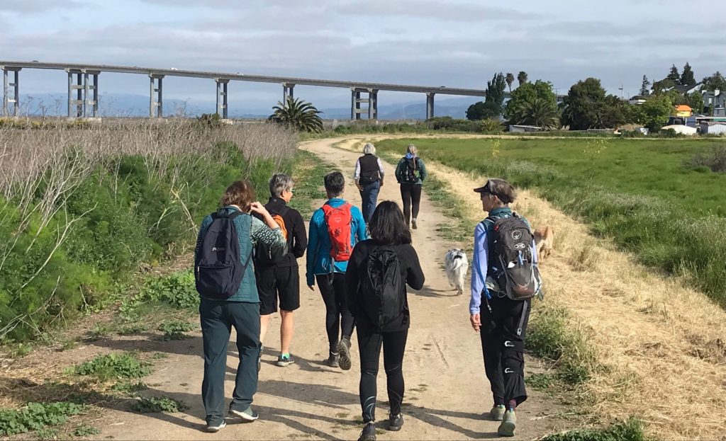
Back
in Bayview at Yosemite Slough, we exited the marsh and walked through an
industrial area with people living in RVs until we found our way back to the water’s
edge at Candlestick Point State Recreation Area. The sky was blue, and a picnic
table beneath a coast live oak tree offered a place for a shared snack.
Navigating around the edges of San Francisco’s Bayview. Photo: Katherine Briccetti
We
walked out to Candlestick Point on the designated trail and found campers (with
tents and a permit), dog walkers, and picnickers setting up colorful
tablecloths and balloons for a special celebration. “I love seeing how many
people love the Bay and are using the trail,” says Dinwoodie, who attributes her good health to
walking and a weekly dance date with Christianson at Berkeley’s Ashkenaz.
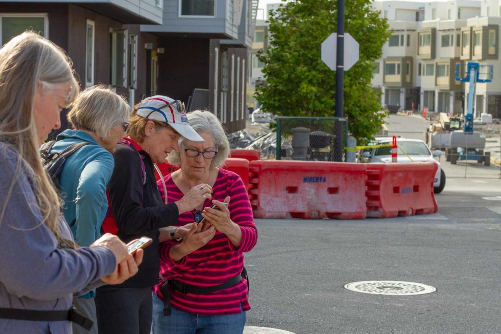
Upon leaving Candlestick Point, we came to more dashed lines and the need to decide on a route. “We are trying to be faithful to the Bay Trail idea by figuring out the most traversable close-to-the-bay route,” says Dinwoodie.
“These women’s mission appears to be a natural
reaction to an unfinished Bay Trail,” says Bay Trail’s Thompson. “Seventy-one
percent complete is enough to motivate people to will it to completion by
walking its imagined entirety. It gives me hope.”
Photo: Annette Williams
The two women trail blazers are looking forward
to the second half of their adventure in the South Bay, where there are long
stretches of completed trail. “We always look for Bay Trail signs. When we find
one, we take a picture of it because we’re so proud we’re on the trail. A lot
of the time we’re not sure,” says Dinwoodie.
“We’ve always had our stretch of trail that
we’ve felt ownership of from Richmond to Oakland. We have that allegiance, and
there’s people north of us and south of us who have their allegiances. The Bay
Trail is really raising consciousness of the Bay,” says Sally.
Of course, one can’t help but wonder what will
happen to the Bay Trail as sea levels continue to rise. Thompson says they are
working with other regional and local interests to address unavoidable
inundation in some locations. “The Bay Area as a region and individual cities
are starting to tackle this,” she says. “It’s important for us to preserve
continuity of the Bay Trail as sea levels rise.”
Next
month, the conversation, the walk, and the friendships continue.
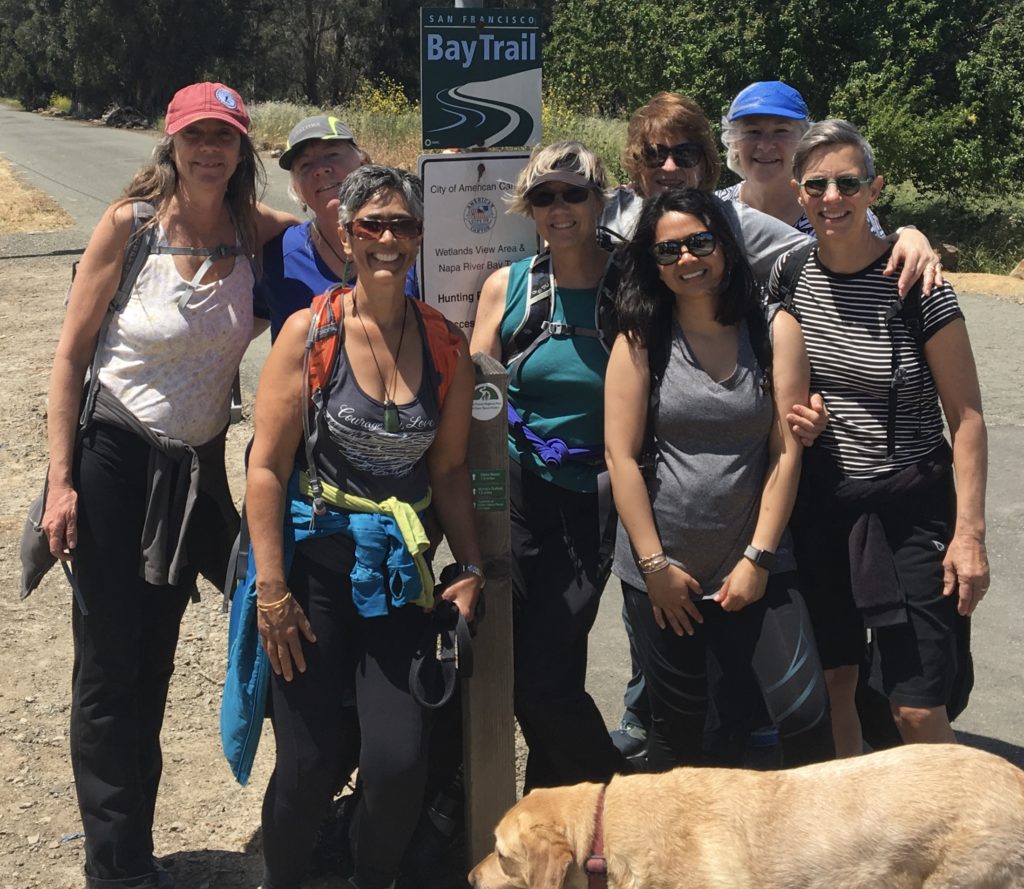
Group photo, ladies with a mission, dog with tired feet.
Our magazine’s media motto for many years has been “Where there’s an estuary, there’s a crowd.” The San Francisco Estuary is a place where people, wildlife, and commerce congregate, and where watersheds, rivers and the ocean meet and mix, creating a place of unusual diversity. In choosing to tell the...
Ever since the state and federal water projects were built in the 1930s and 1940s, California has captured snowmelt in foothill reservoirs, and moved the fresh water from dam releases and river outflows to parched parts of the state via aqueducts hundreds of miles long. A convoluted system of ancient...
Though the Clean Water Act did an amazing job of reducing wastewater and stormwater pollution of the San Francisco Estuary, some contaminants remain thorny problems. Legacy pollutants like mercury washed into the watershed from upstream gold mining, PCBs from old industrial sites, and selenium from agricultural drainage in the San...
Hothouse Earth
By Ariel Rubissow Okamoto
Photo by Megan Nguyen
Nothing could be stranger than sitting in the dark with thousands of suits and heels, watching a parade of promises to decarbonize from companies and countries large and small, reeling from the beauties of big screen rainforests and indigenous necklaces, and getting all choked up.
It was day two of the September 2018 Global Climate Action Summit in San Francisco when I felt it.
At first I wondered if I was simply starstruck. Most of us labor away trying to fix one small corner of the planet or another without seeing the likes of Harrison Ford, Al Gore, Michael Bloomberg, Van Jones, Jerry Brown – or the ministers or mayors of dozens of cities and countries – in person, on stage and at times angry enough to spit. And between these luminaries a steady stream of CEOs, corporate sustainability officers, and pension fund managers promising percentages of renewables and profits in their portfolios dedicated to the climate cause by 2020-2050.
I tried to give every speaker my full attention: the young man of Vuntut Gwichin heritage from the edge of the Yukon’s Arctic National Wildlife Refuge who pleaded with us not to enter his sacred lands with our drills and dependencies; all the women – swathed in bright patterns and head-scarfs – who kept punching their hearts. “My uncle in Uganda would take 129 years to emit the same amount of carbon as an American would in one year,” said Oxfam’s Winnie Byanyima.
“Our janitors are shutting off the lights you leave on,” said Aida Cardenas, speaking about the frontline workers she trains, mostly immigrants, who are excited to be part of climate change solutions in their new country.
The men on the stage, strutting about in feathers and pinstripes, spoke of hopes and dreams, money and power. “The notion that you can either do good or do well is a myth we have to collectively bust,” said New Jersey Governor Phil Murphy whose state is investing heavily in offshore wind farms.
“Climate change isn’t just about risks, it’s about opportunities,” said Blackrock sustainable investment manager Brian Deese.
But it wasn’t all these fine speeches that started the butterflies. Halfway through the second day of testimonials, it was a slight white-haired woman wrapped in an azure pashmina that pricked my tears. One minute she was on the silver screen with Alec Baldwin and the next she taking a seat on stage. She talked about trees. How trees can solve 30% of our carbon reduction problem. How we have to stop whacking them back in the Amazon and start planting them everywhere else. I couldn’t help thinking of Dr. Seuss and his truffala trees. Jane Goodall, over 80, is as fierce as my Lorax. Or my daughter’s Avatar.
Analyzing my take home feeling from the event I realized it wasn’t the usual fear – killer storms, tidal waves, no food for my kids to eat on a half-baked planet – nor a newfound sense of hope – I’ve always thought nature will get along just fine without us. What I felt was relief. People were actually doing something. Doing a lot. And there was so much more we could do.
As we all pumped fists in the dark, as the presentations went on and on and on because so many people and businesses and countries wanted to STEP UP, I realized how swayed I had let myself be by the doomsday news mill.
“We must be like the river, “ said a boy from Bangladesh named Risalat Khan, who had noticed our Sierra watersheds from the plane. “We must cut through the mountain of obstacles. Let’s be the river!”
Or as Harrison Ford less poetically put it: “Let’s turn off our phones and roll up our sleeves and kick this monster’s ass.”
4th California Climate Change Assessment Blues
by Isaac Pearlman
Since California’s last state-led climate change assessment in 2012, the Golden State has experienced a litany of natural disasters. This includes four years of severe drought from 2012 to 2016, an almost non-existent Sierra Nevada snowpack in 2014-2015 costing $2.1 billion in economic losses, widespread Bay Area flooding from winter 2017 storms, and extremely large and damaging wildfires culminating with this year’s Mendocino Complex fire achieving the dubious distinction of the largest in state history. California’s most recent climate assessment, released August 27th, predicts that for the state and the Bay Area, we can expect even more in the future.
The California state government first began assessing climate impacts formally in 2006, due to an executive order by Governor Schwarzenegger. California’s latest iteration and its fourth overall, includes a dizzying array of 44 technical reports; three topical studies on climate justice, tribal and indigenous communities, and the coast and ocean; as well as nine region-specific analyses.
The results are alarming for our state’s future: an estimated four to five feet of sea level rise and loss of one to two-thirds of Southern California beaches by 2100, a 50 percent increase in wildfires over 25,000 acres, stronger and longer heat waves, and infrastructure like airports, wastewater treatment plants, rail and roadways increasingly likely to suffer flooding.
For the first time, California’s latest assessment dives into climate consequences on a regional level. Academics representing nine California regions spearheaded research and summarized the best available science on the variable heat, rain, flooding and extreme event consequences for their areas. For example, the highest local rate of sea level rise in the state is at the rapidly subsiding Humboldt Bay. In San Diego county, the most biodiverse in all of California, preserving its many fragile and endangered species is an urgent priority. Francesca Hopkins from UC Riverside found that the highest rate of childhood asthma in the state isn’t an urban smog-filled city but in the Imperial Valley, where toxic dust from Salton Sea disaster chokes communities – and will only become worse as higher temperatures and less water due to climate change dry and brittle the area.
According to the Bay Area Regional Report, since 1950 the Bay Area has already increased in temperature by 1.7 degrees Fahrenheit and local sea level is eight inches higher than it was one hundred years ago. Future climate will render the Bay Area less suitable for our evergreen redwood and fir forests, and more favorable for tolerant chaparral shrub land. The region’s seven million people and $750 billion economy (almost one-third of California’s total) is predicted to be increasingly beset by more “boom and bust” irregular wet and very dry years, punctuated by increasingly intense and damaging storms.
Unsurprisingly, according to the report the Bay Area’s intensifying housing and equity problems have a multiplier affect with climate change. As Bay Area housing spreads further north, south, and inland the result is higher transportation and energy needs for those with the fewest resources available to afford them; and acute disparity in climate vulnerability across Bay Area communities and populations.
“All Californians will likely endure more illness and be at greater risk of early death because of climate change,” bluntly states the statewide summary brochure for California’s climate assessment. “[However] vulnerable populations that already experience the greatest adverse health impacts will be disproportionately affected.”
“We’re much better at being reactive to a disaster than planning ahead,” said UC Berkeley professor and contributing author David Ackerly at a California Adaptation Forum panel in Sacramento on August 27th. “And it is vulnerable communities that suffer from those disasters. How much human suffering has to happen before it triggers the next round of activity?”
The assessment’s data is publicly available online at “Cal-adapt,” where Californians can explore projected impacts for their neighborhoods, towns, and regions.


 The results are alarming for our state’s future: an estimated four to five feet of sea level rise and loss of one to two-thirds of Southern California beaches by 2100, a 50 percent increase in wildfires over 25,000 acres, stronger and longer heat waves, and infrastructure like airports, wastewater treatment plants, rail and roadways increasingly likely to suffer flooding.