Riding the Restoration Waves: My Estuarine Journey
By Jessica Davenport, State Coastal Conservancy and San Francisco Bay Restoration Authority
After 16 years of working in the San Francisco Estuary, including serving as a manager for key regional agencies, I have ridden several waves of restoration. I’ve seen big changes in how restoration is done, who does it, and who benefits—whether it’s a fish or bird on the verge of extinction or a young person from an urban community learning green job skills on the shoreline. Our view of what matters continues to expand as connections that were once cloudy—between habitat restoration and environmental justice, between upland and bay habitats—come into focus. We’re not just trying to create small patches of tidal marsh but to piece together a huge mosaic of habitats from working lands to wetlands. We now know that a single project can create new homes for fish and wildlife, protect communities from flooding, and provide much-needed access to nature.
Article author, Jessica Davenport
After spending the first decade of my career working internationally on energy efficiency and sustainable agriculture, I have found it rewarding to act locally to address the global challenges we face. While the impacts of climate change and inequities continue to grow, we have unprecedented levels of state and federal funding to do our part to address them. As I look back over the last 16 years of my journey, it feels important to reflect on where we’ve been and where the next wave of restoration may take us.
Bay Beginnings
When I began working at the San Francisco Bay Conservation and Development Commission (BCDC) in 2007, I was one of seven new staff spread across BCDC’s planning, permitting, sediment management, and enforcement divisions. We were lucky to have an infusion of funding that allowed us to be trained in Bay ecology by illustrious experts. We learned about salt marsh harvest mice from Howard Shellhammer, about creeping wild rye and salt marsh pannes from Peter Baye, and about benthic macroinvertebrates and eelgrass from Chela Zabin and Kathy Boyer. We learned about the three Berkeley women who saved the Bay, leading to the creation of Save the Bay and BCDC itself, from BCDC deputy director Steve McAdam, who was one of Save the Bay’s first paid employees and later became one of BCDC’s first and longest-serving employees.
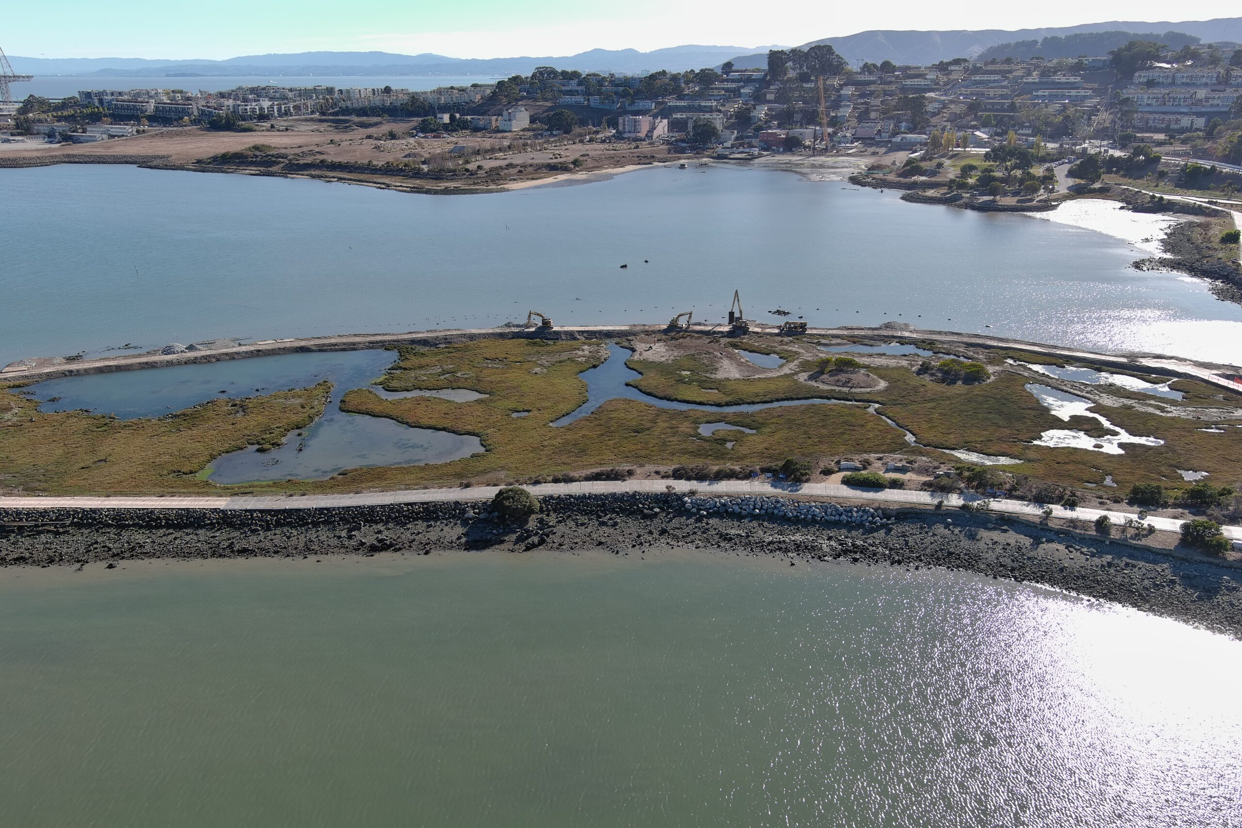
Corralling Sediment and Breaking the Waves
I was assigned to work in sediment management, issuing permits for dredging projects and participating in the ongoing effort to promote the reuse of dredged sediment in restoration projects, where it was desperately needed to raise the elevations of subsided diked Baylands. By 2007, restoration had already been underway for a couple decades, and practitioners and researchers were constantly seeking to figure out why some projects worked better than others, and apply lessons learned to future restoration project designs. At one point, I helped organize a Wind Wave Workshop, where experts came together to debate the best way to design restoration projects so that waves stirred up by the wind could be dampened, and more suspended sediment could settle out and allow the site to reach marsh plain elevation more quickly, at which point plants could grow. The consensus was that marsh mounds (small islands), pre-cut channels, and ditch blocks were all important design features to include in restoration projects.
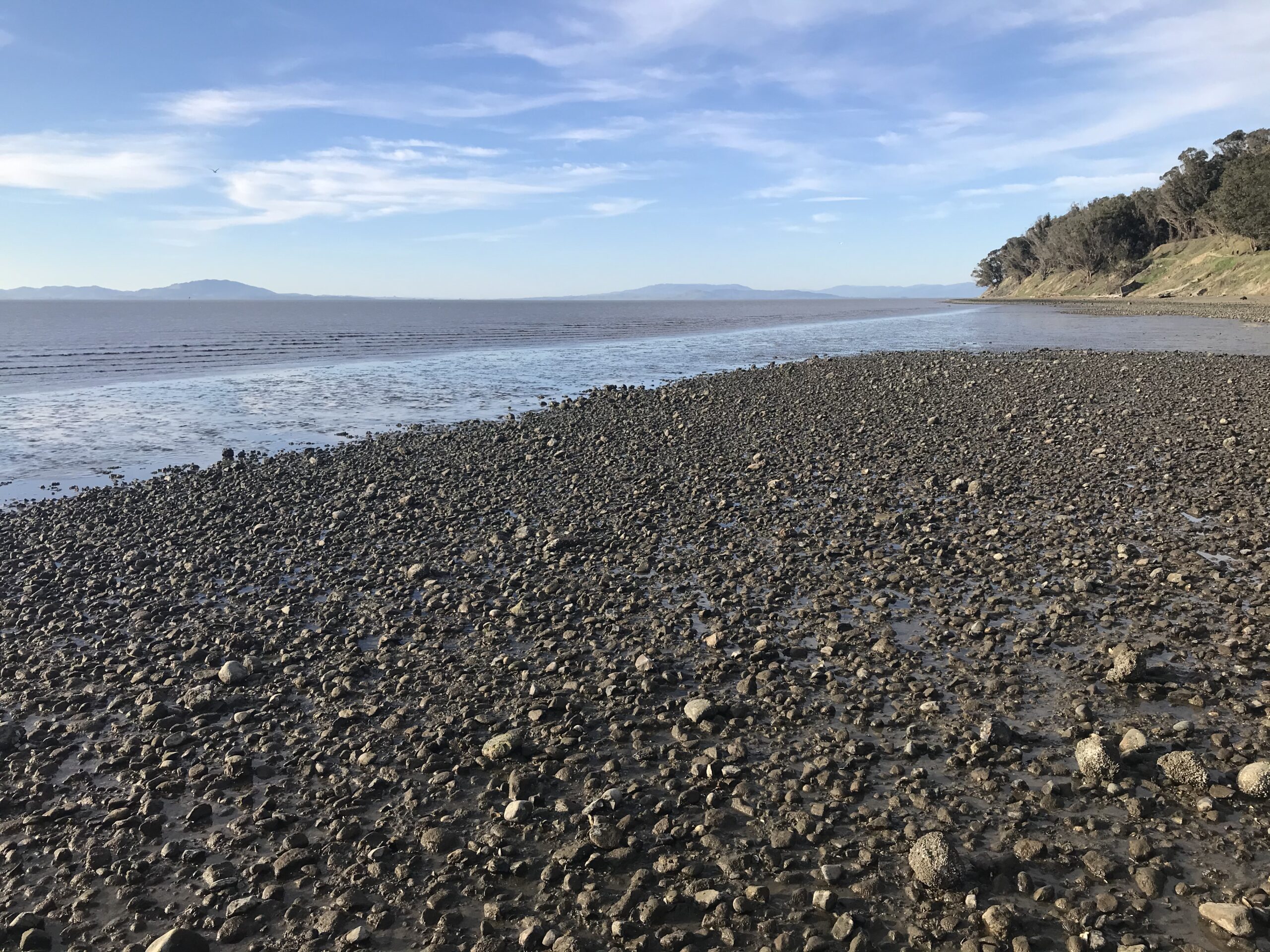
Mixed cobble, gravel and sand beach at king low tide at Point Pinole Regional Shoreline. Photo: Marilyn Latta
Amending the Bay Plan to Address Climate Change
Another highlight of my time at BCDC was participating in the 2011 amendment of the San Francisco Bay Plan to address climate change. One of the major positions of the environmental community was that undeveloped land along the shoreline should be protected from development to reduce the area that would need to be protected by levees as sea level rises and to expand opportunities for habitat restoration.
The Commission eventually adopted a policy that states, “To address the regional adverse impacts of climate change, undeveloped areas that are both vulnerable to future flooding and currently sustain significant habitats or species, or possess conditions that make the areas especially suitable for ecosystem enhancement, should be given special consideration for preservation and habitat enhancement and should be encouraged to be used for those purposes.” While not prohibiting development, the policy did provide a basis for protecting and enhancing undeveloped areas along the Bay shoreline, many of which have since been purchased from willing sellers and restored or planned for restoration.
Adopting the Delta Plan and Funding the Delta Conservancy
The next leg of my estuarine restoration journey took place a few miles upstream, where I joined the Delta Stewardship Council in 2012 to work on ecosystem restoration, land-use planning, and science integration. I participated in the final stages of developing the Delta Plan, modeled after the Bay Plan. The Council’s main contribution to habitat restoration at that time, supported by the Delta Science Program, was to require projects to include adaptive management plans. This requirement was based on an acknowledgement that restoration projects rarely perform exactly as intended, and therefore practitioners need to be vigilant about measuring ecological indicators and making adjustments as needed.
As soon as the Delta Plan was adopted in 2013, it was hit with seven lawsuits filed by 26 parties. Fortunately, the lawsuits were all resolved in the Council’s favor in 2020, affirming its authority to help achieve the state’s coequal goals of providing a more reliable water supply for California and protecting, restoring, and enhancing the Delta ecosystem, by both restoring habitat and reducing the state’s reliance on the Delta for water supply. Still, the legal challenges cast a long shadow over the Council’s work for many years. Compared to their counterparts in the Bay Area, local governments, water agencies, and landowners in the Delta saw habitat restoration as a much more threatening proposition.
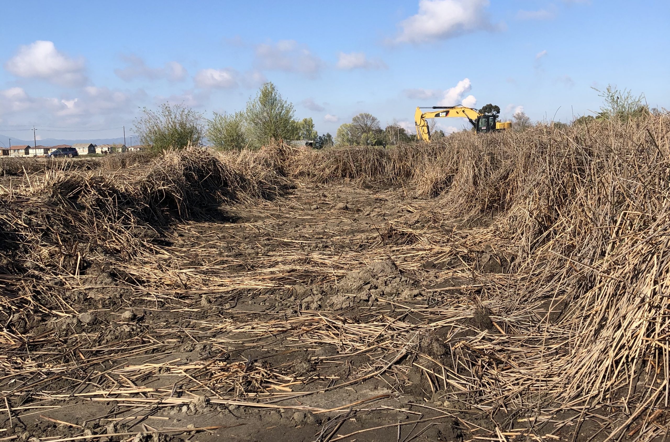
Site clearing work at Dutch Slough, one of the longest ongoing restoration projects in the Delta . Photo: Katherine Bandy
Another challenge to restoration in the Delta was that the Delta Conservancy, created along with the Delta Stewardship Council by Delta Reform Act of 2009, as “a primary agency to implement ecosystem restoration,” did not receive state funding to make grants for several years. Instead, the Delta Conservancy had to apply for grants itself, and focus on convening a long series of meetings to build trust among Delta stakeholders. Eventually, in 2015, the Delta Conservancy received $50 million under Proposition 1, an ecosystem restoration and water quality bond act, to make restoration grants. To date, the Conservancy has approved a total of 29 projects, committing approximately $39.3 million for Proposition 1 grants. More recently, the Amended Budget Act of 2022 provided the Conservancy with $36 million to support restoration, conservation, and climate resilience for wetlands.
The Water Wars
While major habitat restoration projects in the Bay, such as the South Bay Salt Ponds Restoration Project, have proceeded on a voluntary basis, much of the restoration in the Delta is a mitigation requirement, meant to compensate for the ecologically damaging effects of diverting large quantities of water out of the Delta to meet urban and agricultural needs. The “water wars,” often framed as “fish versus farms,” seem to be never-ending. The Bay Delta Conservation Plan, an eight-year, multi-million-dollar effort to create a grand bargain combining aquatic habitat restoration with construction of 40-mile twin tunnels for water diversion under the Delta, ultimately failed in 2015.
The California Department of Water Resources subsequently divided these efforts into twin proposals: WaterFix, focused on water conveyance, and EcoRestore, focused on habitat restoration. In 2018, the Delta Stewardship Council’s staff recommended that the Council find WaterFix inconsistent with the Delta Plan’s coequal goals of ecosystem restoration and water supply reliability, and DWR withdrew the proposal. In response to public input on WaterFix in 2018 and guidance from Governor Newsom in 2019, DWR scaled down its proposal from two tunnels to one. DWR’s comment period on the draft environmental impact report for the project, now rebranded as the Delta Conveyance Project, just closed in December 2022.
Accelerating Delta Restoration
After a slow start, habitat restoration in the Delta has accelerated over the past few years, as major tidal restoration projects, such as Bradmoor Island, and floodplain expansion efforts, such as the Big Notch Project, have broken ground under the banner of the DWR’s EcoRestore initiative. According to DWR, EcoRestore includes more than 30 projects representing an investment of nearly $500 million to date. In addition, long-delayed projects, such as Hill Slough and the first phase of Dutch Slough, finally breached their levees.
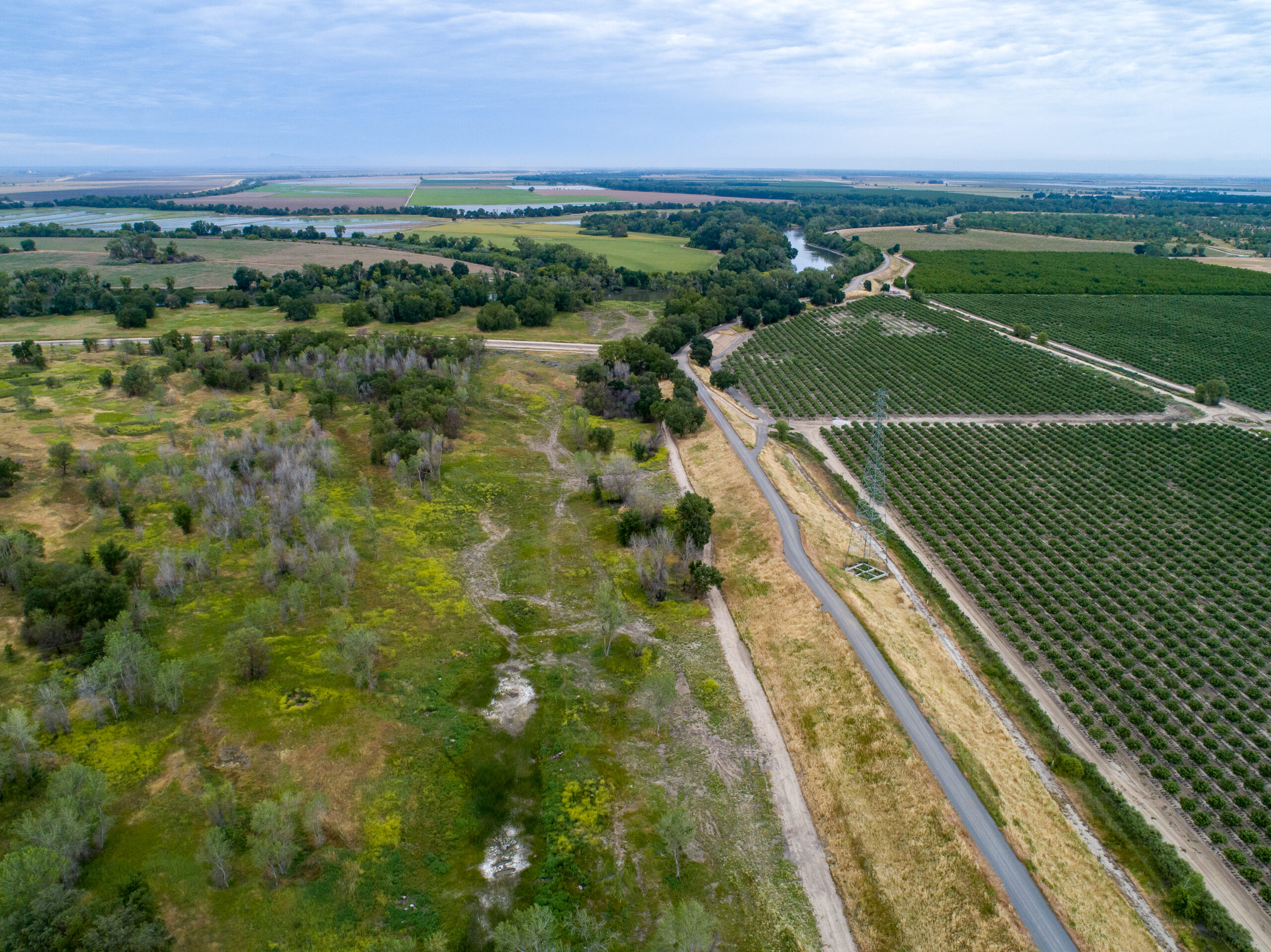
An aerial drone view of the Fremont Weir State Wildlife Area, part of the future Big Notch Project in Yolo County, California. Photo: Kelly M. Grow, DWR
In addition, the Delta Stewardship Council adopted an Ecosystem Amendment to the Delta Plan in 2022, the culmination of a seven-year collaborative process. This updated chapter of the Delta Plan requires project proponents to explain how their projects are designed to accommodate anticipated sea-level rise and to include this information in an adaptive management plan. It recommends the use of a “Good Neighbor Checklist” to help restoration projects avoid or reduce conflict with existing land uses. And it contains new recommendations regarding the need to fund reversing subsidence, enhancing working landscapes, and improving habitat for juvenile salmon.
Measure AA for the Bay
I watched these developments from afar, however, as I floated back downstream to the Bay in 2016 to work for the State Coastal Conservancy’s Bay Area Program. On the heels of the passage of Measure AA in 2016, the Conservancy, in partnership with the San Francisco Estuary Partnership and the Association of Bay Area Governments (which later merged its staff with the Metropolitan Transportation Commission), began ramping up its staffing support for the San Francisco Bay Restoration Authority. Previously operating on a shoestring budget since its creation by the State Legislature in 2008, the Authority began to receive $25 million per year in parcel tax funds ($12 per Bay Area property per year) to support restoration and enhancement of shoreline habitats, starting in 2017.
In its first five years, the San Francisco Bay Restoration Authority awarded more than $125 million generated by Measure AA, and leveraged a further $175 million, to support a broad range of large projects, small-scale pilot projects, and planning and design projects that are improving water quality, climate resilience, wildlife habitat, and public access opportunities at the shoreline in each of the Bay Area’s nine counties. The Authority has now funded 36 projects in total.
Bay Restoration: How, Who, and For Whom?
Since I first arrived on the Bay restoration scene in 2007, I’ve observed significant changes in how restoration is done, who does it, and who benefits. While earlier projects were narrowly focused on restoring tidal marsh, I now see projects that strive to restore a complete marsh ecosystem, including subtidal habitats, mudflats, low marsh, high marsh, and the wetland-upland transition zone. There is a growing focus on supporting increased biodiversity by including uplands and seasonal wetlands, as well as tidal wetlands, in site design. Projects have also evolved from having only ecological goals, with a particular focus on creating habitat for endangered species, to a multi-benefit approach, which involves community engagement, workforce development, flood protection, and public access.
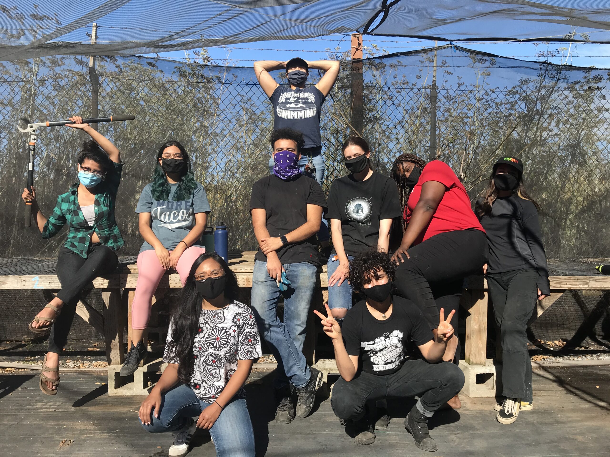
Eco-apprentices at the Literacy for Environmental Justice nursery on the Bayview shore in San Francisco. Photo: SCC
Equity is now front and center, as both the Conservancy and the Authority prioritize projects that expand public access, community engagement, and workforce development in low-income communities of color and improve access for people with disabilities. The Authority has created a Community Grants Program, open only to community-based organization located in economically disadvantaged communities. So far it has provided grants to Marin City Climate Resilience and Health Justice, Literacy for Environmental Justice in San Francisco, and Planting Justice in Oakland. These projects support community engagement in the design of future restoration projects, as well as hands-on restoration work. The Conservancy has also supported many projects that make shoreline trails and other facilities more accessible for people with disabilities.
Advancing Living Shorelines
Addressing current flooding and future sea-level rise is more urgent than ever, as the Legislature recognized when it allocated $175 million to the Conservancy for coastal resilience, including projects that construct living shorelines and other nature-based solutions to flood risk. Both the Conservancy and the Authority are funding several projects where coarse beaches are being used to protect marshes from erosion related to sea-level rise, such as Heron’s Head Park in San Francisco and Greenwood Gravel Beach and Tiscornia Marsh in Marin. “Green” restoration is also being integrated into formerly “gray” flood-protection infrastructure like levees and seawalls. Examples include the South San Francisco Bay Shoreline ecotone levee in San Jose and the Terminal 4 green seawall in Richmond.
Heron’s Head erosion controls (groins and headlands) under construction in San Francisco. Photo: Port of SF
Both agencies, along with the U.S. Environmental Protection Agency, are also funding a big push for programmatic approach to living shorelines to expedite permitting and design for ten projects at once, through the Regionally Advancing Living Shorelines Project led by the Conservancy and the San Francisco Estuary Institute (SFEI). These projects include subtidal habitat restoration of oyster reefs and eelgrass, which also attenuate wave energy.
Flood Control 2.0
Another growing trend is restoration where creeks meet the Bay. As part of implementing the recommendations of SFEI’s Sediment for Survival report, agencies are planning to connect watersheds to marshes for sediment replenishment through project like the Calabazas/San Tomas Aquino Creek-Marsh Connection Project in the South Bay and Evolving Shorelines at Bothin Marsh in Marin, which will reconnect Coyote Creek to the marsh.
In a similar vein, many projects are implementing a strategy dubbed Flood Control 2.0, which combines restoration and flood protection at creek mouths. Examples include Lower Walnut Creek in Contra Costa County, Colma Creek in San Mateo County, Lower Corte Madera Creek in Marin, and San Francisquito Creek on the border of San Mateo and Santa Clara counties.
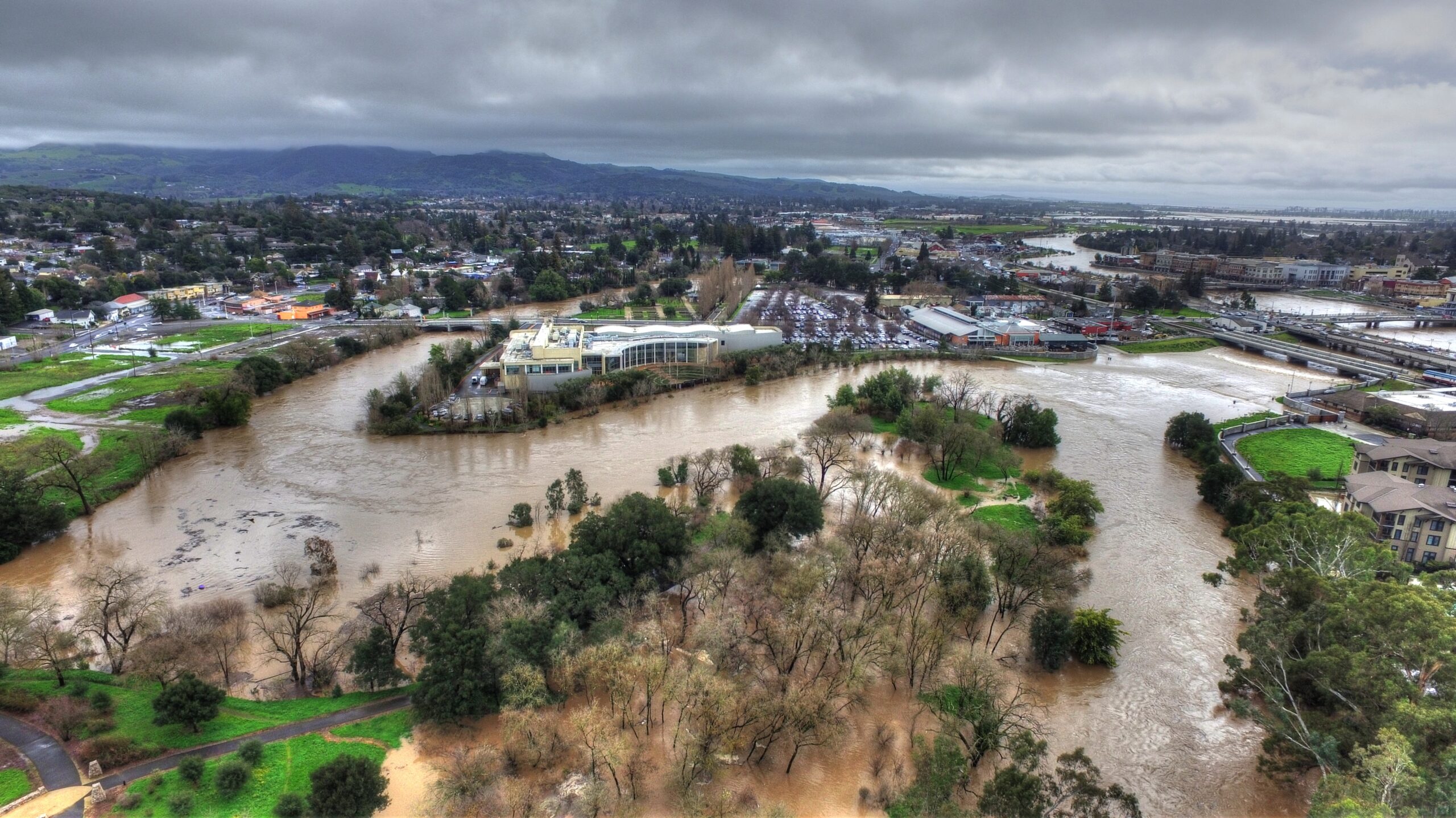
One of the most ambitious and habitat-friendly flood control projects in the region to date created much more space for water to spread out from the Napa River. The project has performed admirably in subsequent storms, including recent deluges like the one pictured here in 2017. Photo: Napa RCD
Scaling Up
Finally, another exciting development is landscape-scale restoration strategies and projects, including efforts to address the challenges of protecting or redesigning infrastructure and other land uses that conflict with ecosystem functions. The Bay Area already has made major strides in this area, such as the completion of the Napa River Salt Marsh Restoration Project, which restored 10,000 acres of former salt ponds, remnant sloughs, fringing marsh, and levees to tidal marsh and other valuable habitats in the North Bay. The project also provides wildlife-oriented public access in what is now the Napa-Sonoma Marshes Wildlife Area.
The South Bay Salt Ponds Restoration Project, at 15,000 acres, completed Phase 1 and Phase 2 is well underway. The Suisun Marsh Plan, completed in 2014, is a 30-year plan that balances the enhancement of 40,000 acres of managed wetland habitat with restoration of 5,000-7,000 acres of tidal marsh. More recently, in 2020, Sonoma Land Trust completed the Sonoma Creek Baylands Strategy, which addresses the constraints to restoration imposed by Highway 37 and SMART rail, as well as providing an innovative vision of how to make the best use of existing sediment when restoring tidal action to large portions of this 35,000-acre planning area, much of which is already in public hands. A similar effort, the Petaluma River Baylands Strategy, is expected to be completed in 2023.
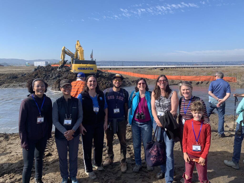
The people that make the Restoration Authority tick at Pacheco Marsh breach. Photo: SCC
Never Satisfied
Looking back on my 16 years of involvement in restoration in the San Francisco Bay-Delta Estuary, I’ve noticed that this community is never satisfied and keeps raising the bar on the definition of what makes a good or a great restoration project. Faced with the whipsaw conditions of droughts and floods, growing income inequality, and ongoing racial injustice, we refuse to retreat into hopelessness or isolation. Instead, we are asking harder questions, reaching out to form new partnerships, and, in return, being restored ourselves by the work we do.
Top Photo: American Avocet on managed, former salt ponds in the South Bay. Photo: Roopak Bhatt, USGS
Our magazine’s media motto for many years has been “Where there’s an estuary, there’s a crowd.” The San Francisco Estuary is a place where people, wildlife, and commerce congregate, and where watersheds, rivers and the ocean meet and mix, creating a place of unusual diversity. In choosing to tell the...
Ever since the state and federal water projects were built in the 1930s and 1940s, California has captured snowmelt in foothill reservoirs, and moved the fresh water from dam releases and river outflows to parched parts of the state via aqueducts hundreds of miles long. A convoluted system of ancient...
Though the Clean Water Act did an amazing job of reducing wastewater and stormwater pollution of the San Francisco Estuary, some contaminants remain thorny problems. Legacy pollutants like mercury washed into the watershed from upstream gold mining, PCBs from old industrial sites, and selenium from agricultural drainage in the San...
Hothouse Earth
By Ariel Rubissow Okamoto
Photo by Megan Nguyen
Nothing could be stranger than sitting in the dark with thousands of suits and heels, watching a parade of promises to decarbonize from companies and countries large and small, reeling from the beauties of big screen rainforests and indigenous necklaces, and getting all choked up.
It was day two of the September 2018 Global Climate Action Summit in San Francisco when I felt it.
At first I wondered if I was simply starstruck. Most of us labor away trying to fix one small corner of the planet or another without seeing the likes of Harrison Ford, Al Gore, Michael Bloomberg, Van Jones, Jerry Brown – or the ministers or mayors of dozens of cities and countries – in person, on stage and at times angry enough to spit. And between these luminaries a steady stream of CEOs, corporate sustainability officers, and pension fund managers promising percentages of renewables and profits in their portfolios dedicated to the climate cause by 2020-2050.
I tried to give every speaker my full attention: the young man of Vuntut Gwichin heritage from the edge of the Yukon’s Arctic National Wildlife Refuge who pleaded with us not to enter his sacred lands with our drills and dependencies; all the women – swathed in bright patterns and head-scarfs – who kept punching their hearts. “My uncle in Uganda would take 129 years to emit the same amount of carbon as an American would in one year,” said Oxfam’s Winnie Byanyima.
“Our janitors are shutting off the lights you leave on,” said Aida Cardenas, speaking about the frontline workers she trains, mostly immigrants, who are excited to be part of climate change solutions in their new country.
The men on the stage, strutting about in feathers and pinstripes, spoke of hopes and dreams, money and power. “The notion that you can either do good or do well is a myth we have to collectively bust,” said New Jersey Governor Phil Murphy whose state is investing heavily in offshore wind farms.
“Climate change isn’t just about risks, it’s about opportunities,” said Blackrock sustainable investment manager Brian Deese.
But it wasn’t all these fine speeches that started the butterflies. Halfway through the second day of testimonials, it was a slight white-haired woman wrapped in an azure pashmina that pricked my tears. One minute she was on the silver screen with Alec Baldwin and the next she taking a seat on stage. She talked about trees. How trees can solve 30% of our carbon reduction problem. How we have to stop whacking them back in the Amazon and start planting them everywhere else. I couldn’t help thinking of Dr. Seuss and his truffala trees. Jane Goodall, over 80, is as fierce as my Lorax. Or my daughter’s Avatar.
Analyzing my take home feeling from the event I realized it wasn’t the usual fear – killer storms, tidal waves, no food for my kids to eat on a half-baked planet – nor a newfound sense of hope – I’ve always thought nature will get along just fine without us. What I felt was relief. People were actually doing something. Doing a lot. And there was so much more we could do.
As we all pumped fists in the dark, as the presentations went on and on and on because so many people and businesses and countries wanted to STEP UP, I realized how swayed I had let myself be by the doomsday news mill.
“We must be like the river, “ said a boy from Bangladesh named Risalat Khan, who had noticed our Sierra watersheds from the plane. “We must cut through the mountain of obstacles. Let’s be the river!”
Or as Harrison Ford less poetically put it: “Let’s turn off our phones and roll up our sleeves and kick this monster’s ass.”
4th California Climate Change Assessment Blues
by Isaac Pearlman
Since California’s last state-led climate change assessment in 2012, the Golden State has experienced a litany of natural disasters. This includes four years of severe drought from 2012 to 2016, an almost non-existent Sierra Nevada snowpack in 2014-2015 costing $2.1 billion in economic losses, widespread Bay Area flooding from winter 2017 storms, and extremely large and damaging wildfires culminating with this year’s Mendocino Complex fire achieving the dubious distinction of the largest in state history. California’s most recent climate assessment, released August 27th, predicts that for the state and the Bay Area, we can expect even more in the future.
The California state government first began assessing climate impacts formally in 2006, due to an executive order by Governor Schwarzenegger. California’s latest iteration and its fourth overall, includes a dizzying array of 44 technical reports; three topical studies on climate justice, tribal and indigenous communities, and the coast and ocean; as well as nine region-specific analyses.
The results are alarming for our state’s future: an estimated four to five feet of sea level rise and loss of one to two-thirds of Southern California beaches by 2100, a 50 percent increase in wildfires over 25,000 acres, stronger and longer heat waves, and infrastructure like airports, wastewater treatment plants, rail and roadways increasingly likely to suffer flooding.
For the first time, California’s latest assessment dives into climate consequences on a regional level. Academics representing nine California regions spearheaded research and summarized the best available science on the variable heat, rain, flooding and extreme event consequences for their areas. For example, the highest local rate of sea level rise in the state is at the rapidly subsiding Humboldt Bay. In San Diego county, the most biodiverse in all of California, preserving its many fragile and endangered species is an urgent priority. Francesca Hopkins from UC Riverside found that the highest rate of childhood asthma in the state isn’t an urban smog-filled city but in the Imperial Valley, where toxic dust from Salton Sea disaster chokes communities – and will only become worse as higher temperatures and less water due to climate change dry and brittle the area.
According to the Bay Area Regional Report, since 1950 the Bay Area has already increased in temperature by 1.7 degrees Fahrenheit and local sea level is eight inches higher than it was one hundred years ago. Future climate will render the Bay Area less suitable for our evergreen redwood and fir forests, and more favorable for tolerant chaparral shrub land. The region’s seven million people and $750 billion economy (almost one-third of California’s total) is predicted to be increasingly beset by more “boom and bust” irregular wet and very dry years, punctuated by increasingly intense and damaging storms.
Unsurprisingly, according to the report the Bay Area’s intensifying housing and equity problems have a multiplier affect with climate change. As Bay Area housing spreads further north, south, and inland the result is higher transportation and energy needs for those with the fewest resources available to afford them; and acute disparity in climate vulnerability across Bay Area communities and populations.
“All Californians will likely endure more illness and be at greater risk of early death because of climate change,” bluntly states the statewide summary brochure for California’s climate assessment. “[However] vulnerable populations that already experience the greatest adverse health impacts will be disproportionately affected.”
“We’re much better at being reactive to a disaster than planning ahead,” said UC Berkeley professor and contributing author David Ackerly at a California Adaptation Forum panel in Sacramento on August 27th. “And it is vulnerable communities that suffer from those disasters. How much human suffering has to happen before it triggers the next round of activity?”
The assessment’s data is publicly available online at “Cal-adapt,” where Californians can explore projected impacts for their neighborhoods, towns, and regions.


 The results are alarming for our state’s future: an estimated four to five feet of sea level rise and loss of one to two-thirds of Southern California beaches by 2100, a 50 percent increase in wildfires over 25,000 acres, stronger and longer heat waves, and infrastructure like airports, wastewater treatment plants, rail and roadways increasingly likely to suffer flooding.