Offshore, kelp forests were dwindling. Outside, hillsides
were burning. Inside the Scottish Rite Center in Oakland, scientists and policy
people were sharing the latest findings concerning the vital shallows in
between: the San Francisco Estuary. The patient pursuit of knowledge, essential
to smart action in a changing world, had chalked up a fruitful two years. Of
the action itself, there was rather less sign.
Felicia Marcus might speak to that better than anyone. As
chair of the State Water Resources Control Board, she had coaxed along a
nine-year process, mandated by law, to raise minimum flows in the major rivers
that sustain the Estuary. The Board took the first of several wrenchingly hard
decisions 12 months ago. Result: the process was put on hold, pending another
round of stakeholder negotiations, and Marcus lost her job.
Marcus did not mention these facts in her Tuesday morning
talk on how we must see and teach the interconnectedness of Bay, Delta,
watershed, and the California water system as a whole. “Are we going to be the
generation that loses salmon?” she demanded, concluding with a series of
questions, a kind of call-and-response. “Can we give native fish a fighting
chance?” Catching on quickly, the audience roared back the appropriate answers,
about as well as scientists can roar. Then Marcus added a note of dount and
urgency: “Can we? I don’t know.”
As if to back her up, a brief ceremony marked the addition
of the Bay to Mission Blue’s list of planetary Hope Spots, marine or estuarine
areas that have gained, or at any rate deserve, a high level of protection. And
Erik Vink of the Delta Protection Commission reported that Congress has
designated the Delta a National Heritage Area. These distinctions are
reminiscent of Barack Obama’s Nobel Peace Prize: given less to honor past
achievement than to spur the recipient on.
A spur seems to be in order.
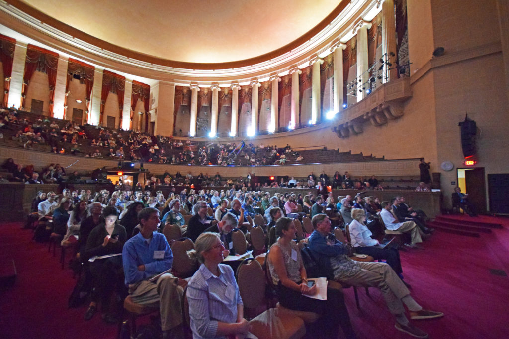
Photo: Noah Berger
In a Tuesday afternoon panel — “Panels and Engineers and
Regulators, Oh My” — six well-situated people talked about how to organize the
Bay and Delta regions for the larger actions that are going to be required,
notably to meet sea-level rise. How can we confront the regional effects of
rising tides, for instance on highways and low-lying sewage treatment plants?
How can we ensure that local actions, like seawall building, don’t simply shove
the impacts around? Can every place, asset, or island be defended, and for how
long?
A lot of good people are working on such problems. A staple
of conferences these days is the “spaghetti chart” showing how many partner
organizations are involved in any big issue, and we saw a couple of these. “We
don’t have a government gap,” Bay Conservation and Development Commission
(BCDC) planning director Jessica Fain remarked. “We have a government
abundance.” But getting all those levels and agencies to pull together where it
counts remains the headache it always has been. Veteran water reformer Phil
Isenberg was quoted: “Everybody’s involved, no one is in charge.”
Who, if anyone, should be in charge? The Bay Conservation and Development Commission seems the logical lead agency for threatened Bay shorelines, as many “policy actors” agree. BCDC itself seeks no added authority but is pushing local governments and other powers to converge on a Regional Adaptation Strategy. The goal, said BCDC’s Fain, is to “start to create some conversation about best practices.” That conversation, she acknowledged, might lead to “hard choices” some time in the future. No one seemed in much hurry to get there.
Drawing on the results of an extensive survey, Mark Lubell of the University of California at Davis reported, “Everybody wants a plan, nobody wants to establish a new authority.” And anything that impinges on land-use control by local governments is a “non-starter.”
Lubell did point to a nearby model, the Delta Stewardship Council. Back in 2009, faced with a similar logjam in the Delta, the Legislature came up with an ingenious solution. Agencies and governments whose work affects the Delta must “certify” that actions of certain types comply with an overarching vision, the Council’s Delta Plan. The Council can overturn such a certification on appeal, effectively blocking the decision or project from going forward. (The Council staff’s refusal to bless California WaterFix was one of the last straws for Jerry Brown’s two-tunnel plan.) In the Bay Area, such a mechanism might backstop an agreed-upon Regional Adaptation Strategy. But at the moment, even this indirect form of supervision seems politically out of reach.
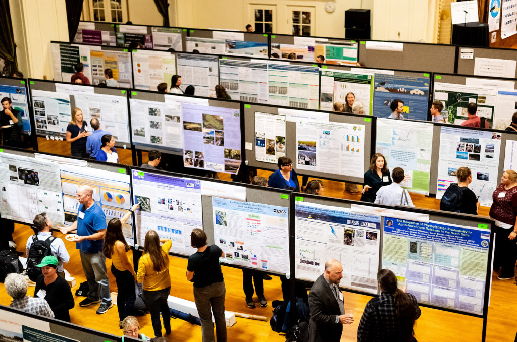
Sharing science at a conference poster session. Photo: Noah Berger
Can there be a plan without power? Can a blueprint be
developed and carried out on a purely cooperative basis? One lever toward unity
is the competition for funding. Maya Hayden of Point Blue had earlier reviewed
the discouraging outlook for San Mateo’s bayshore marshes. In the governance
panel, Erika Powell told how the need to make a common pitch for federal grants
led the county and its 20 cities to launch a Flood and Sea-Level Rise
Resiliency Agency. It comes into being on New Year’s Day 2020. It will not, of
course, impinge on land-use autonomy.
In the end there seemed to be a surprising convergence on
two points. First, the present system isn’t working. Second, no one who is part
of that system is in a position to rock the boat. Indeed, on the panel, it was
the representatives of agencies with the most direct clout — BCDC, the
Stewardship Council — who spoke most soothingly to their governmental
colleagues.
Mark Lubell noted: “It often takes a crisis before you have
that unification of political will.” Perhaps the best we can do, he suggested,
is have a good plan ready for the moment when an undeniable emergency shocks
open the doors to action.
There may be another route, however. Several panelists noted
how strong leaders, above or outside the local establishment, have made things
move. Governor Schwarzenegger’s Delta Vision Task Force started the ball
rolling for the Delta Stewardship Council, and ex-Assemblyman Phil Isenberg
kept it moving. In San Mateo County, it was Representative Jackie Speier and
Supervisor Dave Pine who championed the new flood agency. Mike Mielke of the
Silicon Valley Leadership Group gave Diane Feinstein credit for starting the
push toward Measure AA; Jim McGrath of the regional water board gave her
similar credit for purchase of the Bay’s salt ponds. The list can be run
backward all the way to the three founders of Save the Bay. Without their
grass-roots insurgency — a major insult to local government privilege — we
might still be reading learned papers about the effects of recent Bay fills.
“What’s missing here is political leadership,” said Mielke. “Would the governor be interested in calling the region together” to confront sea-level rise, in something analogous to Delta Vision?
John Hart is an environmental journalist and author of sixteen books and several hundred other published works. He is also the winner of the James D. Phelan Award, the Commonwealth Club Medal in Californiana, and the David R. Brower Award for Service in the Field of Conservation. For ESTUARY, he writes on groundwater, infrastructure, and California water politics and history.
Our magazine’s media motto for many years has been “Where there’s an estuary, there’s a crowd.” The San Francisco Estuary is a place where people, wildlife, and commerce congregate, and where watersheds, rivers and the ocean meet and mix, creating a place of unusual diversity. In choosing to tell the...
Ever since the state and federal water projects were built in the 1930s and 1940s, California has captured snowmelt in foothill reservoirs, and moved the fresh water from dam releases and river outflows to parched parts of the state via aqueducts hundreds of miles long. A convoluted system of ancient...
Though the Clean Water Act did an amazing job of reducing wastewater and stormwater pollution of the San Francisco Estuary, some contaminants remain thorny problems. Legacy pollutants like mercury washed into the watershed from upstream gold mining, PCBs from old industrial sites, and selenium from agricultural drainage in the San...
Hothouse Earth
By Ariel Rubissow Okamoto
Photo by Megan Nguyen
Nothing could be stranger than sitting in the dark with thousands of suits and heels, watching a parade of promises to decarbonize from companies and countries large and small, reeling from the beauties of big screen rainforests and indigenous necklaces, and getting all choked up.
It was day two of the September 2018 Global Climate Action Summit in San Francisco when I felt it.
At first I wondered if I was simply starstruck. Most of us labor away trying to fix one small corner of the planet or another without seeing the likes of Harrison Ford, Al Gore, Michael Bloomberg, Van Jones, Jerry Brown – or the ministers or mayors of dozens of cities and countries – in person, on stage and at times angry enough to spit. And between these luminaries a steady stream of CEOs, corporate sustainability officers, and pension fund managers promising percentages of renewables and profits in their portfolios dedicated to the climate cause by 2020-2050.
I tried to give every speaker my full attention: the young man of Vuntut Gwichin heritage from the edge of the Yukon’s Arctic National Wildlife Refuge who pleaded with us not to enter his sacred lands with our drills and dependencies; all the women – swathed in bright patterns and head-scarfs – who kept punching their hearts. “My uncle in Uganda would take 129 years to emit the same amount of carbon as an American would in one year,” said Oxfam’s Winnie Byanyima.
“Our janitors are shutting off the lights you leave on,” said Aida Cardenas, speaking about the frontline workers she trains, mostly immigrants, who are excited to be part of climate change solutions in their new country.
The men on the stage, strutting about in feathers and pinstripes, spoke of hopes and dreams, money and power. “The notion that you can either do good or do well is a myth we have to collectively bust,” said New Jersey Governor Phil Murphy whose state is investing heavily in offshore wind farms.
“Climate change isn’t just about risks, it’s about opportunities,” said Blackrock sustainable investment manager Brian Deese.
But it wasn’t all these fine speeches that started the butterflies. Halfway through the second day of testimonials, it was a slight white-haired woman wrapped in an azure pashmina that pricked my tears. One minute she was on the silver screen with Alec Baldwin and the next she taking a seat on stage. She talked about trees. How trees can solve 30% of our carbon reduction problem. How we have to stop whacking them back in the Amazon and start planting them everywhere else. I couldn’t help thinking of Dr. Seuss and his truffala trees. Jane Goodall, over 80, is as fierce as my Lorax. Or my daughter’s Avatar.
Analyzing my take home feeling from the event I realized it wasn’t the usual fear – killer storms, tidal waves, no food for my kids to eat on a half-baked planet – nor a newfound sense of hope – I’ve always thought nature will get along just fine without us. What I felt was relief. People were actually doing something. Doing a lot. And there was so much more we could do.
As we all pumped fists in the dark, as the presentations went on and on and on because so many people and businesses and countries wanted to STEP UP, I realized how swayed I had let myself be by the doomsday news mill.
“We must be like the river, “ said a boy from Bangladesh named Risalat Khan, who had noticed our Sierra watersheds from the plane. “We must cut through the mountain of obstacles. Let’s be the river!”
Or as Harrison Ford less poetically put it: “Let’s turn off our phones and roll up our sleeves and kick this monster’s ass.”
4th California Climate Change Assessment Blues
by Isaac Pearlman
Since California’s last state-led climate change assessment in 2012, the Golden State has experienced a litany of natural disasters. This includes four years of severe drought from 2012 to 2016, an almost non-existent Sierra Nevada snowpack in 2014-2015 costing $2.1 billion in economic losses, widespread Bay Area flooding from winter 2017 storms, and extremely large and damaging wildfires culminating with this year’s Mendocino Complex fire achieving the dubious distinction of the largest in state history. California’s most recent climate assessment, released August 27th, predicts that for the state and the Bay Area, we can expect even more in the future.
The California state government first began assessing climate impacts formally in 2006, due to an executive order by Governor Schwarzenegger. California’s latest iteration and its fourth overall, includes a dizzying array of 44 technical reports; three topical studies on climate justice, tribal and indigenous communities, and the coast and ocean; as well as nine region-specific analyses.
The results are alarming for our state’s future: an estimated four to five feet of sea level rise and loss of one to two-thirds of Southern California beaches by 2100, a 50 percent increase in wildfires over 25,000 acres, stronger and longer heat waves, and infrastructure like airports, wastewater treatment plants, rail and roadways increasingly likely to suffer flooding.
For the first time, California’s latest assessment dives into climate consequences on a regional level. Academics representing nine California regions spearheaded research and summarized the best available science on the variable heat, rain, flooding and extreme event consequences for their areas. For example, the highest local rate of sea level rise in the state is at the rapidly subsiding Humboldt Bay. In San Diego county, the most biodiverse in all of California, preserving its many fragile and endangered species is an urgent priority. Francesca Hopkins from UC Riverside found that the highest rate of childhood asthma in the state isn’t an urban smog-filled city but in the Imperial Valley, where toxic dust from Salton Sea disaster chokes communities – and will only become worse as higher temperatures and less water due to climate change dry and brittle the area.
According to the Bay Area Regional Report, since 1950 the Bay Area has already increased in temperature by 1.7 degrees Fahrenheit and local sea level is eight inches higher than it was one hundred years ago. Future climate will render the Bay Area less suitable for our evergreen redwood and fir forests, and more favorable for tolerant chaparral shrub land. The region’s seven million people and $750 billion economy (almost one-third of California’s total) is predicted to be increasingly beset by more “boom and bust” irregular wet and very dry years, punctuated by increasingly intense and damaging storms.
Unsurprisingly, according to the report the Bay Area’s intensifying housing and equity problems have a multiplier affect with climate change. As Bay Area housing spreads further north, south, and inland the result is higher transportation and energy needs for those with the fewest resources available to afford them; and acute disparity in climate vulnerability across Bay Area communities and populations.
“All Californians will likely endure more illness and be at greater risk of early death because of climate change,” bluntly states the statewide summary brochure for California’s climate assessment. “[However] vulnerable populations that already experience the greatest adverse health impacts will be disproportionately affected.”
“We’re much better at being reactive to a disaster than planning ahead,” said UC Berkeley professor and contributing author David Ackerly at a California Adaptation Forum panel in Sacramento on August 27th. “And it is vulnerable communities that suffer from those disasters. How much human suffering has to happen before it triggers the next round of activity?”
The assessment’s data is publicly available online at “Cal-adapt,” where Californians can explore projected impacts for their neighborhoods, towns, and regions.


 The results are alarming for our state’s future: an estimated four to five feet of sea level rise and loss of one to two-thirds of Southern California beaches by 2100, a 50 percent increase in wildfires over 25,000 acres, stronger and longer heat waves, and infrastructure like airports, wastewater treatment plants, rail and roadways increasingly likely to suffer flooding.