On a hazy Delta morning at Isleton’s B & W Resort, more than a dozen trucks are already neatly arrayed in the double-long parking spaces with empty trailers facing the boat launch: evidence of fishers and boaters getting an early start on their Labor Day weekend. Randy Mager, sporting a flannel shirt and worn baseball cap, radiates earnest enthusiasm, which for a 20-year state government veteran is as refreshing and rare as a Delta smelt. “I am more excited about this than I have been about pretty much anything else in my career,” says Mager, a senior environmental scientist with California’s Department of Water Resources (DWR).
Randy Mager. Photo: Isaac Pearlman
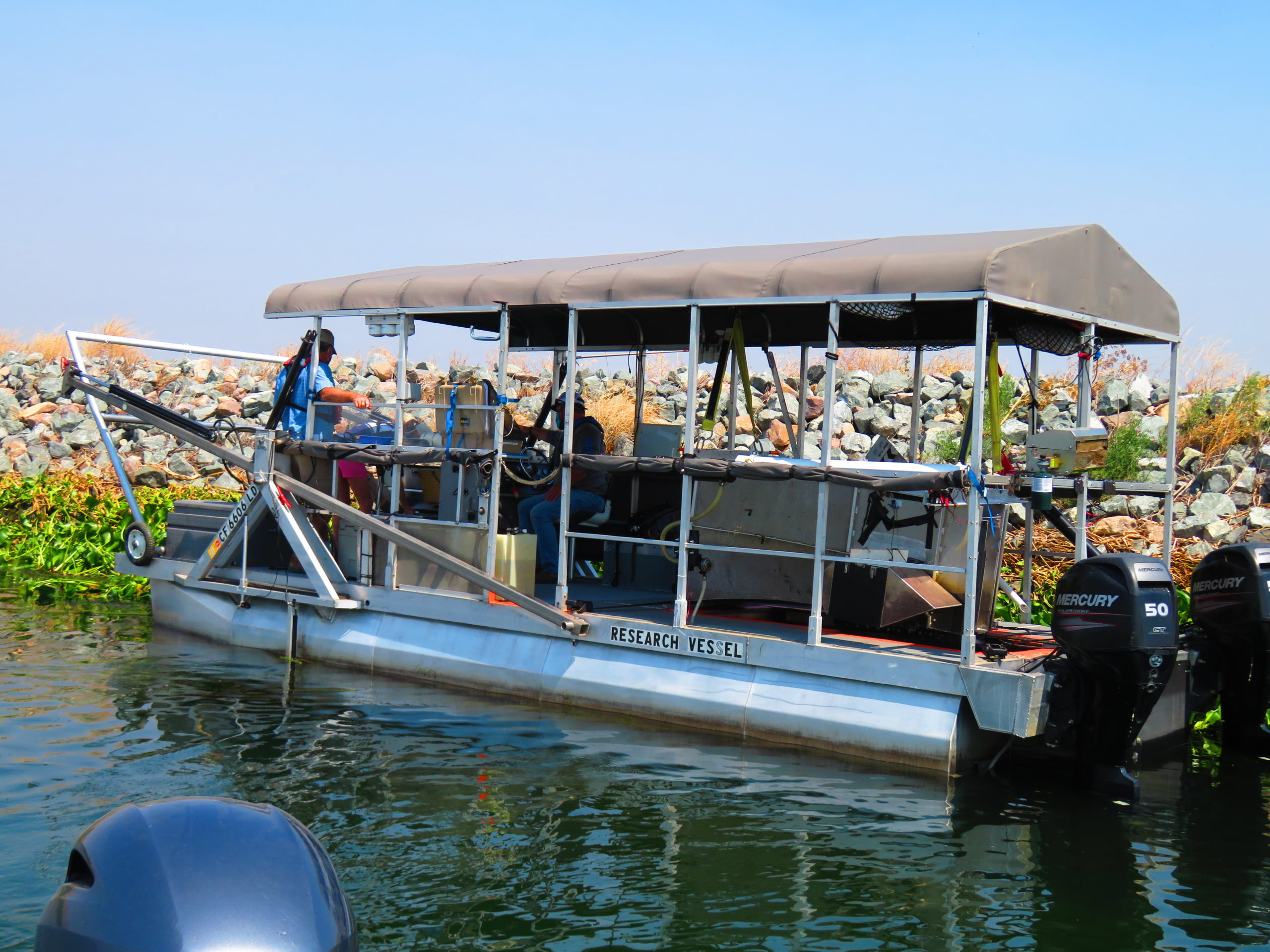
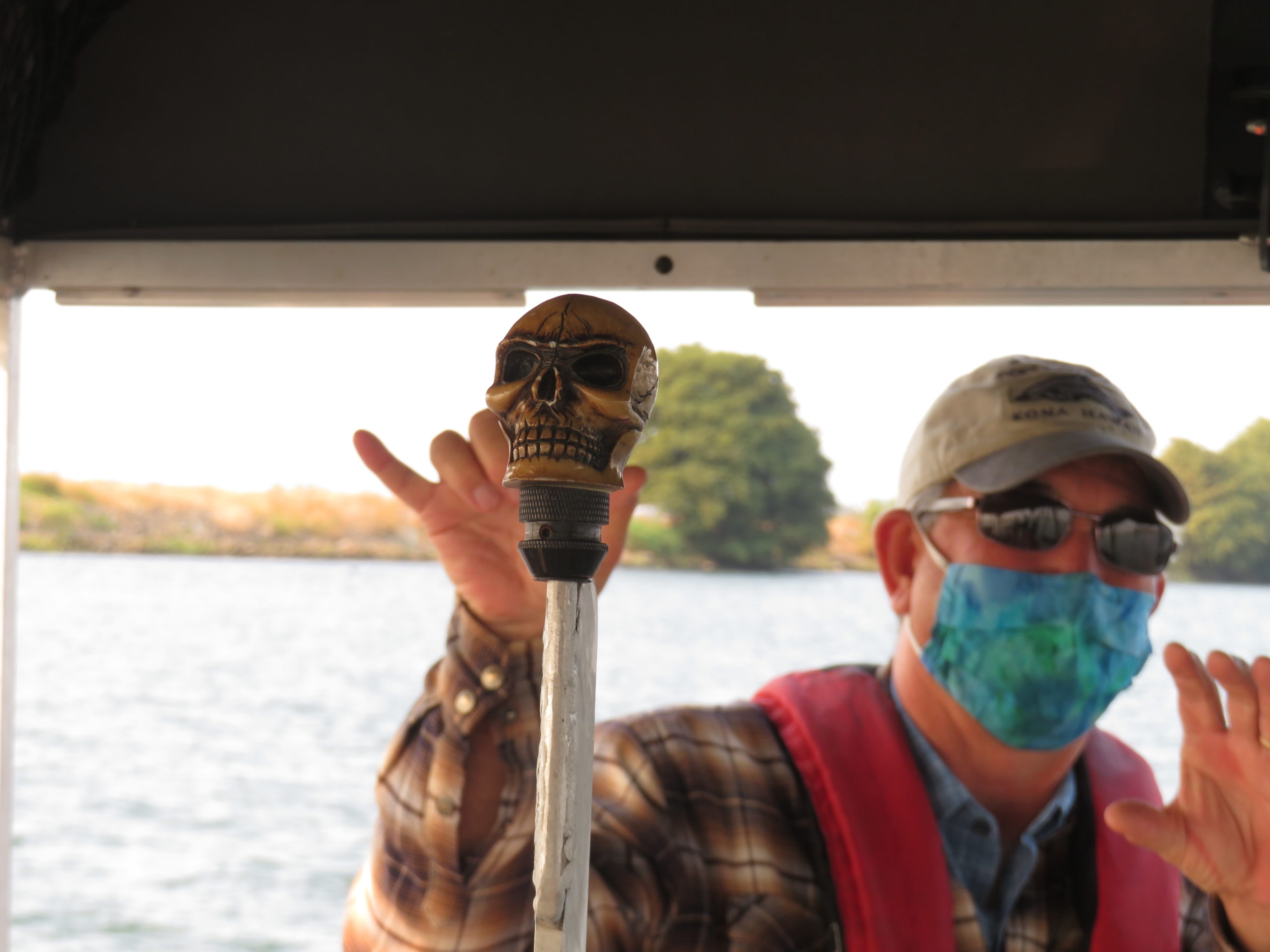
The subject of his palpable excitement lays in the water in front of us: a 25-foot long pontoon boat with a soccer-goal-like rectangular array mounted on the front, and a gaping table-size hole cut into the boat’s flat floor. Joe Merz, whose company Cramer Fish Sciences designed the boat, issues an invitation aboard from behind a shark-covered facemask, telling us how the vessel was a Lake Shasta houseboat when he bought it in 2015. After years of testing and modifications, the boat has been so radically changed that according to Merz the only remaining original part is the steering console and instrument panel.
Whitney Thorpe, a fisheries biologist at Cramer and the MacGyver-like genius behind much of the boat’s transformation, hands out life jackets and efficiently runs us through the boat’s safety protocols. “Obviously watch out for the giant hole,” she points out with a friendly laugh. “It’s painted bright orange so you can’t miss it!”
Largemouth bass photo shot by new camera rig. Photo: Cramer Fish Sciences
The new monitoring boat is capable of something never done before: combining video technology and DNA analysis from shed molecules in the water to get a clearer picture of what’s going on in the Delta’s murky depths. “Fish monitoring is limited in the Delta’s restored habitats,” explains Mager. Net surveys are all but impossible in shallow riverbanks and intertidal wetlands, where dense aquatic plants choke nets and propellers, and levee rip-rap bruises boat bottoms. “You end up with a net full of vegetation and fish that die by the time you take them out,” he says. Which poses a problem if some of those species are endangered.
With the new method, fish aren’t captured — they simply pass through a water-filled chute under the boat, without being pulled from the water or handled. Mager calls the technology a “game changer” and raves about all the new data it collects and questions it can answer, including whether fish prefer a certain type of restored habitat.
Joe Merz and Whitney Thorpe lower the fish video system through the boat bottom. Video: Isaac Pearlman
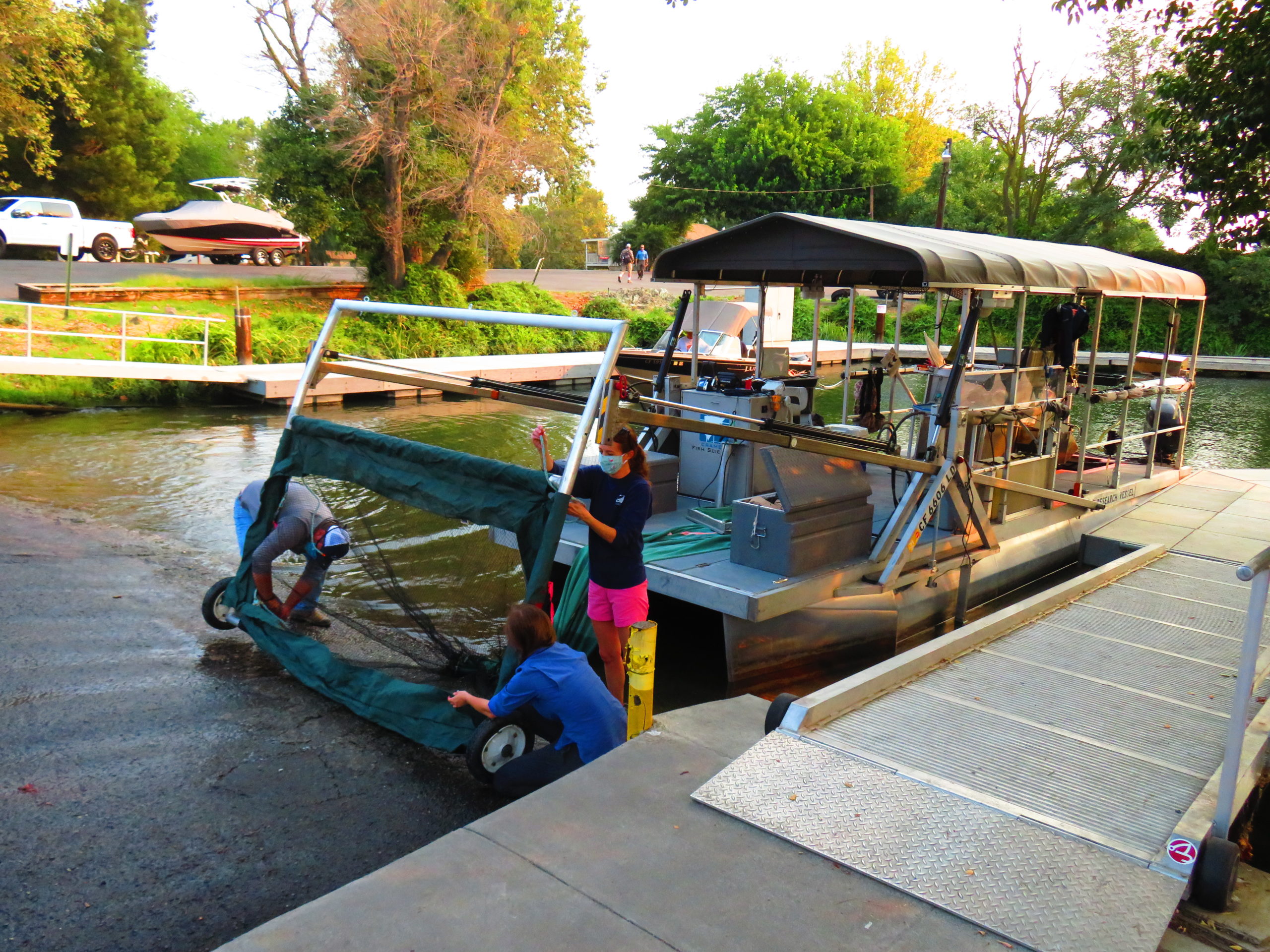
As we drift into the south fork of the Mokelumne River, the rest of Joe Merz’s crew trails behind us in a second boat. Normally the DNA sampling team would also be on the platform boat, scooping up water samples to hunt for molecules they can use to identify what species have passed through the water column recently. But due to coronavirus protocols the group is split up today, in order to have no more than four people per boat.
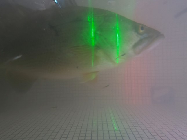
Merz pilots us to the first sample site, peppering jokes and friendly banter into his overview of the boat’s technology and their research. Meanwhile Thorpe moves in a hyper-efficient blur, rigging up two GoPro cameras and snapping them into a waterproof housing. She belly-flops onto the boat’s floor to connect the net that will funnel fish from the wide-mouthed front array through a narrow chute under the boat’s platform, where the fish pass in front of the cameras before exiting through gates in the back. The apparent simplicity is deceptive: Merz notes they contracted a company to model the fluid dynamics of the water flow in order to design the system so that fish pass through slow enough and at the best orientation to the cameras for successful identification. “This system has been in my head for 20 years,” he says.
Whitney Thorpe bellyflops to adjust the apparatus. Photo: Isaac Pearlman
We head toward an island of reeds and thick hyacinth in the middle of the river, and Merz uses hydraulics to maneuver the rectangular intake in front of the boat up and down like a bulldozer’s blade. A tablet streaming the video feed shows several fish rapidly passing through the chute, almost too fast to see, though Merz can identify them with just a glance: “Bass,” he says, checking the boat’s line then turning back to the screen. “There goes a bluegill.” Soon he won’t have to, though: the team has developed an algorithm that can automatically identify the fish species from the video. “We’re at 95% accuracy for some of the more common Delta species,” says Merz, who at this point relies on trained staff to verify and improve the algorithm’s recognition. “Our goal is 100%.”
As we nose into the green swath of vegetation, the perils of aquatic plants that Mager warned about quickly become evident. Green beards of algae float by on the video screen, and Thorpe uses a small rake to rapidly pull out the thick clumps so they don’t block the fish passage or cameras. Eventually the net clogs and Thorpe lifts a floor panel to unzip the net from the top, pulling out double handfuls of green sludge.
Whitney Thorpe cleans out green sludge that can clog the sampling chute. Video: Isaac Pearlman
“When you haul up net, you are just getting an average,” Mager points out. “You don’t know if the fish [you catch in the net] were all in one group, or all at one depth.” He explains that Merz’s group is collecting real-time data on water temperature, salinity, and more that is time-stamped and matched to the individual fish recorded on the video. This gives a much more detailed, nuanced look than simply lumping together fish caught from throughout the water column in a trawl or seine net under one measurement. “With a trawl survey you could spend an hour picking through the net,” says Mager, shaking his head with amazement at how fast Thorpe and Merz have the net cleared and ready.
Merz next demonstrates the vessel’s “four-wheeling” capability, piloting the boat close enough to a rip-rapped levee to elicit an astonished curse from Mager. The boat’s front intake has wheels on the bottom of the posts, allowing it to act as a fender as it bumps along the shallow river bottom. If it encounters something larger, like a tree stump (or, as the requisite Delta joke goes, a dead body), the array is designed to snap off and easily reattach, rather than bending or breaking.
The DNA sampling crew pull up next to us and show off their finger-length clear plastic capsules of water. From these samples the DNA team will filter and capture molecules that fish have sloughed off from scales, mucus, and feces. Once the specimens, traveling on ice to prevent DNA degradation, reach the lab the team will know within 90 minutes which locations had Chinook salmon DNA and therefore which type of habitat the species may prefer.
Katie Karpenko collects DNA samples from the water. Video: Isaac Pearlman
“[DNA analysis] isn’t new,” notes Gregg Schumer, who oversees Cramer’s environmental DNA services. He points out that the technique just came slowly to environmental monitoring. “Before it was like doing santeria on the Delta,” he laughs, joking that early on his DNA presentation audiences consisted of his mother and one other person. “Now, the rooms are packed.”
Mager excitedly rattles off research questions this technology and data could answer next, ranging from nutrient blooms during levee breeches to salinity gradient impact on fish distribution. “It’s like we just got a new Lego set,” he says. “We could build anything.”
Photo: Isaac Pearlman
However, Merz and his crew are seeking bigger prey. With the recent addition of a second camera, they now can measure fish length from video, and are starting to incorporate fish larvae into their video identification algorithm. And though their DNA analysis focuses on migratory salmon for Mager’s project, Schumer points out that their treasure trove of samples could be analyzed for a broader sweep of species in order to unveil a more comprehensive picture of the Delta ecosystem.
“We need to monitor the Delta like a patient in a hospital: looking at the big picture,” says Schumer, equating traditional monitoring to diagnosing a patient by staring at their pinky. “We are just scratching the surface of the things we can do.”
Isaac Pearlman covers sea level rise, flooding, and other topics for ESTUARY. A Bay Area native, Isaac's writing is informed by his master's degree in environmental science, as well as many adventures from living and working in South America, Europe, and Southeast Asia. His stories and essays have been featured in Earth Island Journal, the Progressive Populist, and Ecosystems among other outlets. https://isaacpearlman.wordpress.com
Our magazine’s media motto for many years has been “Where there’s an estuary, there’s a crowd.” The San Francisco Estuary is a place where people, wildlife, and commerce congregate, and where watersheds, rivers and the ocean meet and mix, creating a place of unusual diversity. In choosing to tell the...
Ever since the state and federal water projects were built in the 1930s and 1940s, California has captured snowmelt in foothill reservoirs, and moved the fresh water from dam releases and river outflows to parched parts of the state via aqueducts hundreds of miles long. A convoluted system of ancient...
Though the Clean Water Act did an amazing job of reducing wastewater and stormwater pollution of the San Francisco Estuary, some contaminants remain thorny problems. Legacy pollutants like mercury washed into the watershed from upstream gold mining, PCBs from old industrial sites, and selenium from agricultural drainage in the San...
Hothouse Earth
By Ariel Rubissow Okamoto
Photo by Megan Nguyen
Nothing could be stranger than sitting in the dark with thousands of suits and heels, watching a parade of promises to decarbonize from companies and countries large and small, reeling from the beauties of big screen rainforests and indigenous necklaces, and getting all choked up.
It was day two of the September 2018 Global Climate Action Summit in San Francisco when I felt it.
At first I wondered if I was simply starstruck. Most of us labor away trying to fix one small corner of the planet or another without seeing the likes of Harrison Ford, Al Gore, Michael Bloomberg, Van Jones, Jerry Brown – or the ministers or mayors of dozens of cities and countries – in person, on stage and at times angry enough to spit. And between these luminaries a steady stream of CEOs, corporate sustainability officers, and pension fund managers promising percentages of renewables and profits in their portfolios dedicated to the climate cause by 2020-2050.
I tried to give every speaker my full attention: the young man of Vuntut Gwichin heritage from the edge of the Yukon’s Arctic National Wildlife Refuge who pleaded with us not to enter his sacred lands with our drills and dependencies; all the women – swathed in bright patterns and head-scarfs – who kept punching their hearts. “My uncle in Uganda would take 129 years to emit the same amount of carbon as an American would in one year,” said Oxfam’s Winnie Byanyima.
“Our janitors are shutting off the lights you leave on,” said Aida Cardenas, speaking about the frontline workers she trains, mostly immigrants, who are excited to be part of climate change solutions in their new country.
The men on the stage, strutting about in feathers and pinstripes, spoke of hopes and dreams, money and power. “The notion that you can either do good or do well is a myth we have to collectively bust,” said New Jersey Governor Phil Murphy whose state is investing heavily in offshore wind farms.
“Climate change isn’t just about risks, it’s about opportunities,” said Blackrock sustainable investment manager Brian Deese.
But it wasn’t all these fine speeches that started the butterflies. Halfway through the second day of testimonials, it was a slight white-haired woman wrapped in an azure pashmina that pricked my tears. One minute she was on the silver screen with Alec Baldwin and the next she taking a seat on stage. She talked about trees. How trees can solve 30% of our carbon reduction problem. How we have to stop whacking them back in the Amazon and start planting them everywhere else. I couldn’t help thinking of Dr. Seuss and his truffala trees. Jane Goodall, over 80, is as fierce as my Lorax. Or my daughter’s Avatar.
Analyzing my take home feeling from the event I realized it wasn’t the usual fear – killer storms, tidal waves, no food for my kids to eat on a half-baked planet – nor a newfound sense of hope – I’ve always thought nature will get along just fine without us. What I felt was relief. People were actually doing something. Doing a lot. And there was so much more we could do.
As we all pumped fists in the dark, as the presentations went on and on and on because so many people and businesses and countries wanted to STEP UP, I realized how swayed I had let myself be by the doomsday news mill.
“We must be like the river, “ said a boy from Bangladesh named Risalat Khan, who had noticed our Sierra watersheds from the plane. “We must cut through the mountain of obstacles. Let’s be the river!”
Or as Harrison Ford less poetically put it: “Let’s turn off our phones and roll up our sleeves and kick this monster’s ass.”
4th California Climate Change Assessment Blues
by Isaac Pearlman
Since California’s last state-led climate change assessment in 2012, the Golden State has experienced a litany of natural disasters. This includes four years of severe drought from 2012 to 2016, an almost non-existent Sierra Nevada snowpack in 2014-2015 costing $2.1 billion in economic losses, widespread Bay Area flooding from winter 2017 storms, and extremely large and damaging wildfires culminating with this year’s Mendocino Complex fire achieving the dubious distinction of the largest in state history. California’s most recent climate assessment, released August 27th, predicts that for the state and the Bay Area, we can expect even more in the future.
The California state government first began assessing climate impacts formally in 2006, due to an executive order by Governor Schwarzenegger. California’s latest iteration and its fourth overall, includes a dizzying array of 44 technical reports; three topical studies on climate justice, tribal and indigenous communities, and the coast and ocean; as well as nine region-specific analyses.
The results are alarming for our state’s future: an estimated four to five feet of sea level rise and loss of one to two-thirds of Southern California beaches by 2100, a 50 percent increase in wildfires over 25,000 acres, stronger and longer heat waves, and infrastructure like airports, wastewater treatment plants, rail and roadways increasingly likely to suffer flooding.
For the first time, California’s latest assessment dives into climate consequences on a regional level. Academics representing nine California regions spearheaded research and summarized the best available science on the variable heat, rain, flooding and extreme event consequences for their areas. For example, the highest local rate of sea level rise in the state is at the rapidly subsiding Humboldt Bay. In San Diego county, the most biodiverse in all of California, preserving its many fragile and endangered species is an urgent priority. Francesca Hopkins from UC Riverside found that the highest rate of childhood asthma in the state isn’t an urban smog-filled city but in the Imperial Valley, where toxic dust from Salton Sea disaster chokes communities – and will only become worse as higher temperatures and less water due to climate change dry and brittle the area.
According to the Bay Area Regional Report, since 1950 the Bay Area has already increased in temperature by 1.7 degrees Fahrenheit and local sea level is eight inches higher than it was one hundred years ago. Future climate will render the Bay Area less suitable for our evergreen redwood and fir forests, and more favorable for tolerant chaparral shrub land. The region’s seven million people and $750 billion economy (almost one-third of California’s total) is predicted to be increasingly beset by more “boom and bust” irregular wet and very dry years, punctuated by increasingly intense and damaging storms.
Unsurprisingly, according to the report the Bay Area’s intensifying housing and equity problems have a multiplier affect with climate change. As Bay Area housing spreads further north, south, and inland the result is higher transportation and energy needs for those with the fewest resources available to afford them; and acute disparity in climate vulnerability across Bay Area communities and populations.
“All Californians will likely endure more illness and be at greater risk of early death because of climate change,” bluntly states the statewide summary brochure for California’s climate assessment. “[However] vulnerable populations that already experience the greatest adverse health impacts will be disproportionately affected.”
“We’re much better at being reactive to a disaster than planning ahead,” said UC Berkeley professor and contributing author David Ackerly at a California Adaptation Forum panel in Sacramento on August 27th. “And it is vulnerable communities that suffer from those disasters. How much human suffering has to happen before it triggers the next round of activity?”
The assessment’s data is publicly available online at “Cal-adapt,” where Californians can explore projected impacts for their neighborhoods, towns, and regions.


 The results are alarming for our state’s future: an estimated four to five feet of sea level rise and loss of one to two-thirds of Southern California beaches by 2100, a 50 percent increase in wildfires over 25,000 acres, stronger and longer heat waves, and infrastructure like airports, wastewater treatment plants, rail and roadways increasingly likely to suffer flooding.