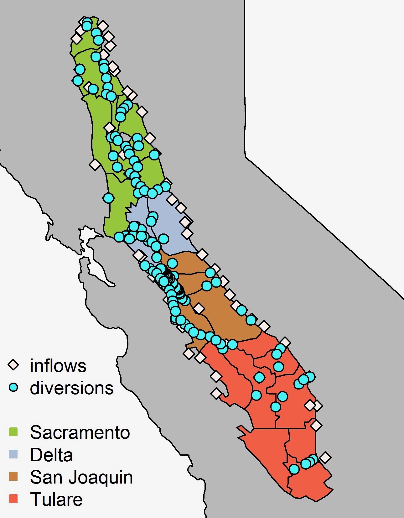
Valley groundwater pumping is calculated as the total water demand minus surface water deliveries. However, today’s water model relies on individually reported diversions across the entire valley, and compiling all these data is a slow process; by the time the numbers are crunched, assessments of groundwater use are already outdated. “It can take years,” says Jordan Goodrich of University of Waikato in New Zealand. “It’s one of the biggest problems we face in tracking the Central Valley water budget.” Overdrafting groundwater can cause subsidence, permanently reducing the storage capacity of aquifers as well as jeopardizing above-ground infrastructure that delivers water and controls flooding. In the March 2020 issue of San Francisco Estuary and Watershed Science, Goodrich and colleagues at Scripps Institute of Oceanography in La Jolla—where he was previously a researcher—show that surface water diversions can be estimated based on current and long-term precipitation. “It’s a really powerful tool,” says Goodrich. Statewide, people take one-third of the flow in streams and rivers for their own uses, particularly irrigated agriculture. The researchers found that the link between climate and stream diversions is strongest in the southern Central Valley, which is more arid and has fewer reservoirs. “More of the surface-acquired irrigation water there comes from precipitation that has fallen within the current year,” Goodrich explains. In contrast, the link between climate and stream diversions is less pronounced in the northern part of the valley, which is wetter and has more reservoirs to help meet the demand for water. After about five or six years of drought, though, the climate-stream diversion link is strong in the northern Central Valley as well. Now the team is developing a new approach for modeling Central Valley water that uses regional precipitation and temperature to track groundwater use in near-real time.


")
_FieldSampling")

 The results are alarming for our state’s future: an estimated four to five feet of sea level rise and loss of one to two-thirds of Southern California beaches by 2100, a 50 percent increase in wildfires over 25,000 acres, stronger and longer heat waves, and infrastructure like airports, wastewater treatment plants, rail and roadways increasingly likely to suffer flooding.