It is two decades now since some 23 square miles of South Bay salt evaporation ponds became public property. Eighty-eight old impoundments were to be remade into habitat for birds and other creatures—and into a superior flood-control buffer for communities beside the rising Bay.
Progress since then has been slow, and fast. Slow, because relatively small swathes of territory have been visibly, obviously changed. Slow, because a whole set of basic questions had to be answered before the work could pick up speed. And fast, because those questions have now been answered, by and large, and the news is pretty good. As sea-level rise makes the project ever more urgent, the way seems open to a rapid transformation in the years to come.
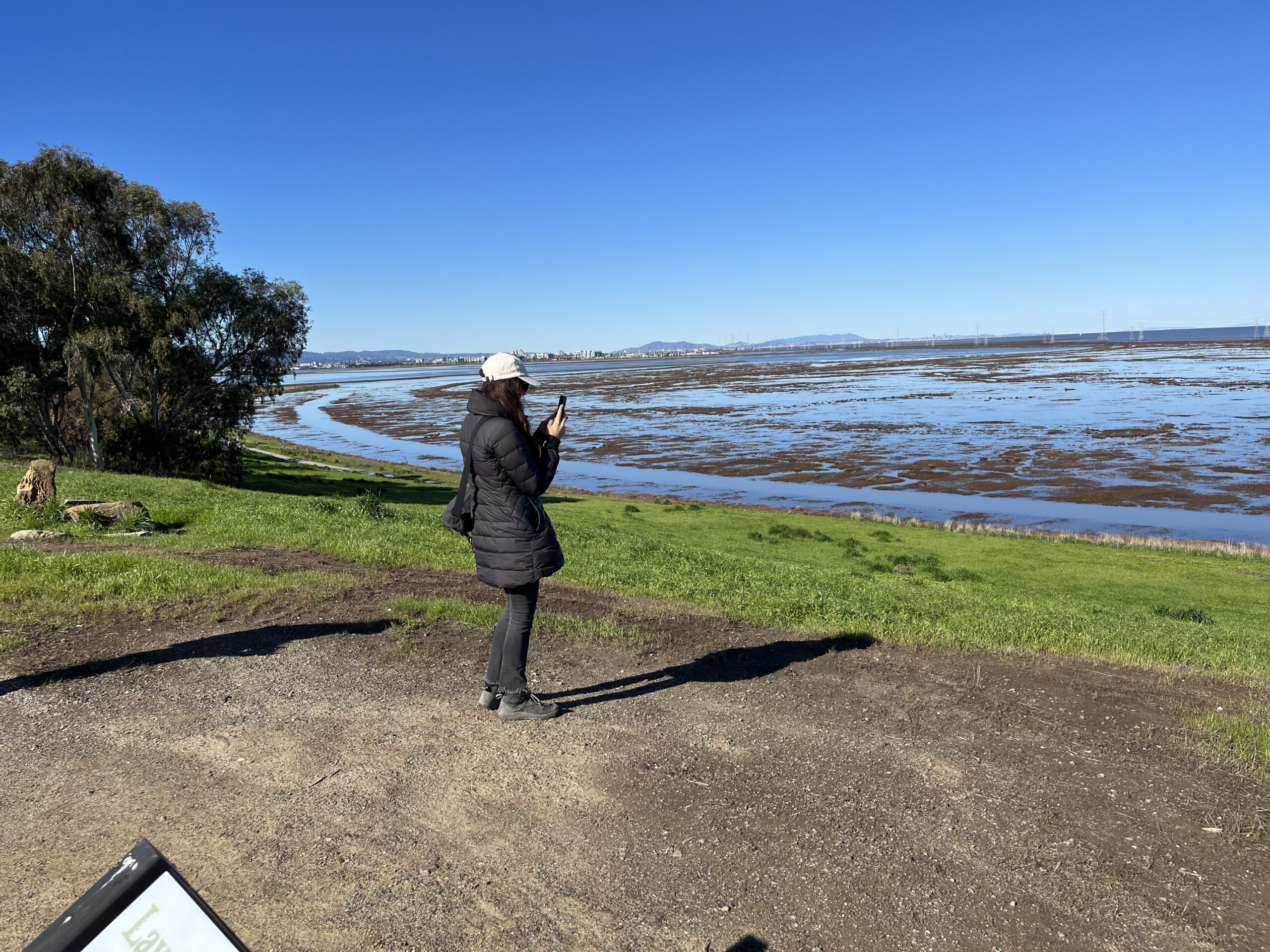
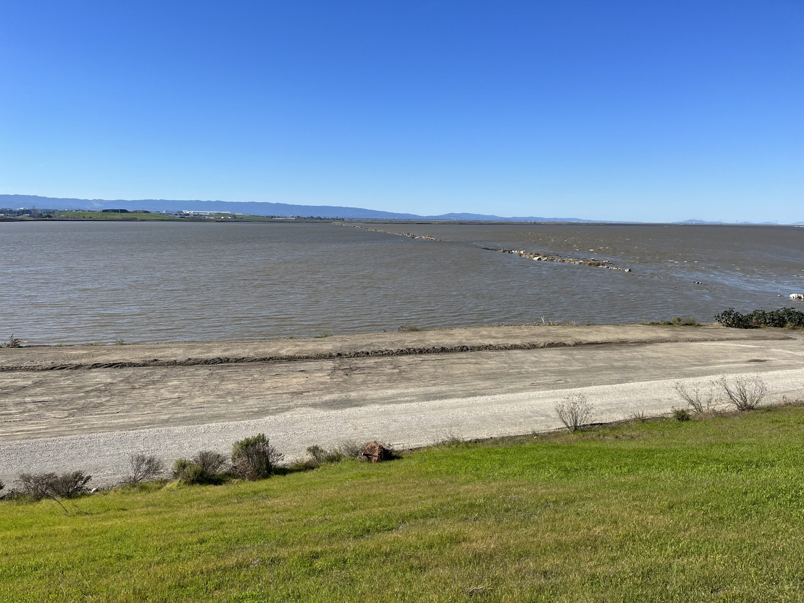
The playing field is 15,100 acres in three blocks. On the eastern shore, just south of the Hayward-San Mateo Bridge, is Eden Landing, with about 5,500 acres. On the western shore, at the San Mateo end of the Dumbarton Bridge, lies the Ravenswood cluster, just under 1,700 acres. The large remainder, almost 8,000 acres, wraps around the southernmost tip of San Francisco Bay: the Alviso ponds.
Eden Landing. Photo: John Hart
Alviso and Ravenswood are parts of the Don Edwards San Francisco Bay National Wildlife Refuge; Eden Landing is a State Ecological Reserve. The U.S. Fish and Wildlife Service and the California Department of Fish and Wildlife, however, have joined in what looks like a seamless effort: the South Bay Salt Pond Restoration Project, currently headed by Dave Halsing on behalf of the California Coastal Conservancy, the project’s primary administrator and sponsor.
Before restoration could begin, there was a major housekeeping task: the purging of a system overcharged with salt, and its replumbing for wider purposes. The Cargill pond sequences, known as “plants,” were like conveyor belts, taking Bay water through a series of ever-saltier impoundments until all that remained was sodium chloride and the residual chemical mix called bittern. As a condition of sale, Cargill essentially ran the belts in reverse for a while. After taking title, the new managers replaced the industrial valving with an elaborate system of gates, allowing better control of salinity and tidal exchange.
Meanwhile, next steps were pondered.
Before the salt ponds (and urban landfill and diking projects) were built, the entire South Bay had been encased in marsh. Couldn’t that scene be largely recreated? To start such a process—to reconnect diked areas to the tide—would be easy indeed. John Bourgeois, the project’s previous manager, liked to say: “Give me an air boat and a box of dynamite, and I’ll restore the marshes.” But such a revolution could not be launched lightly, or without regard for the surrounding cities. As Bourgeois hastened to add: “I’d destroy the infrastructure, too.”
Also, for all the ecological services they provide, marshes aren’t good for everyone. Open, sheltered waters and even desiccated flats are vital to various species of birds. Ponds of moderate salinity swarm with brine shrimp, a major avian food item. As similar habitats elsewhere dwindled, many Cargill ponds became wildlife havens by accident, harboring roughly the species you’d find at a saline desert lake like Mono: gulls, terns, grebes, plovers, phalaropes. (See also p. 9).
So how much acreage should now go to wild pickleweed and cordgrass, how much to ponds and other managed habitats? The first generation of planners joked about being “Marshists” or “Pondinistas.” Of course everyone was a bit of both; the trick was to define a balance.
The comprehensive plan released in 2008 left the matter somewhat open. At least half of the restored acreage would be marsh, but that proportion could mount as high as 90%—provided the needs of open water birds were also being met. Pilot projects were launched to answer questions about each of these management forms.
Question: Is there enough mud to make all these marshes?
Testing ground: Island Ponds, Ducks Head, Old Alameda Creek.
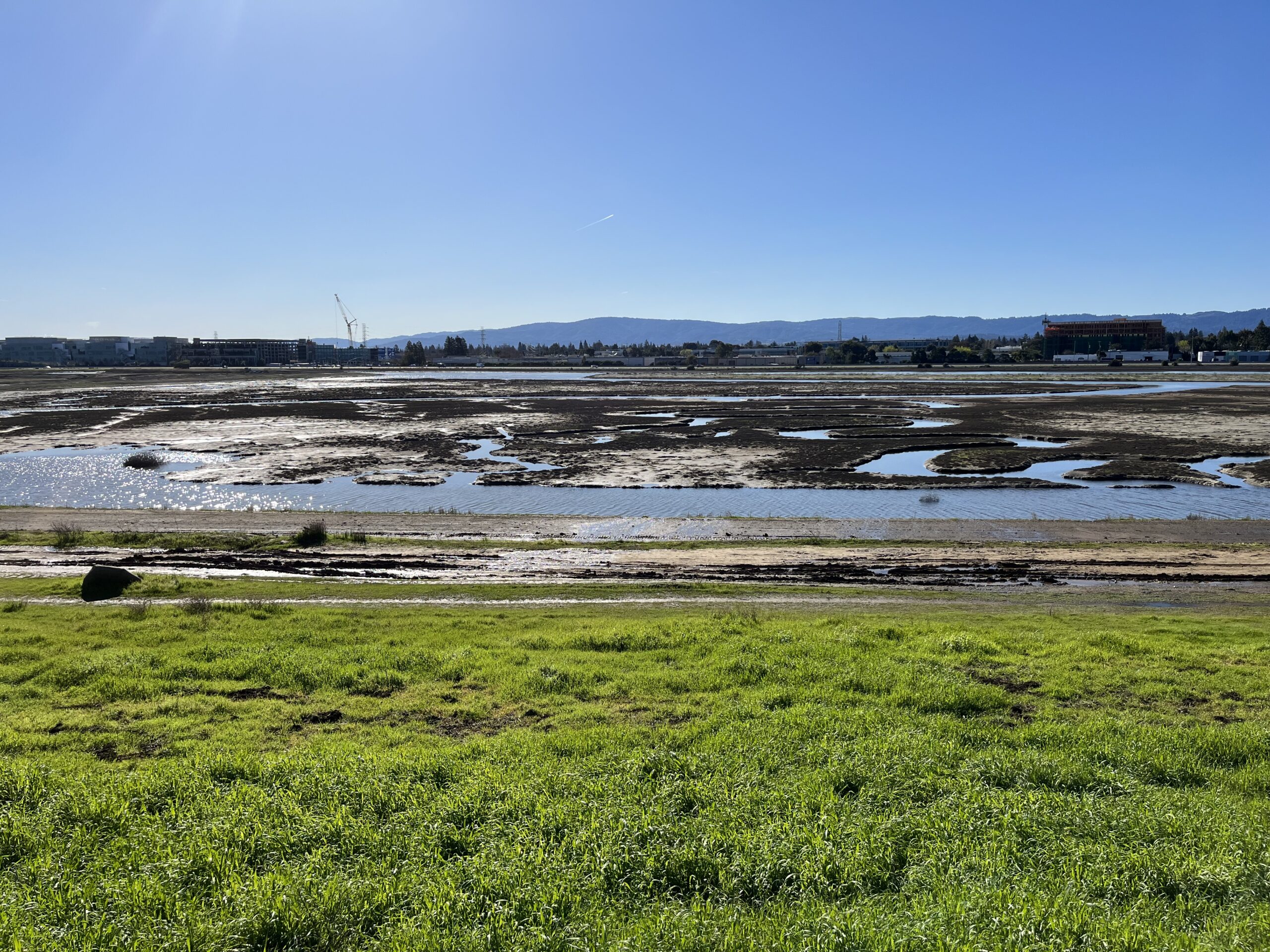
When Bay muds dry out, they oxidize, so that the ground sinks. Saltmaking had kept most areas wetted, most of the time, yet some tracts had subsided a good deal. This was especially the case near Alviso, where excessive groundwater extraction had caused the very foundations of the shore to sink. How quickly would the mud suspended in South Bay waters settle out in the reconnected ponds, building soil and supporting renascent marsh?
The prototype was a group of then-dry tracts near Fremont known as the Island Ponds (A for Alviso 19, A20, A21). Wedged between Coyote Creek and lands retained by Cargill, they were not as subsided as some others; also, they didn’t butt up against developed areas—the rare case where the question of flood control didn’t arise.
Ravenswood ponds. Photo: John Hart
In 2006 the dikes along Coyote Slough were breached in five places. The results at first were mixed. The westernmost pond, A21, responded even faster than expected; within ten years, it had generous marsh vegetation and supported salt marsh harvest mice and Ridgway’s rails. But A20, farther in from the Bay, was slower to respond. A19, the easternmost, lagged even more. The lesson derived was not that sediment was lacking but rather that the dike breakers should have made more and larger openings to let more silt-laden water in. In 2021, the team added breaks along the north side of the project, into the encouragingly named Mud Slough. It is too soon to judge the response.
No such problems beset additional tracts opened up four years later: Pond A6 north of Alviso, named the Ducks Head for its distinctive outline, and a group in the Eden Landing area, along the channel known as Old Alameda Creek. Sedimentation and revegetation have been rapid in these places.
These results matched hopes based on geography. In this southernmost chamber of San Francisco Bay, shallow and windblown, bottom muds are constantly stirred up, often making waters more brown than blue. Additional sediment swirls in from the central Bay. The particles will settle where they can.
Yet the supply is not unlimited, and biologists worry that the Bay system as a whole is entering a phase of sediment deficit. Stuart Siegel, author of early salt pond restoration studies, wishes for detailed bathymetric work to refine understanding of where sediments move. Noting the habitat value of mudflats, he wonders: “Are we strip-mining the flats for the sake of new marshes? It’s possible.”
A USGS assessment in 2018 concluded that “there is sufficient sediment to restore marshes and maintain mudflat habitat, but concern in light of long-term trends.”
Question: Is there enough dirt to make all those levees?
Testing ground: many sites.
As part of the South Bay Salt Pond Restoration Project, or at least in concert with it, tens of miles of levees are being strengthened or built anew. Many of these are to be “horizontal” or ecotone levees, sloping gently outward on one side to support several habitat zones even as the water rises. At Eden Landing, an ecotone levee will divide western ponds headed for marsh conditions from eastern ones that are to be enhanced for birds. From the Alviso Marina County Park, one can see machines at work on a new levee stairstepping northward from this spot to Milpitas. This is the San Francisco Bay Shoreline Project Phase One, a formally separate undertaking of the U.S. Army Corps of Engineers and the Santa Clara Valley Water Agency (Valley Water), along with the Coastal Conservancy.
Material stockpiled for a future ecotone levee at Alviso ponds. Photo: John Hart
Some of the ecotone levees merge into the artificial hills that here and there rise from soggy flatlands: old landfills. In a landscape short of vertical relief, these monuments to waste now offer room for plants and animals to shift their ranges upward. Halsing remarks wryly: “Landfills are one of the best things people have done for sea-level rise.” The ecotone buffers incidentally keep marsh water from leaching into the buried, albeit lined, garbage deposits.
But the dirt! Vast quantities are needed. Project managers are constantly on the lookout for sources of clean fill. Urban construction projects are always disgorging earth and rock, and what could be more practical than to truck the stuff to nearby wetland sites? A recent development in downtown Sunnyvale provided one such windfall: more than 250,000 cubic yards of clean fill for use in different parts of the Restoration Project. However, a surprisingly small fraction of candidate material tests out as clean enough to use, and timing is an intricate dance. The receiving site must be ready to take the fill immediately after its excavation; any stockpiling increases costs tremendously.
Question: Will reconnecting ponds stir up mercury?
The testing ground: The A8 ponds near Alviso.
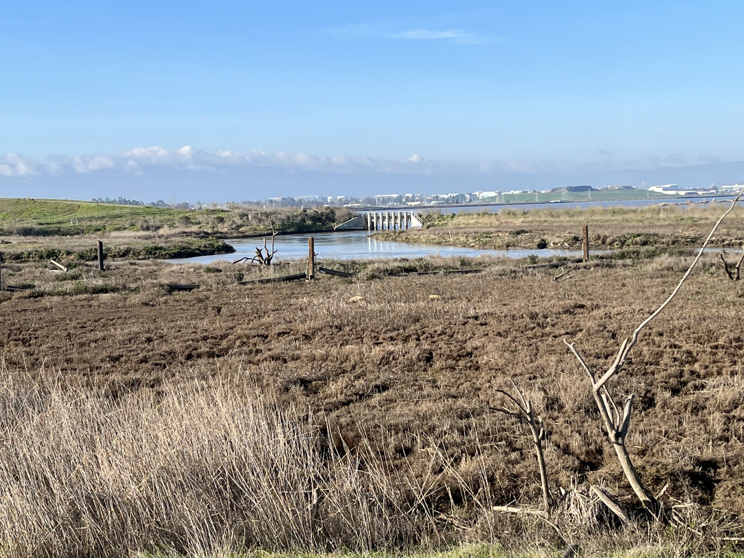
The very southern limit of San Francisco Bay today is Pond A8S, at the foot of Great America Parkway, within walking distance of Levi’s Stadium. This and three ponds adjoining to the north were slated for marshland, but full tidal connection was deferred due to a lurking problem: mercury.
There is a lot of this toxic metal in South Bay muds, derived mostly from a local source, the New Almaden Mine at the headwaters of the Guadalupe River. Contaminated tailings washed down into the old marshes. Then the salt ponds took over. Could the clock now be turned back safely? Or would marsh restoration stir the poison up and introduce it, in the biologically active form of methyl mercury, into the food chain?
Alviso ponds with A8 “notch” in the distance. The notch (a 40-foot opening) was installed during the restoration phase to allow re-closing if legacy mercury in those ponds became a problem, or if steelhead smolts became entrained. Neither proved problematic, and since 2017 the gates have been left wide open. Photo: John Hart
When this set of ponds was prepared for tidal reconnection, a kind of emergency brake was built in. A narrow and fortified tidal gate was emplaced, allowing the managers to cut off the link at any time; the area could default to permanent managed pond.
When the tides were admitted in 2011, mercury levels did indeed surge. This was an expected effect of construction disturbance. The good news was that the toxin quickly subsided to background levels. This outcome boded well for more than one site only. If the mercury problem was evanescent here, it would probably pose little threat anywhere else.
Question: Will invasive plants compromise new marshes?
Testing ground: wherever dikes were broken.
The invasive spartina removal program now includes Civic Corps job training for young people. Photo: Claire Meyler
In 1973, as mitigation for some dredging, the Army Corps of Engineers set out some cordgrass on the banks of the Alameda Creek Flood Control Channel just south of Eden Landing. Unfortunately, the chosen species was not the native California cordgrass but instead one called smooth cordgrass, a mainstay of East Coast marshes. A blameless citizen of its native ecosystem, smooth cordgrass proved an aggressive invader here. It not only outcompeted the local grass but also occupied habitats the local strain left bare, choking sloughs and blanketing mudflats. At the time the Salt Pond Restoration Project was conceived, the invasion was near its peak. Would newly created marshes become smooth cordgrass monocultures, uniform plains of diminished habitat value?
California responded with the San Francisco Estuary Invasive Spartina Project, a multi-agency campaign led by the Coastal Conservancy. Since its launch in 2000, the project has succeeded in reducing the problem from a crisis to a chronic maintenance issue. Smooth cordgrass is no longer an impediment to salt marsh restoration. (See also Battle for Native Cordgrass).
Harmful exotic species don’t stop arriving. While combating the old invader at the Island Ponds, biologists spotted a new one: the fast-spreading eastern turfgrass Paspalum vaginatum. A timely, targeted application of herbicide may have headed off a much larger problem.
The question: How finely should we tune salinity in ponds?
Testing ground: Ponds E12 and E13 at Eden Landing.
A trail at Eden Landing Ecological Reserve shows off this laboratory. Along with the moody ruins of pre-Cargill salt works, visitors often notice strange tinges in the water. Low levees subdivide two large ponds into smaller units, each managed for a different salinity and hence developing a different color. It’s a miniature of the Cargill pond patchwork so often noticed from the air. The intent here was to see if different species and guilds of birds would favor different levels of saltiness. The results were rather surprising: though the mini-ponds were all valuable habitat, the expected sorting by species was rather weak. Micro-management of salinity may yield less reward than thought.
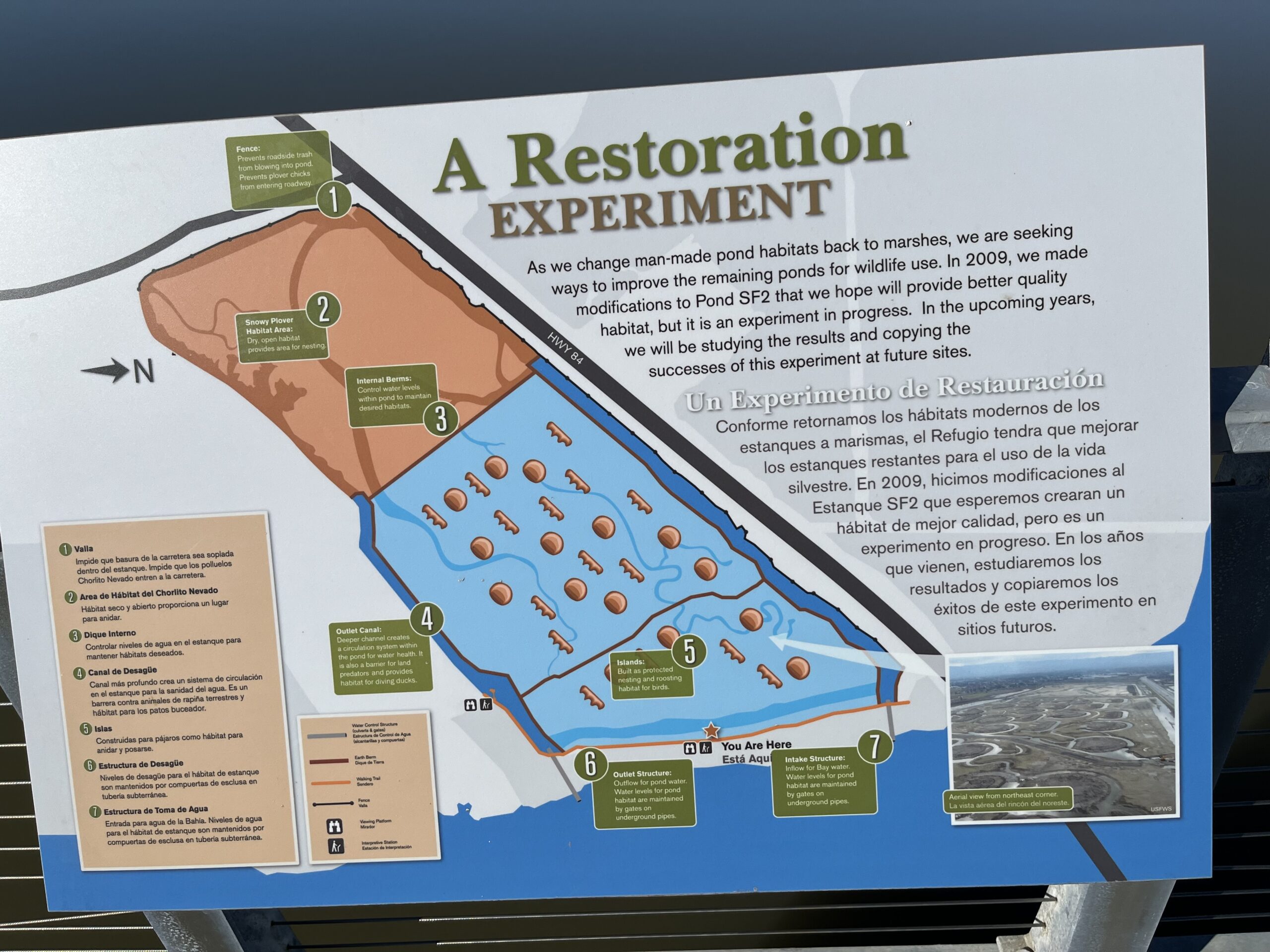
Question: Do constructed habitat islands work and what is the best design?
Testing ground: Pond SF2 at Ravenswood, Pond A16 near Alviso.
To protect its levees from wind-driven waves, Cargill created “sacrificial islands” in its ponds, piles of mud that harmlessly absorbed the pummeling. Biologists eventually noticed that these high spots were favorite resting and nesting spots for many species of birds. Surely islands built deliberately for habitat would be better still!
Photo: John Hart
To determine the best shapes, sizes, and spacings, managers constructed two archipelagos. A swarm of 30 islands, some roundish and some skinny, dot Ravenswood Pond SF2, just south of the Dumbarton Bridge. In Pond A16 at Alviso, the islands are fewer, larger, and more widely spaced. Conclusion after several years: shape matters some (the linear islands were preferred to rounder ones), but size and separation matter more (bigger and farther apart is better). David Halsing says of the Ravenswood site: “I don’t think we’ll do anything that elaborate ever again.”
SF2 also taught a lesson about island surfaces. Piled-up bay mud cracked as it dried, making little traps in which plover chicks got stuck and died. The ground had to be reworked with dirt and sand.Later on, different surface treatments were devised to discourage the growth of bushes that terns and other nesters avoid.
Question: Overall, can the numbers of pond-loving birds be kept high?
Testing ground: Everywhere.
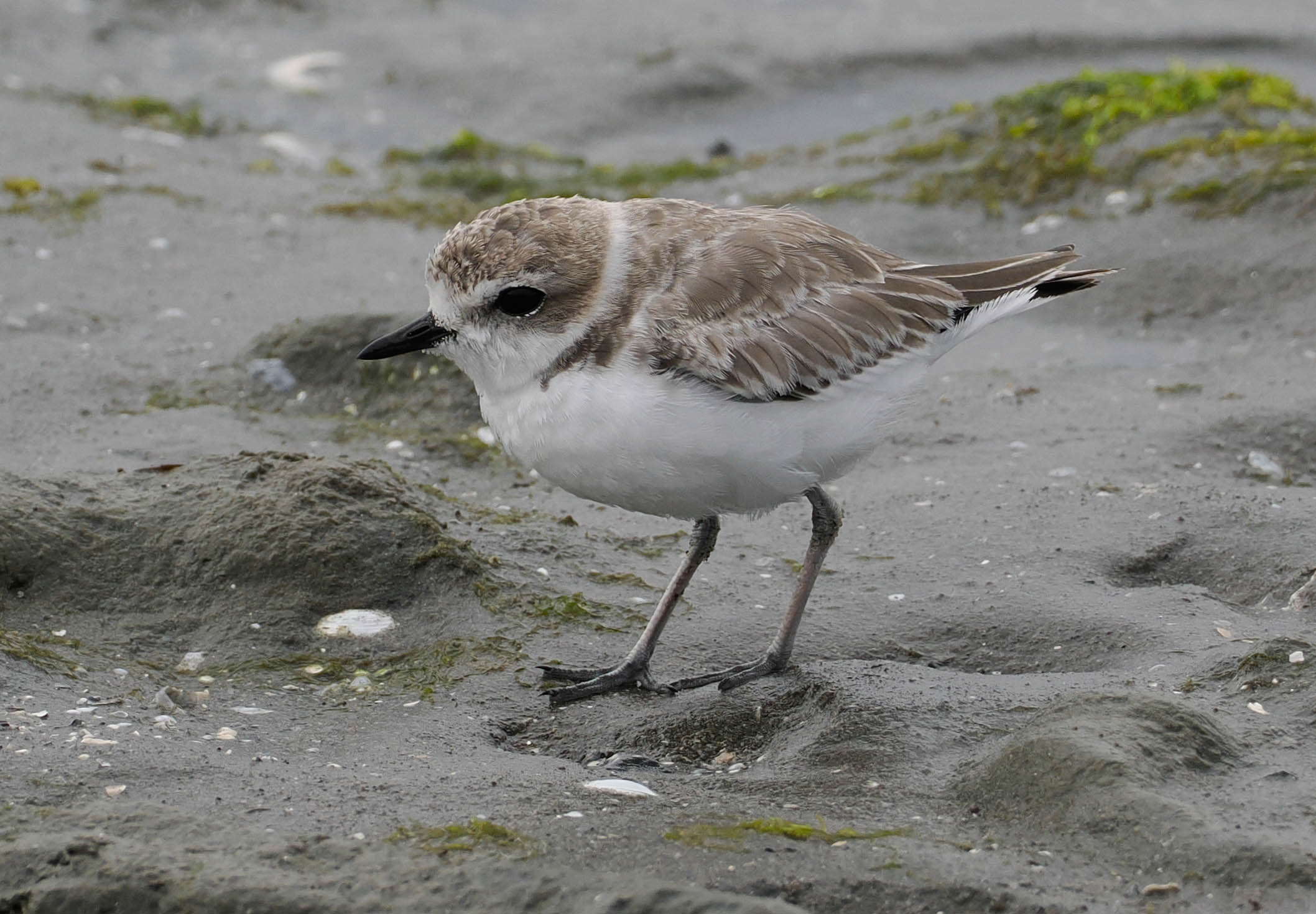
From the beginning, biologists have tracked, with some anxiety, the occurrence of all those birds that don’t directly benefit from marshes: ducks and geese, stilts and avocets, terns and gulls. How these respond will dictate the final balance between tidal wetlands and managed ponds. (See also p. 29.) So far the news is inconsistent, yet largely good. Migrating waterbird numbers have doubled since the work began. On the downside, snowy plovers have barely held their own, due not so much to habitat loss as to predation: crows and gulls, especially, carry off many chicks. Terns initially proved skeptical of the carefully planned islands, but were successfully lured back by decoys and recorded calls.
Snowy plover. Photo: William Chan, USGS
Moving On to the Next Phase
Phase 1 of the project officially wrapped up in 2015. More than 1,500 acres of marsh had been set on the road to restoration; approximately 700 acres of ponds had been improved; and some 1,400 acres, the A8 ponds, were in a kind of limbo as “reversible tidal.” At this point, the USGS summed up a decade of experience and assessed the prospects, revisiting questions first posed in 2008. In the majority of categories, the outlook was described as “uncertain, trending positive.” Given that uncertainty is a permanent condition, the road ahead seems pretty clear.
On the agenda now are the breaching of Pond R4 at Ravenswood, due this year; a square mile returned to the tides at Mountain View; and the conclusion of major work at Eden Landing. Valley Water is taking the lead in revitalizing the A8 pond complex at Alviso, which now seems destined to be fully tidal. Just east of that, the Army Corps and Valley Water are in charge of 2,900 more acres of ponds north of the new Shoreline Levee. When the barrier is complete, the entire swathe will be restored to tidal action.
Ravenswood. Photo: John Hart
When these actions are completed, over 8,000 acres will be headed toward a marshy future, and something under 2,000 acres will have been reserved for managed ponds, muted marsh with limited tidal exchange, or dry plover habitat. Almost two-thirds of the acreage acquired in 2003 will be spoken for. The 50% minimum target for marsh will already have been surpassed.
The outlook has changed in some ways since 2008. Sea-level rise, though acknowledged back then, has become a much more pressing concern. The challenges of maintaining old levee networks grow even as budgets get tighter. The almost pond-by-pond, species-by-species allocations of 2008 now seem a little beside the point. “Back then,” says Halsing, “they thought they had more options and more time.”
At Eden Landing and elsewhere, the shape of the future seems to be emerging: an outer belt of marshes; an ecotone levee amidships; and an inner belt of managed ponds. Besides meeting the needs of birds and other creatures, this ecological layer system seems to offer the best protection for one colonial species, attracted to water yet somewhat afraid of it, that clusters very thickly on these shores: human beings.
Top Photo: Ravenswood. Photo: John Hart
On Another Note: (Re)Connections
The sidewalk superintendents of restoration tend to gaze outwards, towards the Bay. People who are actually doing the work spend a lot of time looking in the other direction, toward the encircling cities and hills. Vital connections run that way. Creeks and flood channels come down. Trucks bring in clean dirt excavated from urban construction sites. Here and there an open, unbuilt parcel promises room for marshes to migrate inland as sea level rises. And always and everywhere there are the neighbors: residents concerned about flooding, noise, and dust; tech giants who might be expected to show more interest than they do in the problems lapping at their doorsteps; cities, counties, and other local agencies with their own agendas, sometimes very supportive, sometimes less so; and a stack of regional (and broader) environmental agencies whose standards and procedures come to bear.
The most obvious bonds between bayshore and hinterland are the streams. The South Bay’s largest are Alameda Creek, Coyote Creek, the Guadalupe River, Stevens Creek, and San Francisquito Creek. The 20th century regarded these as nuisances, to be confined by levees and hurried out to deep water. Now reconnection is the order of the day. Excess flows can pool in managed ponds; the channel-clogging muds that used to be dredged and trucked away can instead help build marshland soil.
At Alviso, for instance, Pond A8 and its neighbors have been relinked to the Guadalupe River. Two smaller creeks, Calabazas and San Tomas Aquino, are to be tied in here as well. At Ravenswood, a new tide gate links a local flood-control channel to a group of managed ponds, serving to reduce flood frequency in vulnerable neighborhoods. In the era of climate change, such exceptional synergies seem poised to become the norm.
“The projects are getting more and more complicated,” notes California Coastal Conservancy project manager Evyan Borgnis Sloane. “More than ever, we need strong partnerships.”
John Hart is an environmental journalist and author of sixteen books and several hundred other published works. He is also the winner of the James D. Phelan Award, the Commonwealth Club Medal in Californiana, and the David R. Brower Award for Service in the Field of Conservation. For ESTUARY, he writes on groundwater, infrastructure, and California water politics and history.
Our magazine’s media motto for many years has been “Where there’s an estuary, there’s a crowd.” The San Francisco Estuary is a place where people, wildlife, and commerce congregate, and where watersheds, rivers and the ocean meet and mix, creating a place of unusual diversity. In choosing to tell the...
Ever since the state and federal water projects were built in the 1930s and 1940s, California has captured snowmelt in foothill reservoirs, and moved the fresh water from dam releases and river outflows to parched parts of the state via aqueducts hundreds of miles long. A convoluted system of ancient...
Though the Clean Water Act did an amazing job of reducing wastewater and stormwater pollution of the San Francisco Estuary, some contaminants remain thorny problems. Legacy pollutants like mercury washed into the watershed from upstream gold mining, PCBs from old industrial sites, and selenium from agricultural drainage in the San...
Hothouse Earth
By Ariel Rubissow Okamoto
Photo by Megan Nguyen
Nothing could be stranger than sitting in the dark with thousands of suits and heels, watching a parade of promises to decarbonize from companies and countries large and small, reeling from the beauties of big screen rainforests and indigenous necklaces, and getting all choked up.
It was day two of the September 2018 Global Climate Action Summit in San Francisco when I felt it.
At first I wondered if I was simply starstruck. Most of us labor away trying to fix one small corner of the planet or another without seeing the likes of Harrison Ford, Al Gore, Michael Bloomberg, Van Jones, Jerry Brown – or the ministers or mayors of dozens of cities and countries – in person, on stage and at times angry enough to spit. And between these luminaries a steady stream of CEOs, corporate sustainability officers, and pension fund managers promising percentages of renewables and profits in their portfolios dedicated to the climate cause by 2020-2050.
I tried to give every speaker my full attention: the young man of Vuntut Gwichin heritage from the edge of the Yukon’s Arctic National Wildlife Refuge who pleaded with us not to enter his sacred lands with our drills and dependencies; all the women – swathed in bright patterns and head-scarfs – who kept punching their hearts. “My uncle in Uganda would take 129 years to emit the same amount of carbon as an American would in one year,” said Oxfam’s Winnie Byanyima.
“Our janitors are shutting off the lights you leave on,” said Aida Cardenas, speaking about the frontline workers she trains, mostly immigrants, who are excited to be part of climate change solutions in their new country.
The men on the stage, strutting about in feathers and pinstripes, spoke of hopes and dreams, money and power. “The notion that you can either do good or do well is a myth we have to collectively bust,” said New Jersey Governor Phil Murphy whose state is investing heavily in offshore wind farms.
“Climate change isn’t just about risks, it’s about opportunities,” said Blackrock sustainable investment manager Brian Deese.
But it wasn’t all these fine speeches that started the butterflies. Halfway through the second day of testimonials, it was a slight white-haired woman wrapped in an azure pashmina that pricked my tears. One minute she was on the silver screen with Alec Baldwin and the next she taking a seat on stage. She talked about trees. How trees can solve 30% of our carbon reduction problem. How we have to stop whacking them back in the Amazon and start planting them everywhere else. I couldn’t help thinking of Dr. Seuss and his truffala trees. Jane Goodall, over 80, is as fierce as my Lorax. Or my daughter’s Avatar.
Analyzing my take home feeling from the event I realized it wasn’t the usual fear – killer storms, tidal waves, no food for my kids to eat on a half-baked planet – nor a newfound sense of hope – I’ve always thought nature will get along just fine without us. What I felt was relief. People were actually doing something. Doing a lot. And there was so much more we could do.
As we all pumped fists in the dark, as the presentations went on and on and on because so many people and businesses and countries wanted to STEP UP, I realized how swayed I had let myself be by the doomsday news mill.
“We must be like the river, “ said a boy from Bangladesh named Risalat Khan, who had noticed our Sierra watersheds from the plane. “We must cut through the mountain of obstacles. Let’s be the river!”
Or as Harrison Ford less poetically put it: “Let’s turn off our phones and roll up our sleeves and kick this monster’s ass.”
4th California Climate Change Assessment Blues
by Isaac Pearlman
Since California’s last state-led climate change assessment in 2012, the Golden State has experienced a litany of natural disasters. This includes four years of severe drought from 2012 to 2016, an almost non-existent Sierra Nevada snowpack in 2014-2015 costing $2.1 billion in economic losses, widespread Bay Area flooding from winter 2017 storms, and extremely large and damaging wildfires culminating with this year’s Mendocino Complex fire achieving the dubious distinction of the largest in state history. California’s most recent climate assessment, released August 27th, predicts that for the state and the Bay Area, we can expect even more in the future.
The California state government first began assessing climate impacts formally in 2006, due to an executive order by Governor Schwarzenegger. California’s latest iteration and its fourth overall, includes a dizzying array of 44 technical reports; three topical studies on climate justice, tribal and indigenous communities, and the coast and ocean; as well as nine region-specific analyses.
The results are alarming for our state’s future: an estimated four to five feet of sea level rise and loss of one to two-thirds of Southern California beaches by 2100, a 50 percent increase in wildfires over 25,000 acres, stronger and longer heat waves, and infrastructure like airports, wastewater treatment plants, rail and roadways increasingly likely to suffer flooding.
For the first time, California’s latest assessment dives into climate consequences on a regional level. Academics representing nine California regions spearheaded research and summarized the best available science on the variable heat, rain, flooding and extreme event consequences for their areas. For example, the highest local rate of sea level rise in the state is at the rapidly subsiding Humboldt Bay. In San Diego county, the most biodiverse in all of California, preserving its many fragile and endangered species is an urgent priority. Francesca Hopkins from UC Riverside found that the highest rate of childhood asthma in the state isn’t an urban smog-filled city but in the Imperial Valley, where toxic dust from Salton Sea disaster chokes communities – and will only become worse as higher temperatures and less water due to climate change dry and brittle the area.
According to the Bay Area Regional Report, since 1950 the Bay Area has already increased in temperature by 1.7 degrees Fahrenheit and local sea level is eight inches higher than it was one hundred years ago. Future climate will render the Bay Area less suitable for our evergreen redwood and fir forests, and more favorable for tolerant chaparral shrub land. The region’s seven million people and $750 billion economy (almost one-third of California’s total) is predicted to be increasingly beset by more “boom and bust” irregular wet and very dry years, punctuated by increasingly intense and damaging storms.
Unsurprisingly, according to the report the Bay Area’s intensifying housing and equity problems have a multiplier affect with climate change. As Bay Area housing spreads further north, south, and inland the result is higher transportation and energy needs for those with the fewest resources available to afford them; and acute disparity in climate vulnerability across Bay Area communities and populations.
“All Californians will likely endure more illness and be at greater risk of early death because of climate change,” bluntly states the statewide summary brochure for California’s climate assessment. “[However] vulnerable populations that already experience the greatest adverse health impacts will be disproportionately affected.”
“We’re much better at being reactive to a disaster than planning ahead,” said UC Berkeley professor and contributing author David Ackerly at a California Adaptation Forum panel in Sacramento on August 27th. “And it is vulnerable communities that suffer from those disasters. How much human suffering has to happen before it triggers the next round of activity?”
The assessment’s data is publicly available online at “Cal-adapt,” where Californians can explore projected impacts for their neighborhoods, towns, and regions.


 The results are alarming for our state’s future: an estimated four to five feet of sea level rise and loss of one to two-thirds of Southern California beaches by 2100, a 50 percent increase in wildfires over 25,000 acres, stronger and longer heat waves, and infrastructure like airports, wastewater treatment plants, rail and roadways increasingly likely to suffer flooding.