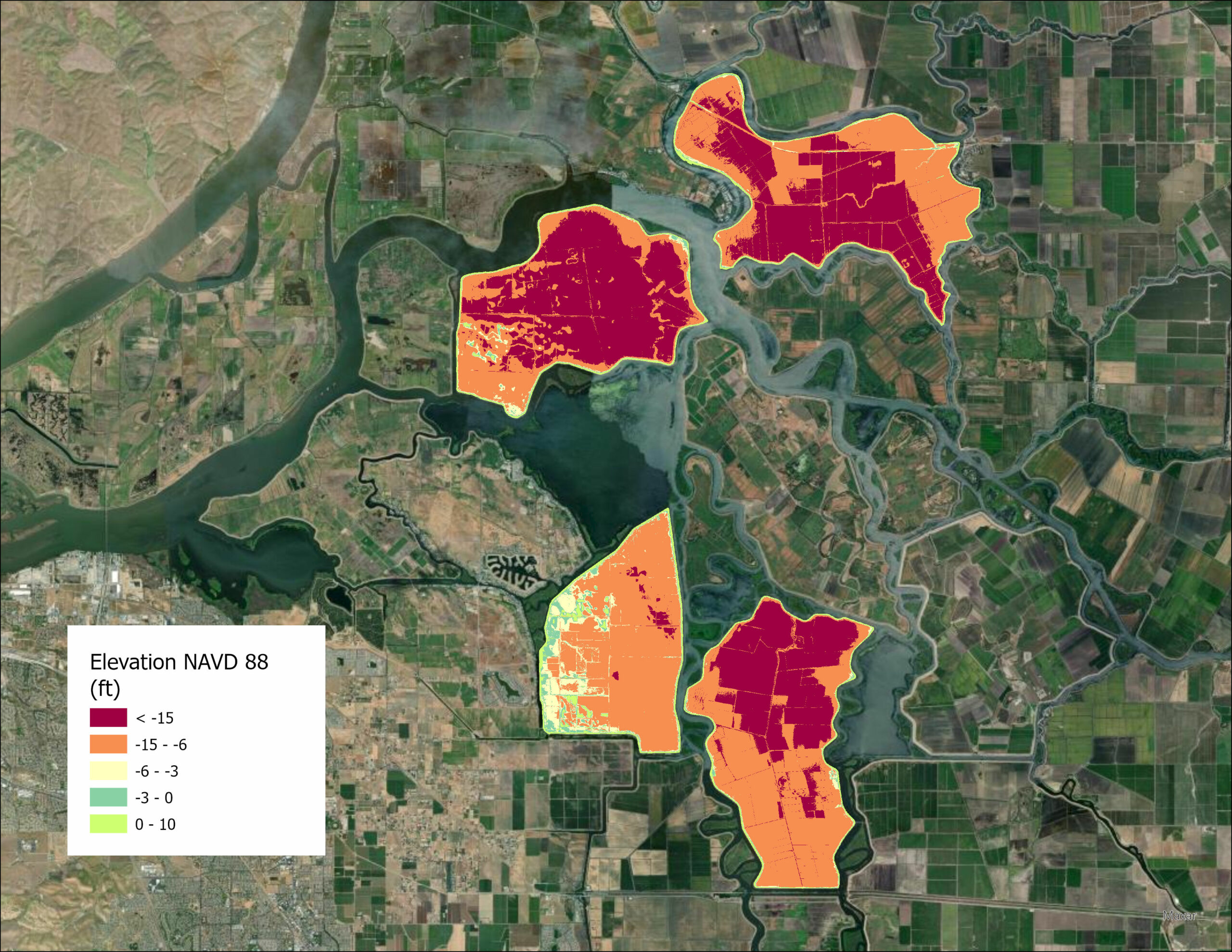
Why not richer rice fields, more wetlands, better boat launches, extended trails, even eco-tourism? ? A new survey for the Delta Islands Adaptation Project, funded by a Prop 1 Watershed Restoration Grant, wants the public’s opinion on the importance of 10 possible land-use objectives leading to the selection of one of the four islands for improvements. As your blinking cursor hovers over a satellite image of Bouldin, Bacon, Webb, and Holland Tracts, the survey lays out all that the experts know already: Holland is the least subsided; Bouldin the most accessible by road; Webb the best candidate for making more fish food, and more. “The Central Delta has some of the most critical landscapes in the state, and also some of the most vulnerable to sea-level rise and flooding,” says UC Davis landscape architect Brett Milligan, who is facilitating the survey. As the Delta public ranks and rates various objectives, one respondent might want to preserve a beloved farm, another to re-ignite local indigenous stewardship, a third to reduce GHG emissions; opinions are sure to vary. “The planning vision is for a mix of land-use strategies–both regenerative and experimental–spread across the one island,” says Milligan.
Editorial Note: When this reporter, a 30-year witness of the water wars, took the survey, I couldn’t help getting impatient. Still more experimental habitat patches and rice fields are fine, but shouldn’t we be getting on with the big stuff? Wise choices need to be made PDQ. Flooding is coming to the Delta in the very near future. Few fish are to be found, and the drought and politics will help us steal their last dribble of throughflow. It’s a time to get heroic and do the hardest things the best we can. One island, one at a time, won’t be near enough. And now that I’m on a rant, when are we going to implement the carefully planned and community-vetted Franks Tract project to prevent salinity intrusion into the pumping zone?


 The results are alarming for our state’s future: an estimated four to five feet of sea level rise and loss of one to two-thirds of Southern California beaches by 2100, a 50 percent increase in wildfires over 25,000 acres, stronger and longer heat waves, and infrastructure like airports, wastewater treatment plants, rail and roadways increasingly likely to suffer flooding.