Early efforts to restore the San Francisco Estuary, before the federal Clean Water Act and Endangered Species Act changed management priorities in the 1970s, focused on preserving marshes for waterfowl hunting, protecting river reaches for fishing, and growing trout and salmon in hatcheries. By that time, the estuarine ecosystem had been so severely altered by draining, diking, damming, farming, urbanization, species invasions and water supply projects that there was little left to restore. Restoration to some pristine former state was soon deemed an impossibility. Nevertheless, new mandates forced planners to consider restoring a variety of habitats used by endangered fish, birds and wildlife, to manage dam releases to provide flows and cold water to migrating species, and to reduce pollution and runoff into waterways and critical habitats. Once it became a legal obligation to restore wetlands as mitigation for destroying them, a new frontier of restoration science, design and engineering opened up around the Bay and Delta.
After piecemeal efforts to restore postage stamp wetlands or waterway reaches in isolation, or with a single species as a focus, a new understanding grew of the need to consider whole landscapes in restoration, backed up by a slew of new Bay and Delta science and research into historic habitats. These larger tracts should, scientists said, include more diverse and connected habitats, and support both endangered and resilient native species. Resource agencies led the charge for a while, encouraged by activists and NGOs, and amplified eventually by regional initiatives like the Delta Stewardship Council and the SF Bay Restoration Authority, as well as the California Coastal Conservancy. Decades of experimentation with various aspects of restoration ensued, ranging from adding gravel to creeks (to help salmon build redds) to allowing farm fields to flood (to provide nursery grounds for juvenile fish) to breaching dikes to restore tides to Delta islands and baylands. Recent projects try to achieve “multiple-benefits” for both species and humans, and also emphasize working with natural processes rather than trying to control them. Read the 17 stories in our Special Restoration Almanac to get the flavor of recent restoration work.
Restoration projects, like species, evolve. The Sonoma Creek Enhancement Project, originally about mosquito control, has shown itself to be a boon to special-status tidal marsh wildlife as well. More than a decade of adaptive management actions made that happen. The existing marsh, formed rapidly beginning in the 1960s by deposited sediment, lacked the dendritic channels […]
What began as a project to convert a submerged Delta island into habitat for endangered native fish has morphed into a multi-benefit package with additional payoffs for water quality and recreation. The collaborative design process for the Franks Tract Futures project brought initially skeptical local stakeholders on board and is being hailed as a model […]
In 2017, a perfect storm hit the City of San Jose in Santa Clara County. Coyote Creek, which winds through the heart of the city, overtopped its banks, flooding businesses and hundreds of homes up to depths of six feet. Thousands of people were evacuated and property damages exceeded $70 million. “If I’ve learned anything in my 25 years here, it’s that you have to give creeks room to move, which also creates more resilience to climate change,” says Valley Water’s Afshin Rouhani…
There may not be a way to give everyone what they want from the Delta. But there are ways to restore ecosystems while preserving local communities. This is true even along State Route 160, which traverses the most populated and most intensively farmed part of the region. The highway follows the Sacramento River into the Delta, twisting and turning around leveed islands between Freeport and Rio Vista. This is the North Delta and it’s a spectacular drive…
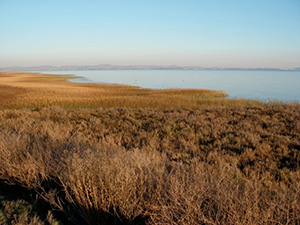
Looking east from the levee-top trail, a silvery swath of bay is dotted with low islands. This is low tide at the nearly 1,000-acre Sears Point wetland restoration project on the western side of San Pablo Bay.
“Without the mounds, you would just have a big area of open water,” says Julian Meisler with Sonoma Land Trust.
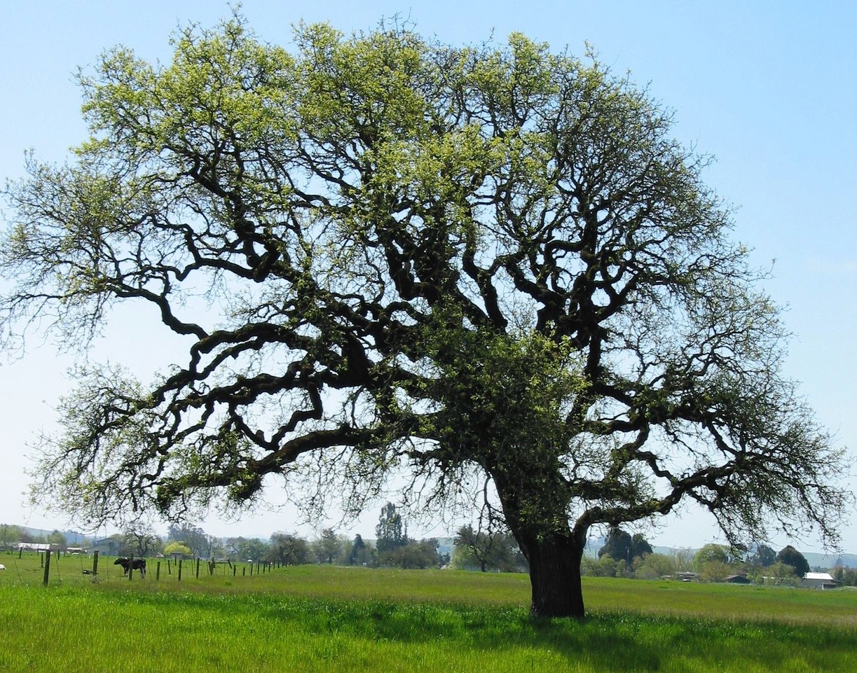
In 2002, when stretches of the Napa River running through Rutherford area vineyards breached levees and flooded yet again, Michael Honig did something remarkable: rather than call the authorities to complain, his neighbors and he banded together to restore their riverbanks. “It had became a kind of competition,” Honig says.
For years, Skaggs Island was a tantalizing blank in the map of San Pablo Bay wetlands restoration. Renee Spenst of Ducks Unlimited says it was “one of those places in a strange limbo.” Two-thirds of it was owned by the US Navy; the rest was privately-owned farmland. Converting any of the 4,400 acres back to tidal wetland was out of the question. “The agencies doing restoration just had to work around these two parcels,” recalls Beth Huning…
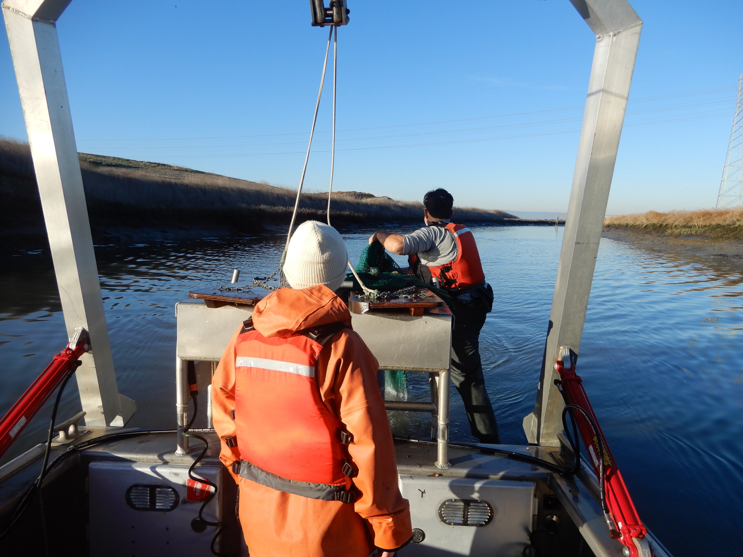
Twelve years ago, scientists at UC Davis began a survey of the southern end of San Francisco Bay — the Lower South Bay — to see how fish responded to the South Bay Salt Ponds Restoration Project. They discovered an unexpectedly diverse and robust aquatic community and a previously unknown spawning ground for the longfin […]
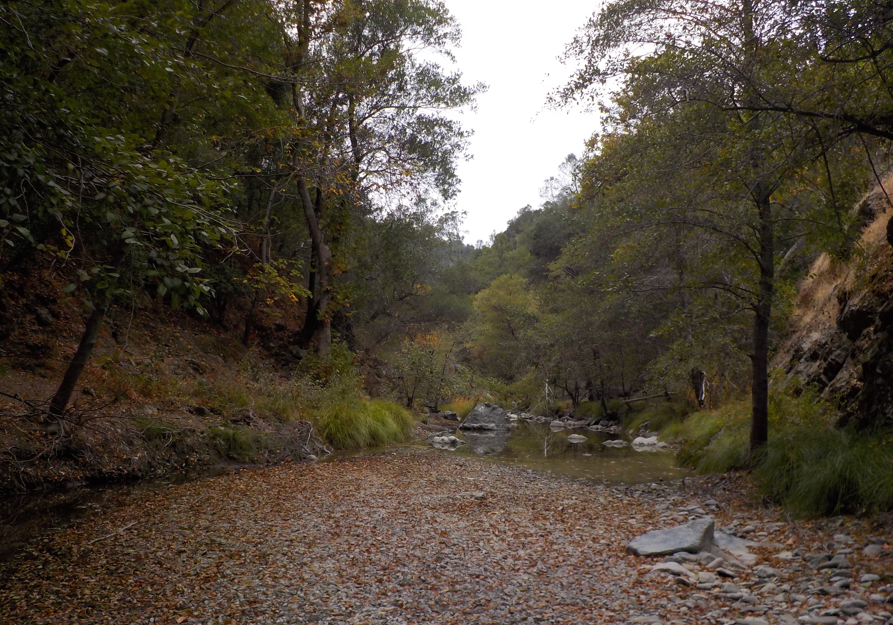
Over the summer, while most of the Bay Area was figuring out how to navigate the COVID-induced shelter-in-place orders, 1,933 heavy truckloads laden with 22,000 yards of material wound their way away from Napa County’s York Creek, and were dumped into two nearby landfills. Extracting these spoils was the last step in the York Creek […]
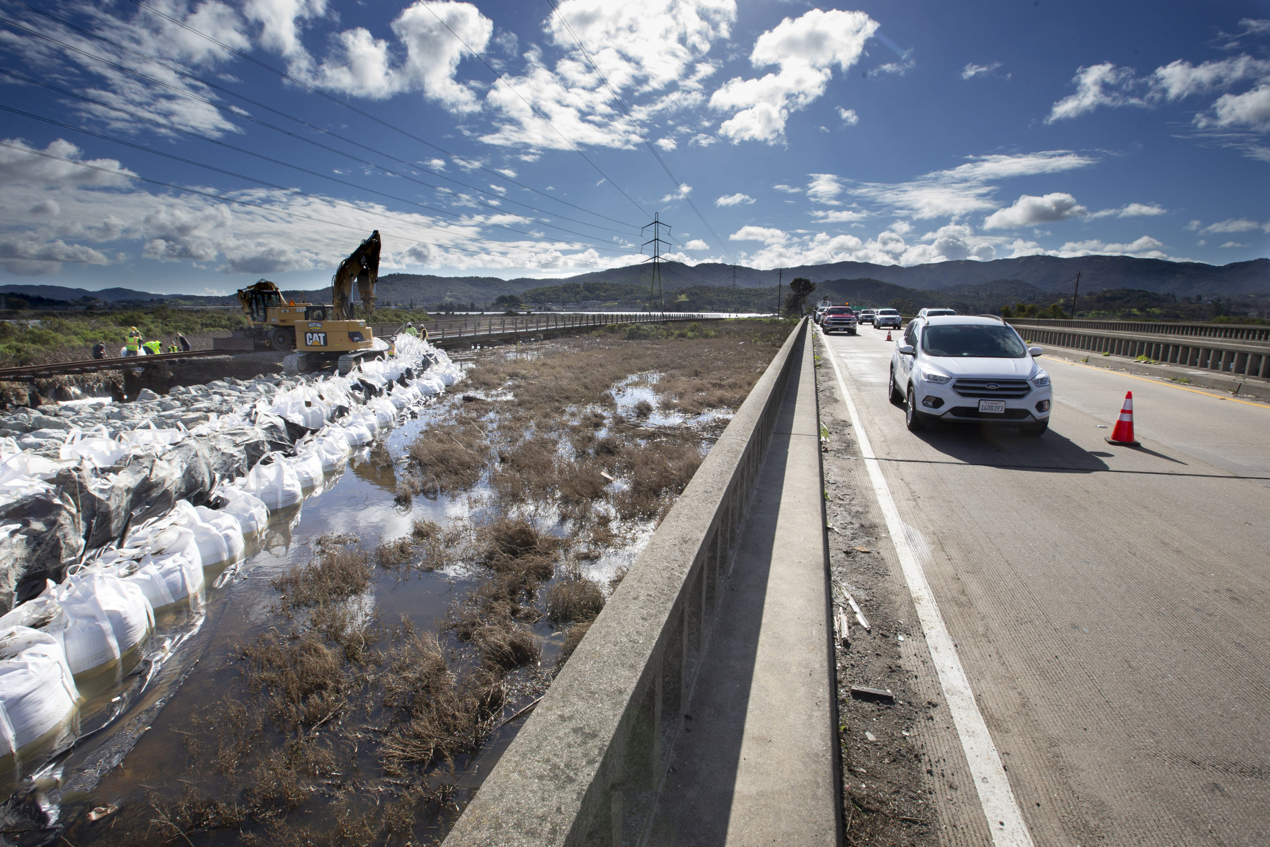
From head-on collisions in the 1980s to crippling congestion now, Highway 37 is a familiar headache for highway engineers. Fearing that engineers might not take full account of the vast marsh restorations underway in the area, the Sonoma Land Trust, the Coastal Conservancy, and others joined in a State Route 37-Baylands Group. In 2017, the group laid down markers: Whatever is done with the east-west highway must also improve the passage of tides and stormwaters north and south, not further impede those flows.
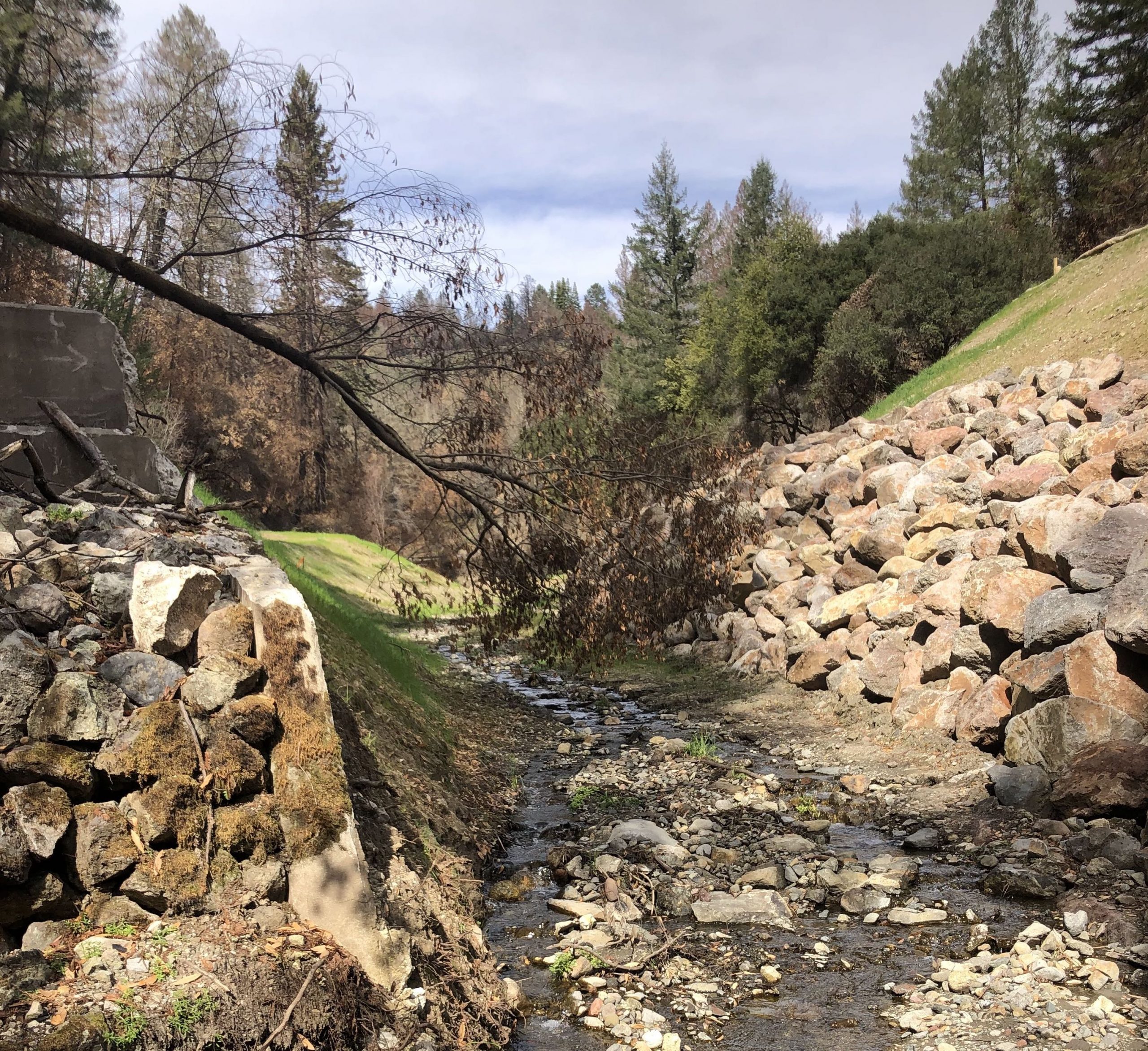
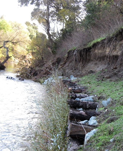
Paul Detjens is driving us from his Martinez office to a restoration site near the mouth of Walnut Creek on Suisun Bay, a project he spearheads as an engineer for the Contra Costa County Flood Control District. These lower reaches of the creek — straightened, widened, and leveed by the U.S. Army Corps of Engineers […]
Statewide, 13,000 miles of levees disconnect our rivers from their floodplains, which once served as nurseries for young salmon migrating to the ocean. California Natural Resources Secretary Wade Crowfoot wants to help restore this connection: “It’s a win-win-win―it’s a way we can reconnect water with land, create habitat, and provide flood protection.”
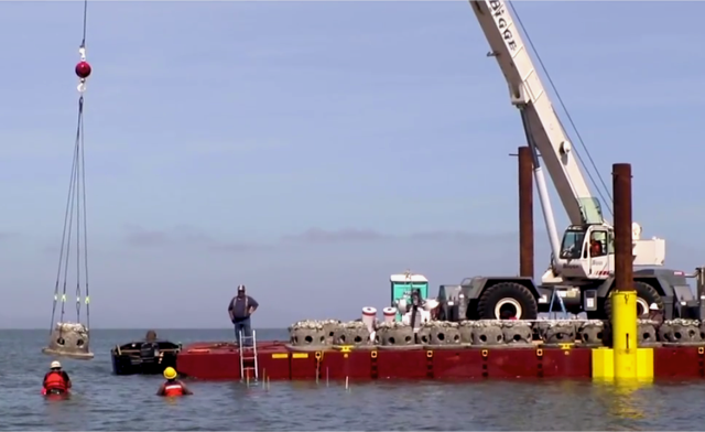
Interview anyone of any stripe about the Giant Marsh living shorelines project and the same two words will be in every other sentence: high tide. Each construction step of this California Coastal Conservancy-led effort to build new native oyster reefs interspersed with eelgrass off the Contra Costa County shore must consider the timing of tides. […]
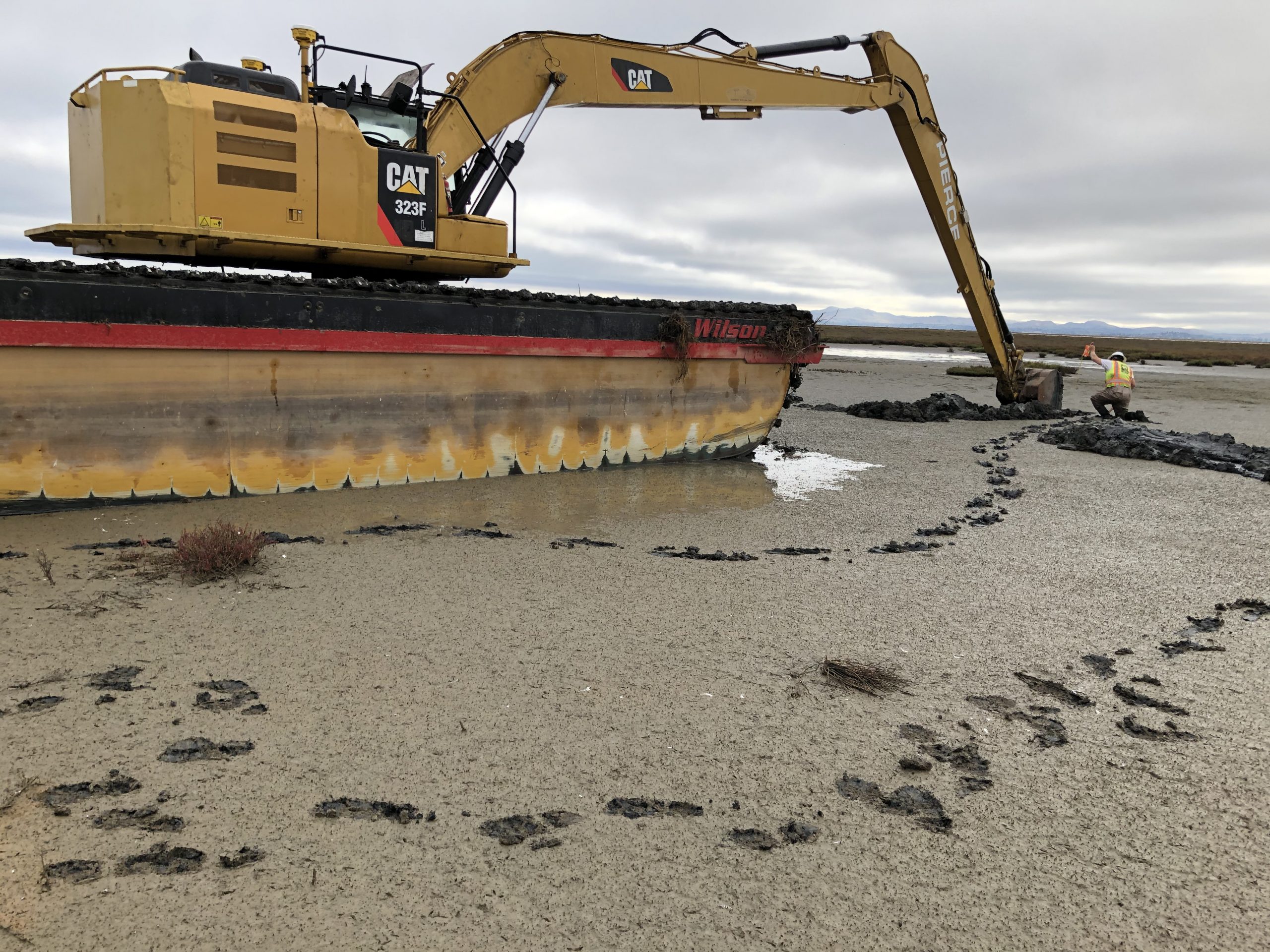
Development agreements were already in place for three parcels of land around Dutch Slough when John Cain first took a hike in this West Delta area in the spring of 1999. “It was clear as day to me that removing the levee would be a great way to restore freshwater wetlands at the mouth of Marsh Creek,” says Cain. Almost two decades later, earthmoving equipment is now preparing 1,178 acres for conversion to marsh habitat.
The 2017 update to the Central Valley Flood Protection Plan, to be released later this summer, radically revises the flood control strategies that have prevailed for more than a century. The plan recognizes the connections between the flood system, the water system and the ecosystem, and relies less on levees and more on floodplain restoration […]
Surprising many observers, Governor Jerry Brown announced late in April that the Bay Delta Conservation Program, which had embraced the new water conveyance popularly known as the Twin Tunnels and a broad program for restoring the complex and heavily impacted Delta environment, was being split into two new entities: Cal WaterFix and Cal EcoRestore. On the restoration side, he announced a more modest goal of 30,000 acres, down from the original 100,000.
Along Alameda Creek, which drains a 640-square-mile watershed, humans have built dams, buried creeks, and reshaped channels. “The watershed is huge and complex, and all these changes, compounded over time, have left us with a long and arduous path to getting it to function more naturally again,” says Carol Mahoney, a planner for Zone 7 Water Agency.
Walk back through time with this sampling of early stories from Estuary’s first two decades of publication. Many stories of the day focused on rescuing creeks and rivers from culverts and rip rap, restoring diked or farmed wetlands, and experimenting with techniques to bring native species back to altered landscapes.
Our magazine’s media motto for many years has been “Where there’s an estuary, there’s a crowd.” The San Francisco Estuary is a place where people, wildlife, and commerce congregate, and where watersheds, rivers and the ocean meet and mix, creating a place of unusual diversity. In choosing to tell the...
Ever since the state and federal water projects were built in the 1930s and 1940s, California has captured snowmelt in foothill reservoirs, and moved the fresh water from dam releases and river outflows to parched parts of the state via aqueducts hundreds of miles long. A convoluted system of ancient...
Though the Clean Water Act did an amazing job of reducing wastewater and stormwater pollution of the San Francisco Estuary, some contaminants remain thorny problems. Legacy pollutants like mercury washed into the watershed from upstream gold mining, PCBs from old industrial sites, and selenium from agricultural drainage in the San...
Hothouse Earth
By Ariel Rubissow Okamoto
Photo by Megan Nguyen
Nothing could be stranger than sitting in the dark with thousands of suits and heels, watching a parade of promises to decarbonize from companies and countries large and small, reeling from the beauties of big screen rainforests and indigenous necklaces, and getting all choked up.
It was day two of the September 2018 Global Climate Action Summit in San Francisco when I felt it.
At first I wondered if I was simply starstruck. Most of us labor away trying to fix one small corner of the planet or another without seeing the likes of Harrison Ford, Al Gore, Michael Bloomberg, Van Jones, Jerry Brown – or the ministers or mayors of dozens of cities and countries – in person, on stage and at times angry enough to spit. And between these luminaries a steady stream of CEOs, corporate sustainability officers, and pension fund managers promising percentages of renewables and profits in their portfolios dedicated to the climate cause by 2020-2050.
I tried to give every speaker my full attention: the young man of Vuntut Gwichin heritage from the edge of the Yukon’s Arctic National Wildlife Refuge who pleaded with us not to enter his sacred lands with our drills and dependencies; all the women – swathed in bright patterns and head-scarfs – who kept punching their hearts. “My uncle in Uganda would take 129 years to emit the same amount of carbon as an American would in one year,” said Oxfam’s Winnie Byanyima.
“Our janitors are shutting off the lights you leave on,” said Aida Cardenas, speaking about the frontline workers she trains, mostly immigrants, who are excited to be part of climate change solutions in their new country.
The men on the stage, strutting about in feathers and pinstripes, spoke of hopes and dreams, money and power. “The notion that you can either do good or do well is a myth we have to collectively bust,” said New Jersey Governor Phil Murphy whose state is investing heavily in offshore wind farms.
“Climate change isn’t just about risks, it’s about opportunities,” said Blackrock sustainable investment manager Brian Deese.
But it wasn’t all these fine speeches that started the butterflies. Halfway through the second day of testimonials, it was a slight white-haired woman wrapped in an azure pashmina that pricked my tears. One minute she was on the silver screen with Alec Baldwin and the next she taking a seat on stage. She talked about trees. How trees can solve 30% of our carbon reduction problem. How we have to stop whacking them back in the Amazon and start planting them everywhere else. I couldn’t help thinking of Dr. Seuss and his truffala trees. Jane Goodall, over 80, is as fierce as my Lorax. Or my daughter’s Avatar.
Analyzing my take home feeling from the event I realized it wasn’t the usual fear – killer storms, tidal waves, no food for my kids to eat on a half-baked planet – nor a newfound sense of hope – I’ve always thought nature will get along just fine without us. What I felt was relief. People were actually doing something. Doing a lot. And there was so much more we could do.
As we all pumped fists in the dark, as the presentations went on and on and on because so many people and businesses and countries wanted to STEP UP, I realized how swayed I had let myself be by the doomsday news mill.
“We must be like the river, “ said a boy from Bangladesh named Risalat Khan, who had noticed our Sierra watersheds from the plane. “We must cut through the mountain of obstacles. Let’s be the river!”
Or as Harrison Ford less poetically put it: “Let’s turn off our phones and roll up our sleeves and kick this monster’s ass.”
4th California Climate Change Assessment Blues
by Isaac Pearlman
Since California’s last state-led climate change assessment in 2012, the Golden State has experienced a litany of natural disasters. This includes four years of severe drought from 2012 to 2016, an almost non-existent Sierra Nevada snowpack in 2014-2015 costing $2.1 billion in economic losses, widespread Bay Area flooding from winter 2017 storms, and extremely large and damaging wildfires culminating with this year’s Mendocino Complex fire achieving the dubious distinction of the largest in state history. California’s most recent climate assessment, released August 27th, predicts that for the state and the Bay Area, we can expect even more in the future.
The California state government first began assessing climate impacts formally in 2006, due to an executive order by Governor Schwarzenegger. California’s latest iteration and its fourth overall, includes a dizzying array of 44 technical reports; three topical studies on climate justice, tribal and indigenous communities, and the coast and ocean; as well as nine region-specific analyses.
The results are alarming for our state’s future: an estimated four to five feet of sea level rise and loss of one to two-thirds of Southern California beaches by 2100, a 50 percent increase in wildfires over 25,000 acres, stronger and longer heat waves, and infrastructure like airports, wastewater treatment plants, rail and roadways increasingly likely to suffer flooding.
For the first time, California’s latest assessment dives into climate consequences on a regional level. Academics representing nine California regions spearheaded research and summarized the best available science on the variable heat, rain, flooding and extreme event consequences for their areas. For example, the highest local rate of sea level rise in the state is at the rapidly subsiding Humboldt Bay. In San Diego county, the most biodiverse in all of California, preserving its many fragile and endangered species is an urgent priority. Francesca Hopkins from UC Riverside found that the highest rate of childhood asthma in the state isn’t an urban smog-filled city but in the Imperial Valley, where toxic dust from Salton Sea disaster chokes communities – and will only become worse as higher temperatures and less water due to climate change dry and brittle the area.
According to the Bay Area Regional Report, since 1950 the Bay Area has already increased in temperature by 1.7 degrees Fahrenheit and local sea level is eight inches higher than it was one hundred years ago. Future climate will render the Bay Area less suitable for our evergreen redwood and fir forests, and more favorable for tolerant chaparral shrub land. The region’s seven million people and $750 billion economy (almost one-third of California’s total) is predicted to be increasingly beset by more “boom and bust” irregular wet and very dry years, punctuated by increasingly intense and damaging storms.
Unsurprisingly, according to the report the Bay Area’s intensifying housing and equity problems have a multiplier affect with climate change. As Bay Area housing spreads further north, south, and inland the result is higher transportation and energy needs for those with the fewest resources available to afford them; and acute disparity in climate vulnerability across Bay Area communities and populations.
“All Californians will likely endure more illness and be at greater risk of early death because of climate change,” bluntly states the statewide summary brochure for California’s climate assessment. “[However] vulnerable populations that already experience the greatest adverse health impacts will be disproportionately affected.”
“We’re much better at being reactive to a disaster than planning ahead,” said UC Berkeley professor and contributing author David Ackerly at a California Adaptation Forum panel in Sacramento on August 27th. “And it is vulnerable communities that suffer from those disasters. How much human suffering has to happen before it triggers the next round of activity?”
The assessment’s data is publicly available online at “Cal-adapt,” where Californians can explore projected impacts for their neighborhoods, towns, and regions.


 The results are alarming for our state’s future: an estimated four to five feet of sea level rise and loss of one to two-thirds of Southern California beaches by 2100, a 50 percent increase in wildfires over 25,000 acres, stronger and longer heat waves, and infrastructure like airports, wastewater treatment plants, rail and roadways increasingly likely to suffer flooding.